Namerikawa, Toyama
| Namerikawa 滑川市 | |||
|---|---|---|---|
| City | |||
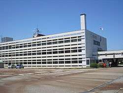 Namerikawa City Hall | |||
| |||
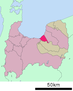 Location of Namerikawa in Toyama Prefecture | |||
 Namerikawa | |||
| Coordinates: 36°45′51.7″N 137°20′28.2″E / 36.764361°N 137.341167°ECoordinates: 36°45′51.7″N 137°20′28.2″E / 36.764361°N 137.341167°E | |||
| Country | Japan | ||
| Region | Chūbu (Kōshin'etsu) | ||
| Prefecture | Toyama | ||
| Area | |||
| • Total | 230.56 km2 (89.02 sq mi) | ||
| Population (March 1, 2018) | |||
| • Total | 33,320 | ||
| • Density | 140/km2 (370/sq mi) | ||
| Time zone | UTC+9 (Japan Standard Time) | ||
| Symbols | |||
| • Tree | Pine | ||
| • Flower | Chrysanthemum morifolium | ||
| • Flowering Tree | Rhododendron | ||
| • Fish | Firefly squid | ||
| Phone number | 076-475-2111 | ||
| Address | Jikei-machi 104, Namerikawa-shi, Toyama-ken 936-8601 | ||
| Website |
www | ||


Namerikawa (滑川市 Namerikawa-shi) is a city in eastern Toyama Prefecture, Japan. As of 1 March 2018, the city had an estimated population of 33,320 in 12224 households [1] and a population density of 140 persons per km². Its total area was 54.63 square kilometres (21.09 sq mi). The coast of Namerikawa is the habitat of the world famous glowing firefly squid (ほたるいか hotaru-ika), which surface yearly in a phenomenon that has been designated a Special Natural Monument by the Japanese government. The city was founded on March 1, 1954.
Geography
Namerikawa is in northeastern Toyama Prefecture, in the Hayatsuki river delta and is bordered by the Sea of Japan (Toyama Bay) to the northwest. Namerikawa is located 1 hour by air (via Toyama Airport), 3 hours by rail and 5 hours by car from Tokyo. Since March 2015, rail access is possible via Hokuriku Shinkansen high-speed train from nearby Toyama. The city area is formed on the alluvial fan between the Hayatsuki River and the Kamiichi River. Namerikawa has a humid continental climate (Köppen Cfa) characterized by mild summers and cold winters with heavy snowfall. The average annual temperature in Namerikawa is 13.9 °C. The average annual rainfall is 2317 mm with September as the wettest month.The temperatures are highest on average in August, at around 26.4 °C, and lowest in January, at around 2.6 °C.[2]
Surrounding municipalities
Demographics
Per Japanese census data,[3] the population of Namerikawa has grown over the past 40 years.
| Census Year | Population |
|---|---|
| 1970 | 30,039 |
| 1980 | 30,744 |
| 1990 | 30,923 |
| 2000 | 33,363 |
| 2010 | 33,676 |
History
The area of present-day Namerikawa was part of ancient Etchū Province. During the Heian period, much of the area was part of shōen controlled by Yasaka Shrine in Kyoto. During the Edo period it was part of the territory controlled by the Maeda clan of Kaga Domain. The town of Namerkawa was created within Nakaniikawa District, Toyama with the establishment of the modern municipalities system on April 1, 1889. On November 1, 1953, Namerigawa merged with the neighboring villages of Nakakazumi, Higashikazumi, Nishikazumi, Kitakazumi, Hamakazumi and Hayatsukikazumi. It was raised to city status on March 1, 1954.
Government
Namerikawa has a mayor-council form of government with a directly elected mayor and a unicameral city legislature of 15 members.
Economy
Once a rural town in the overlooking Toyama bay, then prospering as inn town on the Hokuriku Kaidō, Namerikawa has developed as an industrial city and commercial center, and is increasingly a bedroom community for nearby Uozu.
Education
Namekawa has seven public elementary schools and two public junior high schools operated by the town government, and one public high school operated by the Toyama Prefectural Board of Education.
Transportation
Railway
Highway
Local attractions
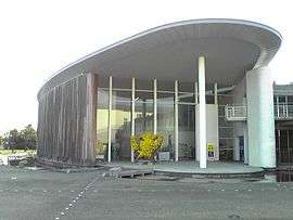
- To promote firefly-squid-themed eco-tourism and education, the world's only firefly squid museum opened in March 1998.
Sister cities
Namerikawa has several sister cities:


External links

- Namerikawa City official website (in Japanese)
- Namerikawa City official website
References
- ↑ http://www.city.namerikawa.toyama.jp/ Official statistics from home page](in Japanese)
- ↑ Namerikawa climate data
- ↑ Namerikawa population statistics
| Core city | ||
|---|---|---|
| Cities | ||
| Districts | ||