Nakashibetsu, Hokkaido
| Nakashibetsu 中標津町 | |||
|---|---|---|---|
| Town | |||
| |||
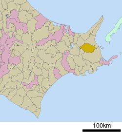 Location of Nakashibetsu in Hokkaido (Nemuro Subprefecture) | |||
 Nakashibetsu Location in Japan | |||
| Coordinates: 43°33′N 144°58′E / 43.550°N 144.967°ECoordinates: 43°33′N 144°58′E / 43.550°N 144.967°E | |||
| Country | Japan | ||
| Region | Hokkaido | ||
| Prefecture | Hokkaido (Nemuro Subprefecture) | ||
| District | Shibetsu | ||
| Government | |||
| • Mayor | Minoru Kobayashi | ||
| Area | |||
| • Total | 684.98 km2 (264.47 sq mi) | ||
| Population (March 31, 2014) | |||
| • Total | 24,014 | ||
| • Density | 34.73/km2 (90.0/sq mi) | ||
| Symbols | |||
| • Tree | White birch | ||
| • Flower | Gentiana triflora var. japonica | ||
| • Bird | common cuckoo | ||
| Time zone | UTC+9 (JST) | ||
| City hall address |
2-22 Maruyama, Nakashibetsu-chō, Shibetsu-gun, Hokkaidō 086-1197 | ||
| Website |
www | ||

Nakashibetsu (中標津町 Nakashibetsu-chō) is a town located in Nemuro Subprefecture, Hokkaido, Japan. As of March 31, 2008, it has an estimated population of 23,958, and an area of 684.98 km².
Nakashibetsu Airport, the easternmost airport in Japan, is located in the town.
History
- 1901 - Division opening of Nakashibetsu area. Development is begun.
- July 1, 1946 - The village of Nakashibetsu splits from Shibetsu.
- January 1, 1950 - Nakashibetsu Village becomes Nakashibetsu Town.
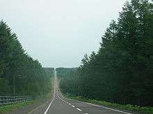
A road from Kaiyōdai hill
In 2004, there was an abortive effort to merge Nakashibetsu with the nearby town of Rausu. The new city would have been named "Higashishiretoko", but the plan was defeated in a referendum held in Nakashibetsu.
External links

- Official Website (in Japanese)
| ||||||||||
| ||||||||||
| ||||||||||
| ||||||||||
| ||||||||||
| ||||||||||
| ||||||||||
| ||||||||||
| ||||||||||
| ||||||||||
| ||||||||||
| ||||||||||
| ||||||||||
| ||||||||||
This article is issued from
Wikipedia.
The text is licensed under Creative Commons - Attribution - Sharealike.
Additional terms may apply for the media files.