Makubetsu, Hokkaido
| Makubetsu 幕別町 | |||
|---|---|---|---|
| Town | |||
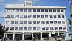 Makubetsu town hall | |||
| |||
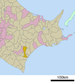 Location of Makubetsu in Hokkaido (Tokachi Subprefecture) | |||
 Makubetsu Location in Japan | |||
| Coordinates: 42°55′N 143°21′E / 42.917°N 143.350°ECoordinates: 42°55′N 143°21′E / 42.917°N 143.350°E | |||
| Country | Japan | ||
| Region | Hokkaido | ||
| Prefecture | Hokkaido (Tokachi Subprefecture) | ||
| District | Nakagawa (Tokachi) | ||
| Area | |||
| • Total | 340.46 km2 (131.45 sq mi) | ||
| Population (September 30, 2016) | |||
| • Total | 27,310 | ||
| • Density | 80/km2 (210/sq mi) | ||
| Time zone | UTC+9 (JST) | ||
| Website |
www | ||


Makubetsu (幕別町 Makubetsu-chō) is a town located in Tokachi Subprefecture, Hokkaido, Japan.
As of September 2016, the town has an estimated population of 27,310 and a density of 80 persons per km². The total area is 340.46 km².
On February 6, 2006, the village of Chūrui (from Hiroo District) was merged into Makubetsu.
Makubetsu is the birthplace of park golf, and as of 2006, has no less than ten individual courses.
Notable people from Makubetsu
- Hiromu Arakawa, the author of Fullmetal Alchemist and Silver Spoon
- Chisato Fukushima, track and field sprint athlete
- Miho Takagi, speed skaterand is on Japan's Olympic Team for the 2010 Vancouver Olympics.[1]
- Nana Takagi, speed skater
- Fumio Ueda, former mayor of Sapporo
- Kohei Yamamoto, mountain biker
References
External links

- Official Website (in Japanese)
| ||||||||||
| ||||||||||
| ||||||||||
| ||||||||||
| ||||||||||
| ||||||||||
| ||||||||||
| ||||||||||
| ||||||||||
| ||||||||||
| ||||||||||
| ||||||||||
| ||||||||||
| ||||||||||
This article is issued from
Wikipedia.
The text is licensed under Creative Commons - Attribution - Sharealike.
Additional terms may apply for the media files.