Rikubetsu, Hokkaido
| Rikubetsu 陸別町 リクン・ペッ | |||
|---|---|---|---|
| Town | |||
 Rikubetsu town hall | |||
| |||
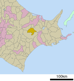 Location of Rikubetsu in Hokkaido (Tokachi Subprefecture) | |||
 Rikubetsu Location in Japan | |||
| Coordinates: 43°28′N 143°45′E / 43.467°N 143.750°ECoordinates: 43°28′N 143°45′E / 43.467°N 143.750°E | |||
| Country | Japan | ||
| Region | Hokkaido | ||
| Prefecture | Hokkaido (Tokachi Subprefecture) | ||
| District | Ashoro | ||
| Area | |||
| • Total | 608.81 km2 (235.06 sq mi) | ||
| Population (September 30, 2016) | |||
| • Total | 2,528 | ||
| • Density | 4.2/km2 (11/sq mi) | ||
| Time zone | UTC+9 (JST) | ||
| Website |
www | ||


Rikubetsu (陸別町 Rikubetsu-chō) is a town located in Tokachi Subprefecture, Hokkaido, Japan. It is located on the edge of the Tokachi Plain at an altitude of 207 metres (679 ft) above sea level.
As of September 2016, the town has an estimated population of 2,528 and a density of 4.2 persons per km². The total area is 608.81 km².
Climate
Rikubetsu is ranked as Japan's coldest area. Daily mean temperature in January is −11.4 °C (11.5 °F), the average low temperature in the end of January and beginning of February are below −20 °C (−4.0 °F), which are the coldest in Japan. On January 27, 2000, the temperature at Seki district recorded below −40 °C (−40.0 °F).[1]
| Climate data for Rikubetsu, Hokkaido (1981~2010) | |||||||||||||
|---|---|---|---|---|---|---|---|---|---|---|---|---|---|
| Month | Jan | Feb | Mar | Apr | May | Jun | Jul | Aug | Sep | Oct | Nov | Dec | Year |
| Record high °C (°F) | 6.6 (43.9) |
9.8 (49.6) |
14.9 (58.8) |
29.3 (84.7) |
31.9 (89.4) |
35.5 (95.9) |
33.7 (92.7) |
35.1 (95.2) |
32.6 (90.7) |
25.0 (77) |
19.9 (67.8) |
12.9 (55.2) |
35.5 (95.9) |
| Average high °C (°F) | −2.8 (27) |
−1.8 (28.8) |
2.6 (36.7) |
10.5 (50.9) |
16.8 (62.2) |
20.5 (68.9) |
23.2 (73.8) |
24.5 (76.1) |
20.3 (68.5) |
14.6 (58.3) |
6.9 (44.4) |
−0.1 (31.8) |
11.3 (52.3) |
| Daily mean °C (°F) | −11.4 (11.5) |
−10 (14) |
−3.7 (25.3) |
3.8 (38.8) |
9.7 (49.5) |
14.1 (57.4) |
17.8 (64) |
19.2 (66.6) |
14.4 (57.9) |
7.6 (45.7) |
0.4 (32.7) |
−7.5 (18.5) |
4.5 (40.1) |
| Average low °C (°F) | −20.2 (−4.4) |
−19.2 (−2.6) |
−11.4 (11.5) |
−2.7 (27.1) |
2.8 (37) |
8.6 (47.5) |
13.4 (56.1) |
14.9 (58.8) |
9.3 (48.7) |
1.3 (34.3) |
−5.8 (21.6) |
−14.9 (5.2) |
−2.0 (28.4) |
| Record low °C (°F) | −33.2 (−27.8) |
−33.1 (−27.6) |
−27.6 (−17.7) |
−19.1 (−2.4) |
−7.2 (19) |
−2.1 (28.2) |
2.1 (35.8) |
4.2 (39.6) |
−2.4 (27.7) |
−9.2 (15.4) |
−20.9 (−5.6) |
−27.6 (−17.7) |
−33.2 (−27.8) |
| Average precipitation mm (inches) | 36.9 (1.453) |
21.7 (0.854) |
41.3 (1.626) |
54.1 (2.13) |
70.5 (2.776) |
60.8 (2.394) |
105.0 (4.134) |
124.3 (4.894) |
120.1 (4.728) |
75.4 (2.969) |
51.1 (2.012) |
36.6 (1.441) |
797.8 (31.411) |
| Average snowfall cm (inches) | 109 (42.9) |
80 (31.5) |
86 (33.9) |
28 (11) |
2 (0.8) |
0 (0) |
0 (0) |
0 (0) |
0 (0) |
1 (0.4) |
20 (7.9) |
94 (37) |
420 (165.4) |
| Source #1: Japan Meteorological Agency[2] | |||||||||||||
| Source #2: Japan Meteorological Agency[3] | |||||||||||||
References
- ↑ 陸別町ホームページワンポイント紹介
- ↑ "平年値(年・月ごとの値)". Japan Meteorological Agency. Retrieved 2011-10-19.
- ↑ "観測史上1~10位の値(年間を通じての値)". Japan Meteorological Agency. Retrieved 2011-10-19.
External links

- Official Website (in Japanese)
| ||||||||||
| ||||||||||
| ||||||||||
| ||||||||||
| ||||||||||
| ||||||||||
| ||||||||||
| ||||||||||
| ||||||||||
| ||||||||||
| ||||||||||
| ||||||||||
| ||||||||||
| ||||||||||
This article is issued from
Wikipedia.
The text is licensed under Creative Commons - Attribution - Sharealike.
Additional terms may apply for the media files.