Bihoro, Hokkaido
| Bihoro 美幌町 | |||
|---|---|---|---|
| Town | |||
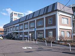 Bihoro Town Hall | |||
| |||
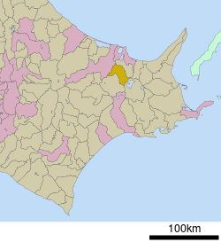 Location of Bihoro in Hokkaido (Okhotsk Subprefecture) | |||
 Bihoro Location in Japan | |||
| Coordinates: 43°49′30″N 144°6′20″E / 43.82500°N 144.10556°ECoordinates: 43°49′30″N 144°6′20″E / 43.82500°N 144.10556°E | |||
| Country | Japan | ||
| Region | Hokkaido | ||
| Prefecture | Hokkaido (Okhotsk Subprefecture) | ||
| District | Abashiri | ||
| Government | |||
| • Mayor | Tsuchiya Kōji (土谷耕治) | ||
| Area | |||
| • Total | 438.36 km2 (169.25 sq mi) | ||
| Population (September 30, 2016) | |||
| • Total | 20,920 | ||
| • Density | 48/km2 (120/sq mi) | ||
| Symbols | |||
| • Tree | Taxus cuspidata | ||
| • Flower | Rhododendron dauricum | ||
| Time zone | UTC+9 (JST) | ||
| City hall address |
2 Chōme 25 Banchi, Aza Higashi 2 Jō Kita, Bihoro-chō, Abashiri-gun, Hokkaidō 092-8650 | ||
| Website |
www | ||


Bihoro (美幌町 Bihoro-chō) is a town located in Okhotsk Subprefecture, Hokkaido, Japan. The name is derived from the Ainu word piporo, meaning "place of much water".
Largely agricultural, the town is best known for the Bihoro Pass, which has views over Lake Kussharo in the Akan National Park.
One of its attractions is Bihoro Aviation Park, which contains a number of aircraft previously used by the Japan Self-Defense Forces.
As of September 2016, the town has an estimated population of 20,920, and a population density of 48 persons per km². The total area is 438.36 km².
History
- 1915: Bihoro Village founded.
- 1919: Tsubetsu Village (津別村), now Tsubetsu Town, split.
- 1921: Part of Tsubetsu Village incorporated.
- 1923: Bihoro Village becomes Bihoro Town.
- 1946: Part of Memanbetsu Village (now Memanbetsu Town) incorporated.
- 1953: Bihoro song, Toru Takemitsu.
External links


- Official Website (in Japanese)
| ||||||||||
| ||||||||||
| ||||||||||
| ||||||||||
| ||||||||||
| ||||||||||
| ||||||||||
| ||||||||||
| ||||||||||
| ||||||||||
| ||||||||||
| ||||||||||
| ||||||||||
| ||||||||||
This article is issued from
Wikipedia.
The text is licensed under Creative Commons - Attribution - Sharealike.
Additional terms may apply for the media files.