Shari, Hokkaido
| Shari 斜里町 | |||
|---|---|---|---|
| Town | |||
| |||
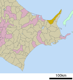 Location of Shari in Hokkaido (Okhotsk Subprefecture) | |||
 Shari Location in Japan | |||
| Coordinates: 43°55′N 144°40′E / 43.917°N 144.667°ECoordinates: 43°55′N 144°40′E / 43.917°N 144.667°E | |||
| Country | Japan | ||
| Region | Hokkaido | ||
| Prefecture | Hokkaido (Okhotsk Subprefecture) | ||
| District | Shari | ||
| Area | |||
| • Total | 736.97 km2 (284.55 sq mi) | ||
| Population (September 30, 2016) | |||
| • Total | 11,897 | ||
| • Density | 16/km2 (42/sq mi) | ||
| Time zone | UTC+9 (JST) | ||
| Website |
www | ||


Shari (斜里町 Shari-chō) is a town located in Okhotsk Subprefecture, Hokkaido, Japan.
As of September 2016, the town has an estimated population of 11,897 and a population density of 16 persons per km². The total area is 736.97 km².
Notable people from Shari
- Tatsuhikari Kumagoro, former sumo ringer
- Tsutomu Takebe, politician
Climate
| Climate data for Shari Averages (1981-2010) Records (1977-2017) | |||||||||||||
|---|---|---|---|---|---|---|---|---|---|---|---|---|---|
| Month | Jan | Feb | Mar | Apr | May | Jun | Jul | Aug | Sep | Oct | Nov | Dec | Year |
| Record high °C (°F) | 9.7 (49.5) |
11.9 (53.4) |
15.8 (60.4) |
31.2 (88.2) |
32.3 (90.1) |
32.8 (91) |
34.9 (94.8) |
36.6 (97.9) |
32.0 (89.6) |
26.8 (80.2) |
21.5 (70.7) |
15.3 (59.5) |
36.6 (97.9) |
| Average high °C (°F) | −2.3 (27.9) |
−2.6 (27.3) |
1.5 (34.7) |
9.2 (48.6) |
15.3 (59.5) |
18.9 (66) |
22.2 (72) |
24.4 (75.9) |
20.8 (69.4) |
15.2 (59.4) |
7.7 (45.9) |
0.9 (33.6) |
10.9 (51.6) |
| Daily mean °C (°F) | −6.8 (19.8) |
−7.6 (18.3) |
−2.8 (27) |
4.2 (39.6) |
9.6 (49.3) |
13.6 (56.5) |
17.3 (63.1) |
19.5 (67.1) |
15.6 (60.1) |
9.8 (49.6) |
3.2 (37.8) |
−3.4 (25.9) |
6.0 (42.8) |
| Average low °C (°F) | −13.1 (8.4) |
−14.3 (6.3) |
−8.6 (16.5) |
−0.9 (30.4) |
3.9 (39) |
8.5 (47.3) |
12.9 (55.2) |
14.9 (58.8) |
10.4 (50.7) |
4.0 (39.2) |
−1.7 (28.9) |
−8.9 (16) |
1.7 (35.1) |
| Record low °C (°F) | −27.8 (−18) |
−31.6 (−24.9) |
−25.7 (−14.3) |
−19.1 (−2.4) |
−4.5 (23.9) |
−1.2 (29.8) |
2.6 (36.7) |
4.2 (39.6) |
0.7 (33.3) |
−4.8 (23.4) |
−20.1 (−4.2) |
−24.0 (−11.2) |
−31.6 (−24.9) |
| Average precipitation mm (inches) | 41.6 (1.638) |
25.4 (1) |
36.8 (1.449) |
50.9 (2.004) |
59.9 (2.358) |
52.3 (2.059) |
83.9 (3.303) |
93.1 (3.665) |
115.8 (4.559) |
75.8 (2.984) |
71.9 (2.831) |
51.1 (2.012) |
778.7 (30.657) |
| Average snowfall cm (inches) | 184 (72.4) |
137 (53.9) |
132 (52) |
42 (16.5) |
1 (0.4) |
0 (0) |
0 (0) |
0 (0) |
0 (0) |
1 (0.4) |
24 (9.4) |
121 (47.6) |
647 (254.7) |
| Source: Japan Meteorological Agency[1] | |||||||||||||
References
External links

- Official Website (in Japanese)
| ||||||||||
| ||||||||||
| ||||||||||
| ||||||||||
| ||||||||||
| ||||||||||
| ||||||||||
| ||||||||||
| ||||||||||
| ||||||||||
| ||||||||||
| ||||||||||
| ||||||||||
| ||||||||||
This article is issued from
Wikipedia.
The text is licensed under Creative Commons - Attribution - Sharealike.
Additional terms may apply for the media files.