Shiroishi-ku, Sapporo
| Shiroishi 白石区 | |
|---|---|
| Ward | |
| Shiroishi Ward | |
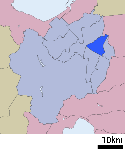 Location of Shiroishi-ku in Sapporo | |
 Shiroishi | |
| Coordinates: 43°02′52″N 141°24′18″E / 43.04778°N 141.40500°ECoordinates: 43°02′52″N 141°24′18″E / 43.04778°N 141.40500°E | |
| Country | Japan |
| Region | Hokkaidō |
| Prefecture | Ishikari |
| City | Sapporo |
| Established | April 1, 1972 |
| Government | |
| • Mayor | Yoichi Horiuchi |
| Area | |
| • Total | 46.35 km2 (17.90 sq mi) |
| Population (February 1, 2012) | |
| • Total | 205,363 |
| • Density | 4,430.70/km2 (11,475.5/sq mi) |
| Time zone | UTC+9 (Japan Standard Time) |
| Tree | Poplar |
| Flower | Rose |
| Telephone | 011-862-2400 |
| Address | 3-Kita-1-1 Hongo-dori, Shiroishi-ku, Sapporo-shi, Hokkaido 003-8612 |
Shiroishi-ku (白石区) is one of the ten wards in Sapporo, Hokkaido, Japan. As of February 1, 2012, the ward has a population of 205,363, with 102,049 households.
History
- 1871: Shiroishi village was founded.[1]
- 1873: Kamishiroishi village split off from Shiroishi village.
- 1902: Shiroishi village and kamishiroishi village were merged to form Shiroishi village.
- 1950: Shiroishi village was merged into Sapporo city.
- 1972: Sapporo was designated as one of the cities designated by government ordinance and Shiroishi-ku was established.
- 1989: Atsubetsu-ku split off from Shiroishi-ku.
Transportation
Rail
Road
- Hokkaido Expressway: Sapporo IC - Kitago IC - Oyachi IC
- Route 12
Education
High schools
- Hokkaido Sapporo Higashi High School
- Hokkaido Sapporo Shiroishi High School
- Hokkaido Sapporo Hakuryo High School
References
External links
- Shiroishi-ku word office (in Japanese)
| Wikimedia Commons has media related to Shiroishi-ku, Sapporo. |
| ||||||||||
| ||||||||||
| ||||||||||
| ||||||||||
| ||||||||||
| ||||||||||
| ||||||||||
| ||||||||||
| ||||||||||
| ||||||||||
| ||||||||||
| ||||||||||
| ||||||||||
| ||||||||||
This article is issued from
Wikipedia.
The text is licensed under Creative Commons - Attribution - Sharealike.
Additional terms may apply for the media files.