Abira, Hokkaido
| Abira 安平町 | |||
|---|---|---|---|
| Town | |||
| |||
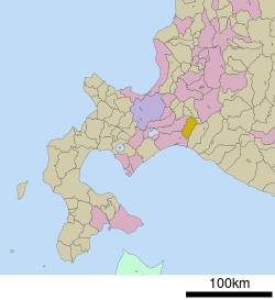 Location of Abira in Hokkaido (Iburi Subprefecture) | |||
 Abira Location in Japan | |||
| Coordinates: 42°46′N 141°49′E / 42.767°N 141.817°ECoordinates: 42°46′N 141°49′E / 42.767°N 141.817°E | |||
| Country | Japan | ||
| Region | Hokkaido | ||
| Prefecture | Hokkaido (Iburi Subprefecture) | ||
| District | Yūfutsu (Iburi) | ||
| Area | |||
| • Total | 237.13 km2 (91.56 sq mi) | ||
| Population (September 30, 2016) | |||
| • Total | 8,323 | ||
| • Density | 35/km2 (91/sq mi) | ||
| Time zone | UTC+9 (JST) | ||
| Website |
www | ||


Abira (安平町 Abira-chō) is a town located in Iburi Subprefecture, Hokkaido, Japan.
Abira was founded on March 27, 2006, by the merger of the towns of Hayakita and Oiwake.
As of September 2016, the town has an estimated population of 8,323, and a density of 35 persons per km². The total area is 237.13 km2 (92 sq mi).
Japan's largest single-site solar power plant, the SoftBank Tomatoh Abira Solar Park, is located in Abira.
External links

- Official Website (in Japanese)
| ||||||||||
| ||||||||||
| ||||||||||
| ||||||||||
| ||||||||||
| ||||||||||
| ||||||||||
| ||||||||||
| ||||||||||
| ||||||||||
| ||||||||||
| ||||||||||
| ||||||||||
| ||||||||||
This article is issued from
Wikipedia.
The text is licensed under Creative Commons - Attribution - Sharealike.
Additional terms may apply for the media files.