Fukagawa (深川市, Fukagawa-shi) is a city located in Sorachi Subprefecture, Hokkaido, Japan.
As of September 2016, the city has an estimated population of 21,618, and the density of 41 persons per km². The total area is 529.12 km².
Fukagawa is a small but vibrant city most known for its plentiful rice fields and apple and cherry orchards in Otoe, a township to the south of the downtown area. Fukagawa is growing largely in Otoe, anchored by its Roadside Station, which is the third-busiest in Hokkaido, according to an article in the Hokkaido Shimbun.
Geography
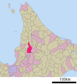
Fukagawa is located on the Ishikari Plain, and is roughly an equal distance in between Asahikawa to the northeast, and Takikawa to the southwest.[1][2]
Neighboring municipalities
Fukagawa borders on nine municipalities in Hokkaido Prefecture, spanning Sorachi, Kamikawa, and Rumoi subprefectures:
- Sorachi Subprefecture
- Kamikawa Subprefecture
- Rumoi Subprefecture
History
Fukagawa was settled by the tondenhei, or the colonist militia, between 1895 and 1896.[1][3]
- 1892 Fukagawa village was founded.
- 1915 Tadoshi village split off from Ichiyan village.
- 1918 Fukagawa village became Fukagawa town.
- 1962 Tadoshi village became Tadoshi town.
- 1963 Fukagawa town, Ichiyan village, Osamunai village, and Otoe village were merged to form Fukagawa city.
- 1970 Tadoshi town was merged into Fukagawa city.
Economy
Fukugawa is rich in rice production. Rice paddies in the city are irrigated by the Taishō Canal, which is channeled off the Ishikari River. Potatoes and apples are also agricultural products of the city.[1]
Education
High schools
Public
- Hokkaido Fukagawa Nishi High School
- Hokkaido Fukagawa Higashi High School
Private
- Clark Memorial International High School
Transportation
Both trains and buses provide a direct link to the prefectural capital, Sapporo.
Noted places
One of the biggest tourist draws is Mount Kamui, a popular ski resort technically in Asahikawa, but only minutes away from Fukagawa by car or bus.[5]
External links
Authority control  | |
|---|