Rishiri, Hokkaido
| Rishiri 利尻町 | |||
|---|---|---|---|
| Town | |||
| |||
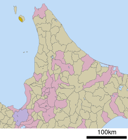 Location of Rishiri in Hokkaido (Sōya Subprefecture) | |||
 Rishiri Location in Japan | |||
| Coordinates: 45°11′N 141°8′E / 45.183°N 141.133°ECoordinates: 45°11′N 141°8′E / 45.183°N 141.133°E | |||
| Country | Japan | ||
| Region | Hokkaido | ||
| Prefecture | Hokkaido (Sōya Subprefecture) | ||
| District | Rishiri | ||
| Government | |||
| • Mayor | Jun'itsu Tajima | ||
| Area | |||
| • Total | 76.49 km2 (29.53 sq mi) | ||
| Population (30 September 2016) | |||
| • Total | 2,169 | ||
| • Density | 28/km2 (73/sq mi) | ||
| Symbols | |||
| • Tree | Siberian dwarf pine (Pinus pumila) | ||
| • Flower | Ezokanzō (Hemerocallis dumortieri var. esculenta) and chishimazakura (Prunus nipponica var. kurilensis) | ||
| • Bird | Rishiri komadori (Erithacus akahige rishiriensis) | ||
| Time zone | UTC+9 (JST) | ||
| City hall address |
14-1 Kutsugata Midorichō, Rishiri-chō, Rishiri-gun, Hokkaidō 097-0401 | ||
| Website |
www | ||


Rishiri (利尻町 Rishiri-chō) is a town located on Rishiri Island in Sōya Subprefecture, Hokkaido, Japan.
As of September 2016, the town has an estimated population of 2,169 and a density of 28 persons per km2. The total area is 76.49 km2.
Rishiri Airport is located in nearby Rishirifuji.
Geography
Rishiri is located on the western portion of Rishiri Island, facing the Sea of Japan. Mount Rishiri (also known as Rishirifuji), at 1721m, is located on the border with Rishirifuji.[1]
Neighbouring municipalities
Education
- Primary schools
- Kutsugata Elementary School
- Senhōshi Elementary School
- Shinminato Elementary School
- Junior high schools
- Kutsugata Junior High School
- Senhōshi Junior High School
- High schools
- Rishiri High School
References
- ↑ 考える社会科地図 Kangaeru Shakaika Chizu. 四谷大塚出版 Yotsuya-Ōtsuka Shuppan. 2005. p. 81.
External links


- Official Website (in Japanese)
| ||||||||||
| ||||||||||
| ||||||||||
| ||||||||||
| ||||||||||
| ||||||||||
| ||||||||||
| ||||||||||
| ||||||||||
| ||||||||||
| ||||||||||
| ||||||||||
| ||||||||||
| ||||||||||
This article is issued from
Wikipedia.
The text is licensed under Creative Commons - Attribution - Sharealike.
Additional terms may apply for the media files.