Nemuro, Hokkaido
| Nemuro 根室市 | |||
|---|---|---|---|
| City | |||
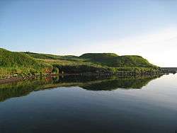
 Cape Ochiishi | |||
| |||
 Location of Nemuro in Hokkaido (Nemuro Subprefecture) | |||
 Nemuro Location in Japan | |||
| Coordinates: 43°20′N 145°35′E / 43.333°N 145.583°ECoordinates: 43°20′N 145°35′E / 43.333°N 145.583°E | |||
| Country | Japan | ||
| Region | Hokkaido | ||
| Prefecture | Hokkaido (Nemuro Subprefecture) | ||
| Government | |||
| • Mayor | Shunsuke Hasegawa | ||
| Area | |||
| • Total | 512.63 km2 (197.93 sq mi) | ||
| Population (September 30, 2016) | |||
| • Total | 27,109 | ||
| • Density | 56.74/km2 (147.0/sq mi) | ||
| Symbols | |||
| • Tree | Chishimazakura (Prunus nipponica Matsumura var. kurilensis) | ||
| • Flower | Yukiwarikozakura (Primula modesta var. fauriei) | ||
| • Bird | Swan | ||
| • Others | Sports: Table tennis | ||
| Time zone | UTC+9 (JST) | ||
| City hall address |
2-27 Tokiwachō, Nemuro-shi, Hokkaido 087-8711 | ||
| Website |
www | ||


Nemuro (根室市 Nemuro-shi, Ainu: Ni-mu-oro) is a city and port located in Nemuro Subprefecture, Hokkaido, Japan. It is the capital city of Nemuro Subprefecture. Much of the city lies on the Nemuro Peninsula.
As of February 29, 2012, the city has an estimated population of 29,087, with 12,966 households, and a population density of 56.74 persons per km² (147.0 persons per sq. mi.). The total area is 512.63 km2 (197.93 sq mi).
History
Nemuro was developed by fisheries. In the early Meiji period, it was the largest city in eastern Hokkaido.[1]
- 1900 Nemuro town was founded.
- 1906 Wada village was founded.
- 1915 Habomai village was founded.
- 1957 Nemuro town and Wada village was merged to form Nemuro city.
- 1959 Habomai village was merged into Nemuro city.
Climate
Nemuro, like most of Hokkaido, has a humid continental climate (Köppen climate classification Dfb), but not far from a marine climate (Koppen: Cfb) due to its low amplitude for a location close to Eurasia and average temperatures during the winter. [2]. It has mild to warm summers and cold snowy winters. Like the more northerly Kuril Islands, it has an extremely strong seasonal lag, with the highest temperatures in August and September and lowest in February, though it is not so gloomy as extremely foggy North Pacific islands like Simushir or the Aleutian Islands. Its peninsular location makes Nemuro very windy, especially during autumn and winter, with mean wind speeds as high as 22.7 kilometres per hour (14.1 mph) in November.
| Climate data for Nemuro, Hokkaido | |||||||||||||
|---|---|---|---|---|---|---|---|---|---|---|---|---|---|
| Month | Jan | Feb | Mar | Apr | May | Jun | Jul | Aug | Sep | Oct | Nov | Dec | Year |
| Record high °C (°F) | 8 (46) |
8 (47) |
13 (55) |
20 (68) |
26 (79) |
27 (81) |
31 (88) |
31 (88) |
26 (79) |
23 (73) |
17 (63) |
12 (54) |
31 (88) |
| Average high °C (°F) | −1.2 (29.8) |
−1.6 (29.1) |
1.6 (34.9) |
7.2 (45) |
11.5 (52.7) |
14.4 (57.9) |
17.9 (64.2) |
20.8 (69.4) |
18.8 (65.8) |
14.4 (57.9) |
8.3 (46.9) |
2.1 (35.8) |
9.5 (49.1) |
| Daily mean °C (°F) | −3.7 (25.3) |
−4.3 (24.3) |
−1.3 (29.7) |
3.4 (38.1) |
7.3 (45.1) |
10.6 (51.1) |
14.2 (57.6) |
17.3 (63.1) |
15.7 (60.3) |
11.3 (52.3) |
5.3 (41.5) |
−0.5 (31.1) |
6.3 (43.3) |
| Average low °C (°F) | −6.9 (19.6) |
−7.6 (18.3) |
−4.3 (24.3) |
0.4 (32.7) |
4.1 (39.4) |
7.7 (45.9) |
11.5 (52.7) |
14.7 (58.5) |
13.1 (55.6) |
8.2 (46.8) |
1.9 (35.4) |
−3.6 (25.5) |
3.3 (37.9) |
| Record low °C (°F) | −18 (−1) |
−22 (−8) |
— | −8 (18) |
−2 (28) |
2 (36) |
4 (39) |
9 (48) |
6 (43) |
1 (33) |
−7 (20) |
−12 (10) |
−22 (−8) |
| Average precipitation mm (inches) | 35.5 (1.398) |
22.6 (0.89) |
52.5 (2.067) |
66.5 (2.618) |
102.1 (4.02) |
90.9 (3.579) |
121.7 (4.791) |
120.8 (4.756) |
167.0 (6.575) |
106.3 (4.185) |
84.5 (3.327) |
50.4 (1.984) |
1,020.8 (40.19) |
| Average snowfall cm (inches) | 62 (24.4) |
55 (21.7) |
50 (19.7) |
14 (5.5) |
1 (0.4) |
0 (0) |
0 (0) |
0 (0) |
0 (0) |
0 (0) |
5 (2) |
36 (14.2) |
223 (87.9) |
| Average precipitation days (≥ 0.5 mm) | 9.8 | 6.0 | 9.3 | 9.4 | 10.5 | 9.7 | 11.3 | 10.6 | 11.5 | 10.4 | 10.0 | 9.7 | 118.2 |
| Average snowy days | 25.6 | 24.9 | 19.8 | 3.3 | 0.1 | 0 | 0 | 0 | 0 | 0 | 1.2 | 11.6 | 86.5 |
| Average relative humidity (%) | 71 | 73 | 75 | 78 | 82 | 89 | 91 | 89 | 84 | 75 | 69 | 68 | 79 |
| Mean monthly sunshine hours | 152.8 | 164.8 | 190.8 | 177.4 | 176.2 | 135.6 | 112.6 | 127.7 | 145.5 | 167.7 | 146.5 | 146.0 | 1,843.6 |
| Source #1: Japan Meteorological Agency | |||||||||||||
| Source #2: Weather Base (records) | |||||||||||||
Transportation
Nearby Nakashibetsu Airport serves Nemuro.
Rail
- Hokkaido Railway Company – Nemuro Main Line
- Stations in the city: Nemuro, Higashi-Nemuro, Hanasaki, Nishi-Wada, Kombumori, Ochiishi, Bettoga, Hattaushi, Attoko
Road
Sightseeing
- Cape Nosappu
- Cape Hanasaki, including "Kurumaishi", a car wheel shaped stone natural monument
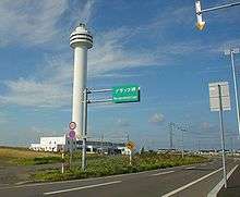
- Cape Ochiishi, a fishing port
- The Ruins of Chashi in the Nemuro Peninsula
- Roadside station Swan 44 Nemuro
- Lake Furen
- Shunkunitai Wild Bird Sanctuary
- Habomai Fishing Port
- Kotohira Shrine
- Meiji Park
- Ohashi Bridge
- Onneto Lake
Cuisine
One local specialty of Nemuro is "escalope". This consists of tonkatsu (breaded deep-fried pork cutlets) over butter fried rice with a special demiglace sauce.[3]
Nemuro is well known by the people of Hokkaido as the one of the best places to eat sushi because of the caught seafood.[3][4] Nemuro also is the origin of two sushi restaurants in Hokkaido: Matsuriya[5] and Hanamaru.[6] Nemuro's seafood delicacies include their fresh Pacific saury, salmon, king crab, and shrimp.
Other delicacies in Nemuro include yakitori bento, Holland sanbei (waffle-like snack), soft serve ice cream, and monjayaki.
Education
High schools
- Hokkaido Nemuro High School
- Hokkaido Nemuro Nishi High School
Sister cities
Nemuro is twinned with the following sister cities:[7]


References
- ↑ History of Nemuro
- ↑ "Koppen Climate Classification" (PDF).
- 1 2 "The Food of Nemuro". Nemuro Tourist Information. Japan: Nemuro Tourist Association. Retrieved 2014-09-03.
- ↑ "Nemuro - DavisHunter.com". www.davishunter.com. Retrieved 2017-12-14.
- ↑ http://www.kushiro-matsuriya.co.jp/shopinfo/nemuro_matsuribayashi.html
- ↑ http://www.sushi-hanamaru.com/
- ↑ Sister-City Relationships in Hokkaido Archived February 24, 2015, at the Wayback Machine.
External links
| Wikimedia Commons has media related to Nemuro, Hokkaido. |

- Official Website (in Japanese)
- English Website
| ||||||||||
| ||||||||||
| ||||||||||
| ||||||||||
| ||||||||||
| ||||||||||
| ||||||||||
| ||||||||||
| ||||||||||
| ||||||||||
| ||||||||||
| ||||||||||
| ||||||||||
| ||||||||||
| Authority control |
|---|