Numata, Hokkaido
| Numata 沼田町 | |||
|---|---|---|---|
| Town | |||
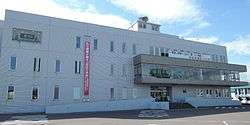 Numata town hall | |||
| |||
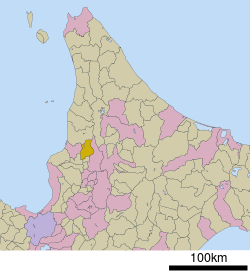 Location of Numata in Hokkaido (Sorachi Subprefecture) | |||
 Numata Location in Japan | |||
| Coordinates: 43°48′N 141°56′E / 43.800°N 141.933°ECoordinates: 43°48′N 141°56′E / 43.800°N 141.933°E | |||
| Country | Japan | ||
| Region | Hokkaido | ||
| Prefecture | Hokkaido (Sorachi Subprefecture) | ||
| District | Uryū | ||
| Area | |||
| • Total | 283.21 km2 (109.35 sq mi) | ||
| Population (September 30, 2016) | |||
| • Total | 3,207 | ||
| • Density | 11/km2 (29/sq mi) | ||
| Time zone | UTC+9 (JST) | ||
| Website |
www | ||


Numata (沼田町 Numata-chō) is a town located in Sorachi Subprefecture, Hokkaido, Japan.
As of September 2016, the town has an estimated population of 3,207. The total area is 283.21 km². Numata's twin city is Port Hardy, Canada.
External links
- Official Website (in Japanese)
| ||||||||||
| ||||||||||
| ||||||||||
| ||||||||||
| ||||||||||
| ||||||||||
| ||||||||||
| ||||||||||
| ||||||||||
| ||||||||||
| ||||||||||
| ||||||||||
| ||||||||||
| ||||||||||
This article is issued from
Wikipedia.
The text is licensed under Creative Commons - Attribution - Sharealike.
Additional terms may apply for the media files.