Kamoenai, Hokkaido
| Kamoenai 神恵内村 | |||
|---|---|---|---|
| Village | |||
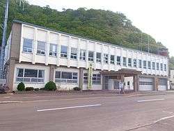 Kamoenai village office | |||
| |||
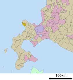 Location of Kamoenai in Hokkaido (Shiribeshi Subprefecture) | |||
 Kamoenai Location in Japan | |||
| Coordinates: 43°9′N 140°26′E / 43.150°N 140.433°ECoordinates: 43°9′N 140°26′E / 43.150°N 140.433°E | |||
| Country | Japan | ||
| Region | Hokkaido | ||
| Prefecture | Hokkaido (Shiribeshi Subprefecture) | ||
| District | Furuu | ||
| Government | |||
| • Mayor | Masayuki Takahashi | ||
| Area | |||
| • Total | 147.71 km2 (57.03 sq mi) | ||
| Population (September 30, 2016) | |||
| • Total | 904 | ||
| • Density | 6.1/km2 (16/sq mi) | ||
| Symbols | |||
| • Tree | Abies sachalinensis | ||
| • Fish | Chum salmon | ||
| Time zone | UTC+9 (JST) | ||
| City hall address |
81-4 Kamoenaimura, Kamoenai, Furuu-gun, Hokkaido 045-0301 | ||
| Website |
www | ||


Kamoenai (神恵内村 Kamoenai-mura) is a village located in Shiribeshi Subprefecture, Hokkaido, Japan. It is the second smallest municipality in Hokkaido by population, after Otoineppu.
As of September 2016, the village has an estimated population of 904. The total area is 147.71 km².
Geography
Kamoenai is located on the western of the Shakotan Peninsula.
Neighboring towns and village
History
Kamoenai was developed by fisheries. Kamoenai Village was merged with Akaishi Village and Sannai Village and became a Second Class Village in 1906.
Education
- Kamoenai Elementary School
- Kamoenai Junior High School
External links

- Official Website (in Japanese)
| ||||||||||
| ||||||||||
| ||||||||||
| ||||||||||
| ||||||||||
| ||||||||||
| ||||||||||
| ||||||||||
| ||||||||||
| ||||||||||
| ||||||||||
| ||||||||||
| ||||||||||
| ||||||||||
This article is issued from
Wikipedia.
The text is licensed under Creative Commons - Attribution - Sharealike.
Additional terms may apply for the media files.