Scott County, Kentucky
| Scott County, Kentucky | |
|---|---|
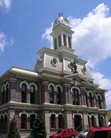 Scott County courthouse in Georgetown | |
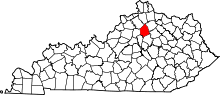 Location in the U.S. state of Kentucky | |
 Kentucky's location in the U.S. | |
| Founded | 1792 |
| Named for | Charles Scott |
| Seat | Georgetown |
| Largest city | Georgetown |
| Area | |
| • Total | 285 sq mi (738 km2) |
| • Land | 282 sq mi (730 km2) |
| • Water | 3.7 sq mi (10 km2), 1.3% |
| Population (est.) | |
| • (2017) | 54,873 |
| • Density | 167/sq mi (64/km2) |
| Congressional district | 6th |
| Time zone | Eastern: UTC−5/−4 |
| Website |
www |
Scott is a county located in the U.S. state of Kentucky. As of the 2010 census, the population was 47,173.[1] Its county seat is Georgetown.[2]
Scott County is part of the Lexington–Fayette, KY Metropolitan Statistical Area.
History
Aboriginal peoples inhabited the Scott County area for at least the last 15,000 years. Evidence of the Adena culture (800 B.C. - 800 A.D.) has been identified, including several significant Adena mounds.
The Scott County area was explored by white explorers as early as 1774. An early settler was John McClelland of Pennsylvania. McLelland's Fort was built overlooking the Georgetown spring. After the local natives attacked the post in 1777, it was abandoned. In 1783 a permanent settlement was established when Robert and Jemima Johnson built Johnson Station (later renamed Great Crossing), near the north fork of Elkhorn Creek (five miles west of present Georgetown).
This area was part of Virginia. In 1776 the Virginia legislature separated the western portion of its lands as Kentucky County. In 1780 that county was divided into three counties: Lincoln, Jefferson, and Fayette. In 1788, a portion of Fayette County was partitioned off and named Woodford County.
On 1 June 1792, the new state of Kentucky became effective. An early act of its new legislature divided existing lands into two new counties; one of these was Scott County,[3] named for General Charles Scott, a Revolutionary War hero, who later served as Kentucky's fourth governor (1808-1812).[4] Its area was taken from the existing Woodford County. Other counties established before the end of 1792 were Clark, Shelby, Logan, and Green counties.
In 1784, Elijah Craig (1743-1808), a Virginia preacher, induced the Virginia legislature to incorporate the town of Lebanon, near the site of McLelland's Fort. In 1790 the town's name was changed to George Town, to honor then-President George Washington. Elijah Craig is also credited with founding the county's first classical school, the first sawmill, the first gristmill, the first fulling and paper mill, the first ropewalk, and (possibly) the area's first bourbon whiskey. In the 27 December 1787, edition of the Kentucky Gazette, he solicited scholars to study at an academy that would open in January 1788 "in Lebanon town," and would offer courses in Latin, Greek,and "such branches of the sciences as are usually taught in public seminaries." Ten years later the school was absorbed by the Rittenhouse Academy, which was given by the state some 5,900 acres in Christian and Cumberland counties so that they might sell the land to benefit their endowment fund. The academy, in turn, was absorbed by Georgetown College in 1829.
The community went into a decline after the death of Elijah Craig in 1808. When Elder Barton Warren Stone (1772-1844), a founder of the Christian Churches movement during the Great Revival, moved to Georgetown in 1816 to become principal of Rittenhouse Academy, he found the community "notorious for its wickedness and irreligion."[5]
In 1825, the Choctaw Nation established the Choctaw Academy at Blue Spring in Scott County. They operated the school for Choctaw boys until 1842, when it was closed. The staff and records moved to the Choctaw Nation, Indian Territory, where the Choctaw Nation had been relocated in the 1830s. In 1844 the Spencer Academy opened as the school for Choctaw boys, while a school was also opened for girls. Later in the century, they allowed Baptist missionaries to found the Armstrong Academy there.
During the American Civil War, Scott County furnished the Union Army with 118 soldiers, while about 1,000 enlisted in the Confederate Army. On 18 November 1861, Scott County native George W. Johnson was elected the provisional Confederate governor of Kentucky.[6]
Scott County is a moist county, meaning that is a dry county with a wet city (Georgetown) within it.[7]
Geography
According to the U.S. Census Bureau, the county has a total area of 285 square miles (740 km2), of which 282 square miles (730 km2) is land and 3.7 square miles (9.6 km2) (1.3%) is water.[8]
Adjacent counties
- Grant County (north)
- Harrison County (northeast)
- Bourbon County (east)
- Fayette County (southeast)
- Woodford County (southwest)
- Franklin County (west)
- Owen County (northwest)
Demographics
| Historical population | |||
|---|---|---|---|
| Census | Pop. | %± | |
| 1800 | 8,007 | — | |
| 1810 | 12,419 | 55.1% | |
| 1820 | 14,219 | 14.5% | |
| 1830 | 14,677 | 3.2% | |
| 1840 | 13,668 | −6.9% | |
| 1850 | 14,946 | 9.4% | |
| 1860 | 14,417 | −3.5% | |
| 1870 | 11,607 | −19.5% | |
| 1880 | 14,965 | 28.9% | |
| 1890 | 16,546 | 10.6% | |
| 1900 | 18,076 | 9.2% | |
| 1910 | 16,956 | −6.2% | |
| 1920 | 15,318 | −9.7% | |
| 1930 | 14,400 | −6.0% | |
| 1940 | 14,314 | −0.6% | |
| 1950 | 15,141 | 5.8% | |
| 1960 | 15,376 | 1.6% | |
| 1970 | 17,948 | 16.7% | |
| 1980 | 21,813 | 21.5% | |
| 1990 | 23,867 | 9.4% | |
| 2000 | 33,061 | 38.5% | |
| 2010 | 47,173 | 42.7% | |
| Est. 2017 | 54,873 | [9] | 16.3% |
| U.S. Decennial Census[10] 1790–1960[11] 1900–1990[12] 1990–2000[13] 2010–2014[1] | |||
As of the census[14] of 2000, there were 33,061 people, 12,110 households, and 8,985 families residing in the county. The population density was 116 per square mile (45/km2). There were 12,977 housing units at an average density of 46 per square mile (18/km2). The racial makeup of the county was 91.94% White, 5.35% Black or African American, 0.26% Native American, 0.50% Asian, 0.01% Pacific Islander, 0.82% from other races, and 1.13% from two or more races. 1.61% of the population were Hispanic or Latino of any race.
There were 12,110 households out of which 38.50% had children under the age of 18 living with them, 58.80% were married couples living together, 11.50% had a female householder with no husband present, and 25.80% were non-families. 21.00% of all households were made up of individuals and 7.00% had someone living alone who was 65 years of age or older. The average household size was 2.61 and the average family size was 3.01.
In the county, the population was spread out with 26.30% under the age of 18, 11.80% from 18 to 24, 32.60% from 25 to 44, 20.40% from 45 to 64, and 8.90% who were 65 years of age or older. The median age was 32 years. For every 100 females, there were 95.80 males. For every 100 females age 18 and over, there were 90.70 males.
The median income for a household in the county was $47,081, and the median income for a family was $54,117. Males had a median income of $40,604 versus $25,767 for females. The per capita income for the county was $21,490. About 7.30% of families and 8.80% of the population were below the poverty line, including 11.00% of those under age 18 and 12.10% of those age 65 or over.
Communities
- Georgetown (county seat)
- Sadieville
- Stamping Ground
Notable people
- James C. C. Black - U.S. Representative from Georgia. Born in Stamping Ground.
- J. Campbell Cantrill - politician, U.S. Representative from Kentucky.
- Daniel Cook - First Attorney General of Illinois.
- Basil Duke - Confederate General, took part in Morgan's Raid. Brother-in-law of John Hunt Morgan.
- William H. Hatch - politician, U.S. Representative from Missouri.
- Henry P. Haun - politician, U.S. Senator from California.
- George W. Johnson - politician, 1st Confederate Governor of Kentucky, died at the Battle of Shiloh.
- John T. Johnson - politician, U.S. Representative from Kentucky, brother of Richard M. Johnson.
- Richard M. Johnson - politician, Vice-President of the United States 1837–43.
- Tom L. Johnson - U.S. Representative from Ohio 1891–95, Mayor of Cleveland 1901–1909.
- John M. Palmer - Civil War general, Governor of Illinois 1869–1873, National Democratic Party presidential candidate 1896.
- James F. Robinson - politician, 22nd Governor of Kentucky. Federal governor during the Civil War. Cardome in Georgetown was his family home.
- John M. Robinson - politician, United States Senator from Illinois.
- Robert Ward Johnson - U.S. and Confederate senator from Arkansas. Nephew of Richard M. Johnson.
- Gustavus W. Smith - General in the Confederate Army during the Civil War, Confederate Secretary of War in 1862.
- Junius Ward - 19th century horseman and plantation owner, founder of Ward Hall.
- Edith Summers Kelley - Canadian author, wrote Weeds (1923), novel about "an artistic tomboy in the rural hills of Kentucky, who struggles unsuccessfully to overcome the oppressive roles assigned to her as a woman"[15]
Politics
| Year | Republican | Democratic | Third parties |
|---|---|---|---|
| 2016 | 62.2% 15,052 | 31.9% 7,715 | 5.9% 1,433 |
| 2012 | 61.6% 12,679 | 36.6% 7,532 | 1.8% 362 |
| 2008 | 59.7% 11,782 | 39.1% 7,712 | 1.2% 236 |
| 2004 | 62.2% 10,600 | 37.1% 6,325 | 0.7% 125 |
| 2000 | 57.7% 7,952 | 39.7% 5,472 | 2.6% 362 |
| 1996 | 45.2% 4,349 | 44.3% 4,258 | 10.5% 1,008 |
| 1992 | 41.1% 3,810 | 39.2% 3,639 | 19.7% 1,824 |
| 1988 | 56.7% 4,482 | 42.7% 3,380 | 0.6% 46 |
| 1984 | 62.4% 4,461 | 36.5% 2,606 | 1.1% 77 |
| 1980 | 43.0% 2,868 | 53.0% 3,531 | 4.0% 268 |
| 1976 | 42.7% 2,408 | 55.3% 3,118 | 2.0% 112 |
| 1972 | 64.8% 3,255 | 32.7% 1,642 | 2.6% 129 |
| 1968 | 35.1% 1,748 | 39.4% 1,961 | 25.6% 1,275 |
| 1964 | 28.7% 1,330 | 70.9% 3,289 | 0.4% 20 |
| 1960 | 45.9% 2,200 | 54.2% 2,598 | 0.0% 0 |
| 1956 | 40.0% 1,940 | 59.0% 2,860 | 1.0% 48 |
| 1952 | 60.3% 3,171 | 39.5% 2,077 | 0.3% 13 |
| 1948 | 26.4% 1,352 | 69.2% 3,548 | 4.5% 228 |
| 1944 | 30.3% 1,589 | 69.1% 3,627 | 0.6% 32 |
| 1940 | 30.7% 1,795 | 69.1% 4,039 | 0.3% 15 |
| 1936 | 31.9% 1,861 | 67.9% 3,966 | 0.2% 11 |
| 1932 | 29.7% 1,943 | 69.8% 4,572 | 0.6% 36 |
| 1928 | 52.8% 3,192 | 47.1% 2,843 | 0.1% 8 |
| 1924 | 37.6% 2,334 | 61.3% 3,805 | 1.1% 68 |
| 1920 | 34.7% 2,661 | 65.0% 4,993 | 0.3% 25 |
| 1916 | 36.0% 1,486 | 63.3% 2,611 | 0.7% 28 |
| 1912 | 26.8% 1,047 | 60.5% 2,361 | 12.7% 497 |
See also
External links
References
- 1 2 "State & County QuickFacts". United States Census Bureau. Retrieved 20 August 2014.
- ↑ "Find a County". National Association of Counties. Retrieved 7 June 2011.
- ↑ Collins, Lewis (1882). Collins' Historical Sketches of Kentucky: History of Kentucky, Vol. 2. Collins & Co. p. 26.
- ↑ The county was named for an American Revolutionary War hero, Gen. Charles Scott, who commanded the Kentucky Militia at the disastrous Battle of the Wabash in 1791.The Register of the Kentucky State Historical Society, Vol. 1. Kentucky State Historical Society. 1903. p. 37. Scott later took part in the 1794 victory at the Battle of Fallen Timbers, and served as Governor from 1808 to 1812.
- ↑ History - Georgetown/Scott County
- ↑ Scott County History
- ↑ Kentucky News
- ↑ "2010 Census Gazetteer Files". United States Census Bureau. 22 August 2012. Archived from the original on 12 August 2014. Retrieved 20 August 2014.
- ↑ "Population and Housing Unit Estimates". Retrieved 26 March 2018.
- ↑ "U.S. Decennial Census". United States Census Bureau. Retrieved 20 August 2014.
- ↑ "Historical Census Browser". University of Virginia Library. Retrieved 20 August 2014.
- ↑ "Population of Counties by Decennial Census: 1900 to 1990". United States Census Bureau. Retrieved 20 August 2014.
- ↑ "Census 2000 PHC-T-4. Ranking Tables for Counties: 1990 and 2000" (PDF). United States Census Bureau. Retrieved 2 April 2015.
- ↑ "American FactFinder". United States Census Bureau. Retrieved 31 January 2008.
- ↑ Ballard, Sandra (2003). Listen Here: Women Writing in Appalachia. Lexington, KY: University Press of Kentucky. p. 320. ISBN 978-0-8131-9066-2.
- ↑ Leip, David. "Dave Leip's Atlas of U.S. Presidential Elections". uselectionatlas.org. Retrieved 6 July 2018.
Municipalities and communities of Scott County, Kentucky, United States | ||
|---|---|---|
| Cities | | |
| Other localities |
| |
| Footnotes | ‡This populated place also has portions in an adjacent county or counties | |
| Central city |  | |
|---|---|---|
| Municipalities with population over 10,000 | ||
| Municipalities with population 5,000-10,000 | ||
| Municipalities with population under 5,000 | ||
| Counties | ||
