Nakashibetsu Airport
| Nakashibetsu Airport 中標津空港 | |||||||||||
|---|---|---|---|---|---|---|---|---|---|---|---|
 | |||||||||||
| Summary | |||||||||||
| Airport type | Public | ||||||||||
| Serves | Nakashibetsu, Nemuro | ||||||||||
| Location | Nakashibetsu, Hokkaidō, Japan | ||||||||||
| Elevation AMSL | 214 ft / 65 m | ||||||||||
| Coordinates | 43°34′39″N 144°57′36″E / 43.57750°N 144.96000°ECoordinates: 43°34′39″N 144°57′36″E / 43.57750°N 144.96000°E | ||||||||||
| Map | |||||||||||
 RJCN Location in Japan | |||||||||||
| Runways | |||||||||||
| |||||||||||
| Statistics (2015) | |||||||||||
| |||||||||||
|
Source: Japanese Ministry of Land, Infrastructure, Transport and Tourism[1] | |||||||||||
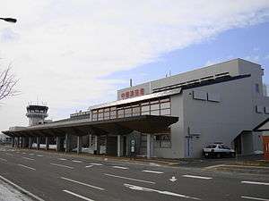
Nakashibetsu Airport (中標津空港 Nakashibetsu Kūkō) (IATA: SHB, ICAO: RJCN) is an airport located 2 NM (3.7 km; 2.3 mi) from Nakashibetsu, Hokkaidō, Japan.
The airport serves Nakashibetsu and the nearby city of Nemuro.
History
Nakashibetsu Airport was constructed as an Imperial Japanese Navy airfield in 1944. It opened for civilian use following the war in 1965, and scheduled service to Okadama Airport in Sapporo began in 1974, followed by service to New Chitose Airport in 1980 and Tokyo Haneda Airport in 1990. Chitose flights were suspended in 2008 but resumed following the termination of Okadama service in 2010.[2]
In 2011, the Hokkaido government announced that landing fees would be waived for international charter flights using the airport in an attempt to lure more overseas tourists to the region.[3]
Airlines and destinations
| Airlines | Destinations |
|---|---|
| All Nippon Airways | Tokyo-Haneda |
| All Nippon Airways operated by ANA Wings | Sapporo-Chitose |
References
- ↑ "Nakashibetsu Airport" (PDF). Japanese Ministry of Land, Infrastructure, Transport and Tourism. Archived from the original (PDF) on 21 October 2016. Retrieved 7 January 2017.
- ↑ "中標津空港について". 釧路総合振興局. Retrieved 10 September 2013.
- ↑ "北海道管理の3空港、国際チャーター便の着陸料無料に". 日本経済新聞. 28 May 2011. Retrieved 10 September 2013.
1 Joint civil-military use | |||||||
| Major hubs | |||||||
| International |
| ||||||
| Domestic |
| ||||||
| General aviation |
| ||||||
| Military | |||||||
| Heliports |
| ||||||
| Defunct | |||||||
Mass transit in Hokkaido | |
|---|---|
| JR named trains | |
| Other railways | |
| Terminals |
|
| Public Ferries |
|
| Miscellaneous |
|
| |