Vaiden, Mississippi
| Vaiden, Mississippi | |
|---|---|
| Town | |
 St. Clement's Episcopal Church, Vaiden, organized 1859 | |
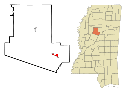 Location of Vaiden, Mississippi | |
| Coordinates: 33°19′54″N 89°44′49″W / 33.33167°N 89.74694°WCoordinates: 33°19′54″N 89°44′49″W / 33.33167°N 89.74694°W | |
| Country | United States |
| State | Mississippi |
| County | Carroll |
| Area | |
| • Total | 2.2 sq mi (5.6 km2) |
| • Land | 2.2 sq mi (5.6 km2) |
| • Water | 0.0 sq mi (0.0 km2) |
| Elevation | 312 ft (95 m) |
| Population (2010) | |
| • Total | 734 |
| • Estimate (2016)[1] | 980 |
| • Density | 340/sq mi (130/km2) |
| Time zone | UTC-6 (Central (CST)) |
| • Summer (DST) | UTC-5 (CDT) |
| ZIP code | 39176 |
| Area code(s) | 662 |
| FIPS code | 28-75880 |
| GNIS feature ID | 0679166 |
Vaiden is a town in Carroll County, Mississippi, United States and its first county seat. The population was 734 at the 2010 census.[2] It is part of the Greenwood, Mississippi micropolitan area.
History
Vaiden was founded about 1857 and named after Dr. Cowles Mead Vaiden (04/21/1812 - 02/06/1880), a local doctor, planter, and philanthropist. In the late 1850s, Dr. Vaiden gave the right-of-way through his land for construction of the last span of the Central Railroad, in order to connect the state capital, Jackson, Mississippi, with Memphis, Tennessee. Around the railroad's completion in 1857, the population that had settled at the former Choctaw Indian town of Shongalo was moved to the east, to allow for better access to the railroad.
The new town was named in honor of Dr. Vaiden, and was made a regular stop on the railroad line. For that reason, it was designated as the county seat of Carroll County. Vaiden was incorporated on February 10, 1860. With additional development of population in the county, residents wanted to have access to a town closer to the Mississippi River. Carrollton, Mississippi was also designated as a county seat and is the site of the county courthouse.
Geography
Vaiden is located in southeastern Carroll County at 33°19′54″N 89°44′49″W / 33.33167°N 89.74694°W (33.331591, -89.747002).[3] U.S. Route 51 passes through the center of town, leading north 11 miles (18 km) to Winona and south 19 miles (31 km) to Durant. The town limits extend west to include the area around Exit 174 on Interstate 55, which leads north 31 miles (50 km) to Grenada and south 79 miles (127 km) to Jackson.
According to the United States Census Bureau, Vaiden has a total area of 2.2 square miles (5.6 km2), all land.[2]
Demographics
| Historical population | |||
|---|---|---|---|
| Census | Pop. | %± | |
| 1880 | 526 | — | |
| 1890 | 533 | 1.3% | |
| 1900 | 474 | −11.1% | |
| 1910 | 713 | 50.4% | |
| 1920 | 579 | −18.8% | |
| 1930 | 648 | 11.9% | |
| 1940 | 601 | −7.3% | |
| 1950 | 583 | −3.0% | |
| 1960 | 475 | −18.5% | |
| 1970 | 716 | 50.7% | |
| 1980 | 924 | 29.1% | |
| 1990 | 789 | −14.6% | |
| 2000 | 840 | 6.5% | |
| 2010 | 734 | −12.6% | |
| Est. 2016 | 980 | [1] | 33.5% |
| U.S. Decennial Census[4] | |||
As of the census[5] of 2000, there were 840 people, 326 households, and 202 families residing in the town. The population density was 383.8 people per square mile (148.1/km²). There were 365 housing units at an average density of 166.8 per square mile (64.4/km²). The racial makeup of the town was 28.45% White, 71.07% African American, 0.12% Native American, 0.12% Asian, 0.12% from other races, and 0.12% from two or more races. Hispanic or Latino of any race were 0.83% of the population.
There were 326 households out of which 30.7% had children under the age of 18 living with them, 31.0% were married couples living together, 26.7% had a female householder with no husband present, and 38.0% were non-families. 34.4% of all households were made up of individuals and 16.0% had someone living alone who was 65 years of age or older. The average household size was 2.31 and the average family size was 2.97.
In the town, the population was spread out with 24.0% under the age of 18, 13.9% from 18 to 24, 29.5% from 25 to 44, 20.5% from 45 to 64, and 12.0% who were 65 years of age or older. The median age was 34 years. For every 100 females, there were 108.4 males. For every 100 females age 18 and over, there were 111.3 males.
The median income for a household in the town was $15,000, and the median income for a family was $26,944. Males had a median income of $26,607 versus $15,500 for females. The per capita income for the town was $17,158. About 26.2% of families and 32.9% of the population were below the poverty line, including 32.9% of those under age 18 and 38.6% of those age 65 or over.
Education
The town of Vaiden is served by the Carroll County School District.
Notable people
- Earl L. Brewer, governor of Mississippi from 1912 to 1916[6]
- Walter Holman, former NFL player
References
- 1 2 "Population and Housing Unit Estimates". Retrieved June 9, 2017.
- 1 2 "Geographic Identifiers: 2010 Demographic Profile Data (G001): Vaiden town, Mississippi". U.S. Census Bureau, American Factfinder. Retrieved October 2, 2014.
- ↑ "US Gazetteer files: 2010, 2000, and 1990". United States Census Bureau. 2011-02-12. Retrieved 2011-04-23.
- ↑ "Census of Population and Housing". Census.gov. Retrieved June 4, 2015.
- ↑ "American FactFinder". United States Census Bureau. Retrieved 2008-01-31.
- ↑ Nancy Capace (2001). Encyclopedia of Mississippi. North American Book Dist LLC. pp. 127–. ISBN 978-0-403-09603-9.
External links
| Wikimedia Commons has media related to Vaiden, Mississippi. |
Municipalities and communities of Carroll County, Mississippi, United States | ||
|---|---|---|
| Towns | 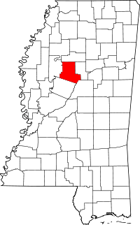 | |
| Unincorporated communities | ||