Argences-en-Aubrac
| Argences-en-Aubrac | |
|---|---|
| Commune | |
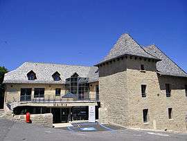 The town hall in Sainte-Geneviève-sur-Argence | |
 Argences-en-Aubrac Location within Occitanie region  Argences-en-Aubrac | |
| Coordinates: 44°48′11″N 2°45′32″E / 44.803°N 2.759°ECoordinates: 44°48′11″N 2°45′32″E / 44.803°N 2.759°E | |
| Country | France |
| Region | Occitanie |
| Department | Aveyron |
| Arrondissement | Rodez |
| Canton | Aubrac et Carladez |
| Area1 | 151.78 km2 (58.60 sq mi) |
| Population (2013)2 | 1,705 |
| • Density | 11/km2 (29/sq mi) |
| Time zone | UTC+1 (CET) |
| • Summer (DST) | UTC+2 (CEST) |
| INSEE/Postal code | 12223 /12420, 12210 |
|
1 French Land Register data, which excludes lakes, ponds, glaciers > 1 km2 (0.386 sq mi or 247 acres) and river estuaries. 2 Population without double counting: residents of multiple communes (e.g., students and military personnel) only counted once. | |
Argences-en-Aubrac is a commune in the department of Aveyron, southern France. The municipality was established on 1 January 2016 by merger of the former communes of Sainte-Geneviève-sur-Argence, Alpuech, Graissac, Lacalm, La Terrisse and Vitrac-en-Viadène.[1]
See also
References
| Wikimedia Commons has media related to Argences en Aubrac. |
- ↑ Arrêté préfectoral 18 November 2015 (in French)
This article is issued from
Wikipedia.
The text is licensed under Creative Commons - Attribution - Sharealike.
Additional terms may apply for the media files.