Saint-Santin
| Saint-Santin | |
|---|---|
| Commune | |
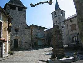 The main square and the two churches | |
 Saint-Santin Location within Occitanie region  Saint-Santin | |
| Coordinates: 44°38′59″N 2°13′09″E / 44.6497°N 2.2192°ECoordinates: 44°38′59″N 2°13′09″E / 44.6497°N 2.2192°E | |
| Country | France |
| Region | Occitanie |
| Department | Aveyron |
| Arrondissement | Villefranche-de-Rouergue |
| Canton | Lot et Dourdou |
| Intercommunality | Vallée du Lot |
| Government | |
| • Mayor (2008–2014) | Raymond Bos |
| Area1 | 22.78 km2 (8.80 sq mi) |
| Population (2008)2 | 561 |
| • Density | 25/km2 (64/sq mi) |
| Time zone | UTC+1 (CET) |
| • Summer (DST) | UTC+2 (CEST) |
| INSEE/Postal code | 12246 /12300 |
| Elevation | 187–592 m (614–1,942 ft) |
|
1 French Land Register data, which excludes lakes, ponds, glaciers > 1 km2 (0.386 sq mi or 247 acres) and river estuaries. 2 Population without double counting: residents of multiple communes (e.g., students and military personnel) only counted once. | |
Saint-Santin is a commune in the Aveyron department in southern France.
Population
| Historical population | ||
|---|---|---|
| Year | Pop. | ±% |
| 1962 | 684 | — |
| 1968 | 696 | +1.8% |
| 1975 | 664 | −4.6% |
| 1982 | 643 | −3.2% |
| 1990 | 575 | −10.6% |
| 1999 | 534 | −7.1% |
| 2008 | 561 | +5.1% |
See also
References
| Wikimedia Commons has media related to Saint-Santin. |
This article is issued from
Wikipedia.
The text is licensed under Creative Commons - Attribution - Sharealike.
Additional terms may apply for the media files.