Curan
| Curan | |
|---|---|
| Commune | |
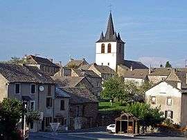 The church and surrounding buildings in Curan | |
 Curan Location within Occitanie region  Curan | |
| Coordinates: 44°12′03″N 2°51′17″E / 44.2008°N 2.8547°ECoordinates: 44°12′03″N 2°51′17″E / 44.2008°N 2.8547°E | |
| Country | France |
| Region | Occitanie |
| Department | Aveyron |
| Arrondissement | Millau |
| Canton | Raspes et Lévezou |
| Government | |
| • Mayor (2008–2014) | Jean-Louis Grimal |
| Area1 | 41.18 km2 (15.90 sq mi) |
| Population (2008)2 | 302 |
| • Density | 7.3/km2 (19/sq mi) |
| Time zone | UTC+1 (CET) |
| • Summer (DST) | UTC+2 (CEST) |
| INSEE/Postal code | 12307 /12410 |
| Elevation |
804–1,062 m (2,638–3,484 ft) (avg. 950 m or 3,120 ft) |
|
1 French Land Register data, which excludes lakes, ponds, glaciers > 1 km2 (0.386 sq mi or 247 acres) and river estuaries. 2 Population without double counting: residents of multiple communes (e.g., students and military personnel) only counted once. | |
Curan is a commune in the Aveyron department in southern France.
Population
| Historical population | ||
|---|---|---|
| Year | Pop. | ±% |
| 1962 | 494 | — |
| 1968 | 510 | +3.2% |
| 1975 | 439 | −13.9% |
| 1982 | 408 | −7.1% |
| 1990 | 357 | −12.5% |
| 1999 | 302 | −15.4% |
| 2008 | 302 | +0.0% |
See also
References
| Wikimedia Commons has media related to Curan. |
This article is issued from
Wikipedia.
The text is licensed under Creative Commons - Attribution - Sharealike.
Additional terms may apply for the media files.