La Capelle-Bleys
| La Capelle-Bleys | |
|---|---|
| Commune | |
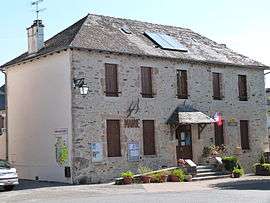 The town hall in La Capelle-Bleys | |
 La Capelle-Bleys Location within Occitanie region  La Capelle-Bleys | |
| Coordinates: 44°17′44″N 2°11′01″E / 44.2956°N 2.1836°ECoordinates: 44°17′44″N 2°11′01″E / 44.2956°N 2.1836°E | |
| Country | France |
| Region | Occitanie |
| Department | Aveyron |
| Arrondissement | Villefranche-de-Rouergue |
| Canton | Aveyron et Tarn |
| Intercommunality | Aveyron Ségala Viaur |
| Government | |
| • Mayor (2008–2014) | Alain Bessac |
| Area1 | 15.63 km2 (6.03 sq mi) |
| Population (2009)2 | 391 |
| • Density | 25/km2 (65/sq mi) |
| Time zone | UTC+1 (CET) |
| • Summer (DST) | UTC+2 (CEST) |
| INSEE/Postal code | 12054 /12240 |
| Elevation |
514–728 m (1,686–2,388 ft) (avg. 619 m or 2,031 ft) |
|
1 French Land Register data, which excludes lakes, ponds, glaciers > 1 km2 (0.386 sq mi or 247 acres) and river estuaries. 2 Population without double counting: residents of multiple communes (e.g., students and military personnel) only counted once. | |
La Capelle-Bleys is a commune in the Aveyron department in southern France.
Population
| Historical population | ||
|---|---|---|
| Year | Pop. | ±% |
| 1990 | 354 | — |
| 1999 | 364 | +2.8% |
| 2006 | 380 | +4.4% |
| 2009 | 391 | +2.9% |
See also
References
| Wikimedia Commons has media related to La Capelle-Bleys. |
This article is issued from
Wikipedia.
The text is licensed under Creative Commons - Attribution - Sharealike.
Additional terms may apply for the media files.