Rodelle
| Rodelle | |
|---|---|
| Commune | |
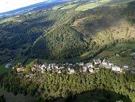 A general view of Rodelle | |
 Rodelle Location within Occitanie region  Rodelle | |
| Coordinates: 44°29′29″N 2°37′38″E / 44.4914°N 2.6272°ECoordinates: 44°29′29″N 2°37′38″E / 44.4914°N 2.6272°E | |
| Country | France |
| Region | Occitanie |
| Department | Aveyron |
| Arrondissement | Rodez |
| Canton | Causse-Comtal |
| Intercommunality | Bozouls Comtal |
| Government | |
| • Mayor (2008–2014) | Jean-Michel Lalle |
| Area1 | 53.43 km2 (20.63 sq mi) |
| Population (2008)2 | 959 |
| • Density | 18/km2 (46/sq mi) |
| Time zone | UTC+1 (CET) |
| • Summer (DST) | UTC+2 (CEST) |
| INSEE/Postal code | 12201 /12340 |
| Elevation | 320–606 m (1,050–1,988 ft) |
|
1 French Land Register data, which excludes lakes, ponds, glaciers > 1 km2 (0.386 sq mi or 247 acres) and river estuaries. 2 Population without double counting: residents of multiple communes (e.g., students and military personnel) only counted once. | |
Rodelle is a commune in the Aveyron department in southern France.
See also
References
| Wikimedia Commons has media related to Rodelle. |
This article is issued from
Wikipedia.
The text is licensed under Creative Commons - Attribution - Sharealike.
Additional terms may apply for the media files.