Durenque
| Durenque | |
|---|---|
| Commune | |
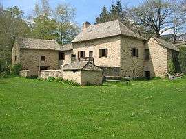 Old mill | |
 Durenque Location within Occitanie region  Durenque | |
| Coordinates: 44°06′38″N 2°37′08″E / 44.1106°N 2.6189°ECoordinates: 44°06′38″N 2°37′08″E / 44.1106°N 2.6189°E | |
| Country | France |
| Region | Occitanie |
| Department | Aveyron |
| Arrondissement | Millau |
| Canton | Monts du Réquistanais |
| Intercommunality | Réquistanais |
| Government | |
| • Mayor (2008–2014) | Vincent Baldet |
| Area1 | 33.15 km2 (12.80 sq mi) |
| Population (2008)2 | 552 |
| • Density | 17/km2 (43/sq mi) |
| Time zone | UTC+1 (CET) |
| • Summer (DST) | UTC+2 (CEST) |
| INSEE/Postal code | 12092 /12170 |
| Elevation |
553–908 m (1,814–2,979 ft) (avg. 722 m or 2,369 ft) |
|
1 French Land Register data, which excludes lakes, ponds, glaciers > 1 km2 (0.386 sq mi or 247 acres) and river estuaries. 2 Population without double counting: residents of multiple communes (e.g., students and military personnel) only counted once. | |
Durenque is a commune in the Aveyron department in southern France.
Population
| Historical population | ||
|---|---|---|
| Year | Pop. | ±% |
| 1962 | 804 | — |
| 1968 | 862 | +7.2% |
| 1975 | 811 | −5.9% |
| 1982 | 805 | −0.7% |
| 1990 | 724 | −10.1% |
| 1999 | 607 | −16.2% |
| 2008 | 552 | −9.1% |
See also
References
| Wikimedia Commons has media related to Durenque. |
This article is issued from
Wikipedia.
The text is licensed under Creative Commons - Attribution - Sharealike.
Additional terms may apply for the media files.