Boussac, Aveyron
| Boussac | |
|---|---|
| Commune | |
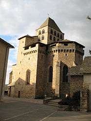 The church in Boussac | |
 Boussac Location within Occitanie region  Boussac | |
| Coordinates: 44°16′54″N 2°22′06″E / 44.2817°N 2.3683°ECoordinates: 44°16′54″N 2°22′06″E / 44.2817°N 2.3683°E | |
| Country | France |
| Region | Occitanie |
| Department | Aveyron |
| Arrondissement | Villefranche-de-Rouergue |
| Canton | Ceor-Ségala |
| Intercommunality | Pays Baraquevillois |
| Government | |
| • Mayor (2008–2014) | François Carrière |
| Area1 | 17.92 km2 (6.92 sq mi) |
| Population (2008)2 | 531 |
| • Density | 30/km2 (77/sq mi) |
| Time zone | UTC+1 (CET) |
| • Summer (DST) | UTC+2 (CEST) |
| INSEE/Postal code | 12032 /12160 |
| Elevation |
518–758 m (1,699–2,487 ft) (avg. 630 m or 2,070 ft) |
|
1 French Land Register data, which excludes lakes, ponds, glaciers > 1 km2 (0.386 sq mi or 247 acres) and river estuaries. 2 Population without double counting: residents of multiple communes (e.g., students and military personnel) only counted once. | |
Boussac is a commune in the Aveyron department in southern France.
Population
| Historical population | ||
|---|---|---|
| Year | Pop. | ±% |
| 1962 | 626 | — |
| 1968 | 633 | +1.1% |
| 1975 | 612 | −3.3% |
| 1982 | 558 | −8.8% |
| 1990 | 465 | −16.7% |
| 1999 | 415 | −10.8% |
| 2008 | 531 | +28.0% |
See also
References
| Wikimedia Commons has media related to Boussac, Aveyron. |
This article is issued from
Wikipedia.
The text is licensed under Creative Commons - Attribution - Sharealike.
Additional terms may apply for the media files.