Le Monastère
| Le Monastère | |
|---|---|
| Commune | |
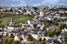 A general view of Le Monastère | |
 Le Monastère Location within Occitanie region  Le Monastère | |
| Coordinates: 44°20′37″N 2°34′45″E / 44.3436°N 2.5792°ECoordinates: 44°20′37″N 2°34′45″E / 44.3436°N 2.5792°E | |
| Country | France |
| Region | Occitanie |
| Department | Aveyron |
| Arrondissement | Rodez |
| Canton | Rodez-2 |
| Intercommunality | Grand Rodez |
| Government | |
| • Mayor (2008–2014) | Michel Gantou |
| Area1 | 6.73 km2 (2.60 sq mi) |
| Population (2008)2 | 2,100 |
| • Density | 310/km2 (810/sq mi) |
| Time zone | UTC+1 (CET) |
| • Summer (DST) | UTC+2 (CEST) |
| INSEE/Postal code | 12146 /12000 |
| Elevation |
519–648 m (1,703–2,126 ft) (avg. 558 m or 1,831 ft) |
|
1 French Land Register data, which excludes lakes, ponds, glaciers > 1 km2 (0.386 sq mi or 247 acres) and river estuaries. 2 Population without double counting: residents of multiple communes (e.g., students and military personnel) only counted once. | |
Le Monastère is a commune in the Aveyron department in southern France.
Population
| Historical population | ||
|---|---|---|
| Year | Pop. | ±% |
| 1962 | 909 | — |
| 1968 | 937 | +3.1% |
| 1975 | 1,201 | +28.2% |
| 1982 | 1,256 | +4.6% |
| 1990 | 1,579 | +25.7% |
| 1999 | 1,809 | +14.6% |
| 2008 | 2,100 | +16.1% |
See also
References
| Wikimedia Commons has media related to Le Monastère. |
This article is issued from
Wikipedia.
The text is licensed under Creative Commons - Attribution - Sharealike.
Additional terms may apply for the media files.