Peyreleau
| Peyreleau | ||
|---|---|---|
| Commune | ||
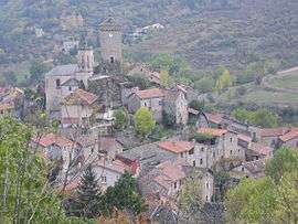 A general view of Peyreleau | ||
| ||
 Peyreleau Location within Occitanie region  Peyreleau | ||
| Coordinates: 44°11′21″N 3°12′33″E / 44.1892°N 3.2092°ECoordinates: 44°11′21″N 3°12′33″E / 44.1892°N 3.2092°E | ||
| Country | France | |
| Region | Occitanie | |
| Department | Aveyron | |
| Arrondissement | Millau | |
| Canton | Tarn et Causses | |
| Intercommunality | Millau Grands Causses | |
| Government | ||
| • Mayor (2008–2014) | Jean Leymarie | |
| Area1 | 16.14 km2 (6.23 sq mi) | |
| Population (2008)2 | 73 | |
| • Density | 4.5/km2 (12/sq mi) | |
| Time zone | UTC+1 (CET) | |
| • Summer (DST) | UTC+2 (CEST) | |
| INSEE/Postal code | 12180 /12720 | |
| Elevation |
392–882 m (1,286–2,894 ft) (avg. 400 m or 1,300 ft) | |
|
1 French Land Register data, which excludes lakes, ponds, glaciers > 1 km2 (0.386 sq mi or 247 acres) and river estuaries. 2 Population without double counting: residents of multiple communes (e.g., students and military personnel) only counted once. | ||
.svg.png)
Peyreleau is a commune in the Aveyron department in southern France.
Population
| Historical population | ||
|---|---|---|
| Year | Pop. | ±% |
| 1962 | 51 | — |
| 1968 | 95 | +86.3% |
| 1975 | 110 | +15.8% |
| 1982 | 100 | −9.1% |
| 1990 | 77 | −23.0% |
| 1999 | 70 | −9.1% |
| 2008 | 73 | +4.3% |
See also
References
| Wikimedia Commons has media related to Peyreleau. |
This article is issued from
Wikipedia.
The text is licensed under Creative Commons - Attribution - Sharealike.
Additional terms may apply for the media files.