Combret
| Combret | ||
|---|---|---|
| Commune | ||
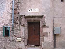 Town hall | ||
| ||
 Combret Location within Occitanie region  Combret | ||
| Coordinates: 43°50′33″N 2°40′24″E / 43.8425°N 2.6733°ECoordinates: 43°50′33″N 2°40′24″E / 43.8425°N 2.6733°E | ||
| Country | France | |
| Region | Occitanie | |
| Department | Aveyron | |
| Arrondissement | Millau | |
| Canton | Causses-Rougiers | |
| Intercommunality | Pays Saint-Serninois | |
| Government | ||
| • Mayor (2008–2014) | Claude Barthélémy | |
| Area1 | 49.85 km2 (19.25 sq mi) | |
| Population (2008)2 | 297 | |
| • Density | 6.0/km2 (15/sq mi) | |
| Time zone | UTC+1 (CET) | |
| • Summer (DST) | UTC+2 (CEST) | |
| INSEE/Postal code | 12069 /12370 | |
| Elevation |
326–919 m (1,070–3,015 ft) (avg. 370 m or 1,210 ft) | |
|
1 French Land Register data, which excludes lakes, ponds, glaciers > 1 km2 (0.386 sq mi or 247 acres) and river estuaries. 2 Population without double counting: residents of multiple communes (e.g., students and military personnel) only counted once. | ||
Combret is a commune in the Aveyron department in southern France.
It has a bridge over the river Rance, which runs alongside the village.
Population
| Historical population | ||
|---|---|---|
| Year | Pop. | ±% |
| 1962 | 392 | — |
| 1968 | 462 | +17.9% |
| 1975 | 370 | −19.9% |
| 1982 | 327 | −11.6% |
| 1990 | 271 | −17.1% |
| 1999 | 296 | +9.2% |
| 2008 | 297 | +0.3% |
Administration
Claude Barthélémy has been the mayor since 2001 and will continue to be until 2014.
See also
References
| Wikimedia Commons has media related to Combret. |
This article is issued from
Wikipedia.
The text is licensed under Creative Commons - Attribution - Sharealike.
Additional terms may apply for the media files.