Richmound
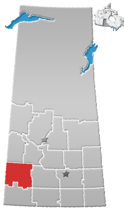
Richmound (2016 population: 147) is a village in the Canadian province of Saskatchewan within the Rural Municipality of Enterprise No. 142 and Census Division No. 8. It is approximately 80 km (50 mi) northeast of Medicine Hat, Alberta. The economy is driven in large part by the oil and gas sector as well as agriculture. The area was originally settled by Germans, mostly Catholics from South Russia.
Richmound | |
|---|---|
Village | |
 Richmound  Richmound | |
| Coordinates: 50.446°N 109.763°W | |
| Country | Canada |
| Province | Saskatchewan |
| Region | Saskatchewan |
| Census division | 8 |
| Rural Municipality | Enterprise |
| Post office Founded | 1912-08-15 |
| Government | |
| • Mayor | Barry Manz |
| • Administrator | Laurie Baron |
| • Governing body | Richmound Village Council |
| Area | |
| • Total | 0.47 km2 (0.18 sq mi) |
| Population (2011)[1] | |
| • Total | 154 |
| • Density | 327.8/km2 (849/sq mi) |
| Time zone | CST |
| Postal code | S0N 2E0 |
| Area code(s) | 306 |
| Highways | Highway 371 Highway 635 |
| Website | Official website |
| [2][3][4][5] | |
The village has a community hall, church, skating arena, curling rink, ball diamonds, stores, and a hotel. The K-12 School was closed in 2008, and the students are now bussed to a neighbouring village.
Local lore states that Richmond, British Columbia is actually named after Richmound. It is said that the founding fathers of Richmond BC simply forgot to add the 'U' in a classic (and historical) spelling error.
History
Richmound incorporated as a village on May 5, 1947.[6]
Demographics
In the 2016 Census of Population conducted by Statistics Canada, the Village of Richmound recorded a population of 147 living in 66 of its 78 total private dwellings, a -4.8% change from its 2011 population of 154. With a land area of 0.47 km2 (0.18 sq mi), it had a population density of 312.8/km2 (810.1/sq mi) in 2016.[9]
In the 2011 Census of Population, the Village of Richmound recorded a population of 154, a -3.1% change from its 2006 population of 159. With a land area of 0.47 km2 (0.18 sq mi), it had a population density of 327.7/km2 (848.6/sq mi) in 2011.[10]
See also
- List of communities in Saskatchewan
- Villages of Saskatchewan
References
- "2011 Community Profiles". Statistics Canada. Government of Canada. Retrieved 2014-08-21.
- National Archives, Archivia Net. "Post Offices and Postmasters". Archived from the original on October 6, 2006. Retrieved 2014-08-21.
- Government of Saskatchewan, MRD Home. "Municipal Directory System". Archived from the original on January 15, 2016. Retrieved 2014-08-21.
- Canadian Textiles Institute. (2005), CTI Determine your provincial constituency, archived from the original on 2007-09-11
- Commissioner of Canada Elections, Chief Electoral Officer of Canada (2005), Elections Canada On-line, archived from the original on April 21, 2007
- "Urban Municipality Incorporations". Saskatchewan Ministry of Government Relations. Archived from the original on October 15, 2014. Retrieved June 1, 2020.
- "Saskatchewan Census Population" (PDF). Saskatchewan Bureau of Statistics. Archived from the original (PDF) on September 24, 2015. Retrieved May 31, 2020.
- "Saskatchewan Census Population". Saskatchewan Bureau of Statistics. Retrieved May 31, 2020.
- "Population and dwelling counts, for Canada, provinces and territories, and census subdivisions (municipalities), 2016 and 2011 censuses – 100% data (Saskatchewan)". Statistics Canada. February 8, 2017. Retrieved May 30, 2020.
- "Population and dwelling counts, for Canada, provinces and territories, and census subdivisions (municipalities), 2011 and 2006 censuses (Saskatchewan)". Statistics Canada. June 3, 2019. Retrieved May 30, 2020.
External links
Places adjacent to Richmound | ||||||||||
|---|---|---|---|---|---|---|---|---|---|---|
| ||||||||||