Chamberlain, Saskatchewan
Chamberlain (2016 population: 90) is a village in the Canadian province of Saskatchewan within the Rural Municipality of Sarnia No. 221 and Census Division No. 6.
Chamberlain | |
|---|---|
| Village of Chamberlain | |
 Chamberlain's Business District along Highway 11 | |
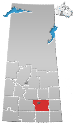
 Location of Chamberlain in Saskatchewan | |
| Coordinates: 50°51′05″N 105°34′05″W | |
| Country | |
| Province | |
| Region | South-central |
| Rural Municipality | Sarnia No. 221 |
| Post office Founded | 1906 |
| Incorporated (Village) | 1911 |
| Government | |
| • Type | Municipal |
| • Governing body | Chamberlain Village Council |
| • Mayor | Shawn Ackerman |
| • Administrator | Sarah Wells |
| Area | |
| • Total | 0.70 km2 (0.27 sq mi) |
| Population (2016) | |
| • Total | 90 |
| • Density | 129.1/km2 (334/sq mi) |
| Time zone | UTC-6 (CST) |
| Postal code | S0G 0R0 |
| Area code(s) | 306 |
| Highways | |
| Railways | Canadian Pacific Railway |
Chamberlain is notable for being the last community between Regina and Saskatoon that Highway 11, the Louis Riel Trail, still passes through. The highway narrows to two lanes and its speed limit is reduced from 110 km/h to 50 km/h. A number of small restaurants and gas stations benefit from having traffic pass through at slow speed. The village is only about half an hour drive from Moose Jaw, an hour away from Regina and one and a half hours to get to Saskatoon. Highway 11 has been realigned around all other communities along its route.[1]
History
Chamberlain incorporated as a village on January 31, 1911.[2]
Demographics
In the 2016 Census of Population conducted by Statistics Canada, the Village of Chamberlain recorded a population of 90 living in 46 of its 56 total private dwellings, a 2.2% change from its 2011 population of 88. With a land area of 0.7 km2 (0.27 sq mi), it had a population density of 128.6/km2 (333.0/sq mi) in 2016.[5]
In the 2011 Census of Population, the Village of Chamberlain recorded a population of 88, a -18.5% change from its 2006 population of 108. With a land area of 0.7 km2 (0.27 sq mi), it had a population density of 125.7/km2 (325.6/sq mi) in 2011.[6]
References
- Adam, Betty Ann. Saskatoon Star Phoenix (ed.). Chamberlain: Highway a lifeline. Saskatoon Star Phoenix newspaper Saturday March 17, 2007. p. 3.
- "Urban Municipality Incorporations". Saskatchewan Ministry of Government Relations. Archived from the original on October 15, 2014. Retrieved June 1, 2020.
- "Saskatchewan Census Population" (PDF). Saskatchewan Bureau of Statistics. Archived from the original (PDF) on September 24, 2015. Retrieved May 31, 2020.
- "Saskatchewan Census Population". Saskatchewan Bureau of Statistics. Retrieved May 31, 2020.
- "Population and dwelling counts, for Canada, provinces and territories, and census subdivisions (municipalities), 2016 and 2011 censuses – 100% data (Saskatchewan)". Statistics Canada. February 8, 2017. Retrieved May 30, 2020.
- "Population and dwelling counts, for Canada, provinces and territories, and census subdivisions (municipalities), 2011 and 2006 censuses (Saskatchewan)". Statistics Canada. June 3, 2019. Retrieved May 30, 2020.
Places adjacent to Chamberlain, Saskatchewan | ||||||||||
|---|---|---|---|---|---|---|---|---|---|---|
| ||||||||||