Waseca, Saskatchewan
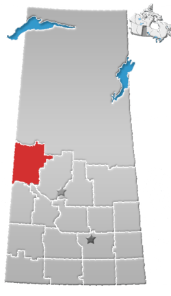
Waseca (2016 population: 149) is a village in the Canadian province of Saskatchewan within the Rural Municipality of Eldon No. 471 and Census Division No. 17. Waseca is located on Highway 16, the Yellowhead Highway, in northwest Saskatchewan.[6] Waseca is located east of Lashburn and west of Maidstone. It was probably named after Waseca, Minnesota.[7] A former resident of the Waseca area (1923-1942) has stated she was told that Waseca was an Indigenous name meaning "looking upwards" and the name was assigned when the CN railway station was built.
Waseca | |
|---|---|
Village | |
 Waseca  Waseca | |
| Coordinates: 53°06′0″N 109°28′0″W | |
| Country | Canada |
| Province | Saskatchewan |
| Rural Municipalities (R.M.) | Waseca No. 341, Saskatchewan |
| Post office founded | 1907-01-15 |
| Government | |
| • Mayor | Curtis Sutherland |
| Area | |
| • Total | 0.68 km2 (0.26 sq mi) |
| Elevation | 642 m (2,106 ft) |
| Population (2011)[1] | |
| • Total | 154 |
| • Density | 225.9/km2 (585/sq mi) |
| Time zone | UTC−7 (MST) |
| • Summer (DST) | UTC−6 (MDT) |
| Postal code | S0M 3A0 |
| Area code(s) | 306 |
| [2][3][4][5] | |
History
Waseca incorporated as a village on March 15, 1911.[8]
Demographics
In the 2016 Census of Population conducted by Statistics Canada, the Village of Waseca recorded a population of 149 living in 64 of its 75 total private dwellings, a -3.4% change from its 2011 population of 154. With a land area of 0.68 km2 (0.26 sq mi), it had a population density of 219.1/km2 (567.5/sq mi) in 2016.[11]
In the 2011 Census of Population, the Village of Waseca recorded a population of 154, a 6.9% change from its 2006 population of 144. With a land area of 0.68 km2 (0.26 sq mi), it had a population density of 226.5/km2 (586.6/sq mi) in 2011.[12]
Climate
| Climate data for Waseca | |||||||||||||
|---|---|---|---|---|---|---|---|---|---|---|---|---|---|
| Month | Jan | Feb | Mar | Apr | May | Jun | Jul | Aug | Sep | Oct | Nov | Dec | Year |
| Record high °C (°F) | 10 (50) |
10 (50) |
17.8 (64.0) |
32.8 (91.0) |
36.7 (98.1) |
37.8 (100.0) |
37.2 (99.0) |
38 (100) |
35 (95) |
28.9 (84.0) |
19.5 (67.1) |
10.6 (51.1) |
38 (100) |
| Average high °C (°F) | −11.7 (10.9) |
−7.7 (18.1) |
−1 (30) |
10.1 (50.2) |
17.6 (63.7) |
21.3 (70.3) |
23.2 (73.8) |
22.9 (73.2) |
16.7 (62.1) |
9.9 (49.8) |
−2.5 (27.5) |
−9.6 (14.7) |
7.4 (45.3) |
| Daily mean °C (°F) | −16.4 (2.5) |
−12.4 (9.7) |
−6 (21) |
4.1 (39.4) |
10.8 (51.4) |
14.9 (58.8) |
16.8 (62.2) |
16 (61) |
10.5 (50.9) |
4.1 (39.4) |
−6.7 (19.9) |
−14 (7) |
1.8 (35.2) |
| Average low °C (°F) | −21 (−6) |
−17.2 (1.0) |
−10.9 (12.4) |
−2.1 (28.2) |
4 (39) |
8.4 (47.1) |
10.3 (50.5) |
9.1 (48.4) |
4.1 (39.4) |
−1.7 (28.9) |
−10.8 (12.6) |
−18.5 (−1.3) |
−3.9 (25.0) |
| Record low °C (°F) | −50 (−58) |
−48.3 (−54.9) |
−40 (−40) |
−30 (−22) |
−10.6 (12.9) |
−7.8 (18.0) |
−3.9 (25.0) |
−3.3 (26.1) |
−13.3 (8.1) |
−25 (−13) |
−35 (−31) |
−45.6 (−50.1) |
−50 (−58) |
| Average precipitation mm (inches) | 20.4 (0.80) |
11.9 (0.47) |
21.3 (0.84) |
27.9 (1.10) |
40.1 (1.58) |
73.3 (2.89) |
80 (3.1) |
57.2 (2.25) |
35.2 (1.39) |
17.2 (0.68) |
19.9 (0.78) |
20.8 (0.82) |
424.9 (16.73) |
| Source: Environment Canada[13] | |||||||||||||
References
- "2011 Community Profiles". Statistics Canada. Government of Canada. Retrieved 2014-08-21.
- National Archives, Archivia Net. "Post Offices and Postmasters". Retrieved 2014-08-21.
- Government of Saskatchewan, MRD Home. "Municipal Directory System". Retrieved 2014-08-21.
- Canadian Textiles Institute. (2005), CTI Determine your provincial constituency
- Commissioner of Canada Elections, Chief Electoral Officer of Canada (2005), Elections Canada On-line
- Adamson, J, Rand McNally 1924 Saskatchewan Map, retrieved 2008-03-26
- Barry, Bill (September 2005). Geographic Names of Saskatchewan. Regina, Saskatchewan: People Places Publishing, Ltd. p. 445. ISBN 1-897010-19-2.
- "Urban Municipality Incorporations". Saskatchewan Ministry of Government Relations. Archived from the original on October 15, 2014. Retrieved June 1, 2020.
- "Saskatchewan Census Population" (PDF). Saskatchewan Bureau of Statistics. Archived from the original (PDF) on September 24, 2015. Retrieved May 31, 2020.
- "Saskatchewan Census Population". Saskatchewan Bureau of Statistics. Retrieved May 31, 2020.
- "Population and dwelling counts, for Canada, provinces and territories, and census subdivisions (municipalities), 2016 and 2011 censuses – 100% data (Saskatchewan)". Statistics Canada. February 8, 2017. Retrieved May 30, 2020.
- "Population and dwelling counts, for Canada, provinces and territories, and census subdivisions (municipalities), 2011 and 2006 censuses (Saskatchewan)". Statistics Canada. June 3, 2019. Retrieved May 30, 2020.
- Environment Canada - Canadian Climate Normals 1971-2000—Canadian Climate Normals 1971–2000, accessed 27 December 2010
Places adjacent to Waseca, Saskatchewan | ||||||||||
|---|---|---|---|---|---|---|---|---|---|---|
| ||||||||||
| Cities |
|  |
|---|---|---|
| Towns |
| |
| Villages | ||
| Resort villages |
| |
| Rural municipalities |
| |
| First Nations | ||
| Indian reserves | ||
| Unincorporated communities | ||