Halbrite
Halbrite (2016 population: 119) is a village in the Canadian province of Saskatchewan within the Rural Municipality of Cymri No. 36 and Census Division No. 2. The village is located approximately 20 kilometres southeast of the City of Weyburn on Highway 39 at the intersections of Highway 606 and 705.
Halbrite | |
|---|---|
| Village of Halbrite | |
 Location of Halbrite in Saskatchewan  Halbrite (Canada) | |
| Coordinates: 49.488°N 103.558°W | |
| Country | |
| Province | |
| Region | Southeast |
| Census division | 2 |
| Rural Municipality | Cymri No. 36 |
| Government | |
| • Type | Municipal |
| • Governing body | Halbrite Village Council |
| • King | Mick Bleasdale |
| • Administrator | Aleshia Underwood |
| • MP | Robert Kitchen |
| • MLA | Dan D'Autremont |
| Area | |
| • Total | 1.20 km2 (0.46 sq mi) |
| Population (2016) | |
| • Total | 119 |
| • Density | 99.3/km2 (257/sq mi) |
| Time zone | UTC-6 (CST) |
| Postal code | S0C 1H0 |
| Area code(s) | 306 |
| Highways | |
| Railways | Canadian Pacific Railway |
| [1][2][3][4] | |
Halbrite gets its name from 3 engineers who, at the time, worked with the Canadian Pacific Railway. Each contributed parts of their last names to make up the community's name: Hall, Bruce, and White.[5]
During the Second World War the Royal Canadian Air Force constructed a Relief Landing Field for RCAF Station Weyburn approximately 2 miles south of the village.[6] Please see RCAF Aerodrome - Halbrite for more information.
History
Halbrite incorporated as a village on February 26, 1904.[7]
Demographics
In the 2016 Census of Population conducted by Statistics Canada, the Village of Halbrite recorded a population of 119 living in 51 of its 55 total private dwellings, a 9.2% change from its 2011 population of 108. With a land area of 1.2 km2 (0.46 sq mi), it had a population density of 99.2/km2 (256.8/sq mi) in 2016.[10]
In the 2011 Census of Population, the Village of Halbrite recorded a population of 108, a 10.2% change from its 2006 population of 98. With a land area of 1.2 km2 (0.46 sq mi), it had a population density of 90.0/km2 (233.1/sq mi) in 2011.[11]
See also
- List of communities in Saskatchewan
- Villages of Saskatchewan
- List of geographic acronyms and initialisms
References
- National Archives, Archivia Net, Post Offices and Postmasters
- Government of Saskatchewan, MRD Home, Municipal Directory System, archived from the original (– Scholar search) on November 21, 2008
- Canadian Textiles Institute. (2005), CTI Determine your provincial constituency, archived from the original on 2007-09-11
- Commissioner of Canada Elections, Chief Electoral Officer of Canada (2005), Elections Canada On-line, archived from the original on 2007-04-21
- Barry, Bill (September 2005). Geographic Names of Saskatchewan. Regina, Saskatchewan: People Places Publishing, Ltd. p. 177. ISBN 1-897010-19-2.
- Staff writer (c. 1942). Pilots Handbook of Aerodromes and Seaplane Bases Vol. 2. Royal Canadian Air Force. p. 43.
- "Urban Municipality Incorporations". Saskatchewan Ministry of Government Relations. Archived from the original on October 15, 2014. Retrieved June 1, 2020.
- "Saskatchewan Census Population" (PDF). Saskatchewan Bureau of Statistics. Archived from the original (PDF) on September 24, 2015. Retrieved May 31, 2020.
- "Saskatchewan Census Population". Saskatchewan Bureau of Statistics. Retrieved May 31, 2020.
- "Population and dwelling counts, for Canada, provinces and territories, and census subdivisions (municipalities), 2016 and 2011 censuses – 100% data (Saskatchewan)". Statistics Canada. February 8, 2017. Retrieved May 30, 2020.
- "Population and dwelling counts, for Canada, provinces and territories, and census subdivisions (municipalities), 2011 and 2006 censuses (Saskatchewan)". Statistics Canada. June 3, 2019. Retrieved May 30, 2020.
| Cities | 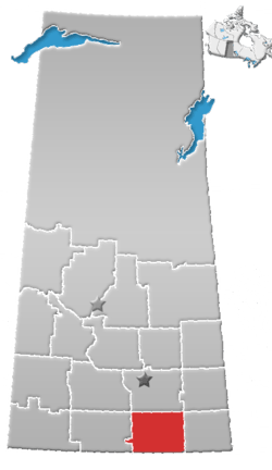 | ||||||
|---|---|---|---|---|---|---|---|
| Towns | |||||||
| Villages | |||||||
| Rural municipalities | |||||||
| First Nations | |||||||
| Indian reserves | |||||||
| Unincorporated communities |
| ||||||