Neilburg
Neilburg (2016 population: 379) is a village in the Canadian province of Saskatchewan within the Rural Municipality of Hillsdale No. 440 and Census Division No. 13. A grade K–12 school is located in the village that services the Neilburg area as well as grade 7–12 students from Marsden. In 1999 crop circles were discovered in a field near the village.[7]
Village of Neilburg | |
|---|---|
Village | |
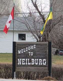 Village sign | |
 | |
| Coordinates: 52.833°N 109.633°W | |
| Country | Canada |
| Province | Saskatchewan |
| Region | Saskatchewan |
| Census division | 13 |
| Rural Municipality | Hillsdale No. 440 |
| School Division | Northwest School Division No. 203 |
| Post office Founded | N/A |
| Incorporated (Hamlet) | 1923[1] |
| Incorporated (Village) | 1946[1] |
| Government | |
| • Mayor | Brent Wiens |
| • Deputy Mayor | Aaron Gibbons |
| • Governing body | Neilburg Village Council |
| Elevation | 677 m (2,221 ft) |
| Population (2016)[2] | |
| • Total | 379 |
| Time zone | UTC−7 (MST) |
| • Summer (DST) | UTC−6 (MDT) |
| Postal code | S0M 2C0 |
| Area code(s) | 306 |
| Highways | |
| Website | www.neilburg.ca |
| [3][4][5][6] | |
Neilburg was named after an early settler, Clifford O’Neil. The first post office was in his home and was located about one mile southeast of where the village is today. Neilburg was established as a hamlet in 1923 and by 1946, it had grown big enough to be incorporated as the Village of Neilburg.
History
Neilburg incorporated as a village on January 1, 1947.[8]
Demographics
In the 2016 Census of Population conducted by Statistics Canada, the Village of Neilburg recorded a population of 379 living in 157 of its 175 total private dwellings, a -18.2% change from its 2011 population of 448. With a land area of 1.22 km2 (0.47 sq mi), it had a population density of 310.7/km2 (804.6/sq mi) in 2016.[2]
In the 2011 Census of Population, the Village of Neilburg recorded a population of 448, a 13.7% change from its 2006 population of 394. With a land area of 1.22 km2 (0.47 sq mi), it had a population density of 367.2/km2 (951.1/sq mi) in 2011.[11]
References
- Village of Neilburg, 13 June 2010
- "Population and dwelling counts, for Canada, provinces and territories, and census subdivisions (municipalities), 2016 and 2011 censuses – 100% data (Saskatchewan)". Statistics Canada. February 8, 2017. Retrieved May 30, 2020.
- National Archives, Archivia Net, Post Offices and Postmasters
- Government of Saskatchewan, MRD Home, Municipal Directory System, archived from the original (– Scholar search) on November 21, 2008
- Canadian Textiles Institute. (2005), CTI Determine your provincial constituency, archived from the original on 2007-09-11
- Commissioner of Canada Elections, Chief Electoral Officer of Canada (2005), Elections Canada On-line, archived from the original on 2007-04-21
- Arndt, Judy. "Crop Circles - Neilburg, Saskatchewan, Canada - Sept. 1999". Treasure House Imports. Retrieved 2008-02-16.
- "Urban Municipality Incorporations". Saskatchewan Ministry of Government Relations. Archived from the original on October 15, 2014. Retrieved June 1, 2020.
- "Saskatchewan Census Population" (PDF). Saskatchewan Bureau of Statistics. Archived from the original (PDF) on September 24, 2015. Retrieved May 31, 2020.
- "Saskatchewan Census Population". Saskatchewan Bureau of Statistics. Retrieved May 31, 2020.
- "Population and dwelling counts, for Canada, provinces and territories, and census subdivisions (municipalities), 2011 and 2006 censuses (Saskatchewan)". Statistics Canada. June 3, 2019. Retrieved May 30, 2020.
| Towns | 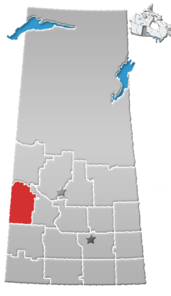 | ||||
|---|---|---|---|---|---|
| Villages | |||||
| Rural municipalities |
| ||||
| First Nations | |||||
| Indian reserves | |||||
| Unincorporated communities |
| ||||