Aylsham, Saskatchewan
Aylsham (2016 population: 65) is a village in the Canadian province of Saskatchewan within the Rural Municipality of Nipawin No. 487 and Census Division No. 14. The village is approximately 65 km (40 mi) northeast of the City of Melfort.
Aylsham | |
|---|---|
| Village of Aylsham | |
 Location of Aylsham in Saskatchewan  Aylsham, Saskatchewan (Canada) | |
| Coordinates: 53.1132°N 103.4819°W | |
| Country | Canada |
| Province | Saskatchewan |
| Region | East-central Saskatchewan |
| Census division | 14 |
| Rural Municipality | Nipawin |
| Government | |
| • Type | Aylsham Village Council |
| Population (2006) | |
| • Total | 92 |
| Time zone | CST |
| Postal code | S0E 0C0 |
| Area code(s) | 306 |
History
Aylsham incorporated as a village on 4 August 1947.[1] The Aylsham post office was opened in 1921, named after Aylsham, Norfolk, England, which in turn was adopted for the community's name.[2]
Demographics
In the 2016 Census of Population conducted by Statistics Canada, the Village of Aylsham recorded a population of 65 living in 40 of its 44 total private dwellings, a -9.2% change from its 2011 population of 71. With a land area of 0.48 km2 (0.19 sq mi), it had a population density of 135.4/km2 (350.7/sq mi) in 2016.[5]
In the 2011 Census of Population, the Village of Aylsham recorded a population of 71, a -22.8% change from its 2006 population of 92. With a land area of 0.48 km2 (0.19 sq mi), it had a population density of 147.9/km2 (383.1/sq mi) in 2011.[6]
Climate
| Climate data for Aylsham | |||||||||||||
|---|---|---|---|---|---|---|---|---|---|---|---|---|---|
| Month | Jan | Feb | Mar | Apr | May | Jun | Jul | Aug | Sep | Oct | Nov | Dec | Year |
| Record high °C (°F) | 6 (43) |
7.5 (45.5) |
17 (63) |
31.1 (88.0) |
35 (95) |
38.5 (101.3) |
34.5 (94.1) |
35.5 (95.9) |
33.3 (91.9) |
27 (81) |
17.8 (64.0) |
11 (52) |
38.5 (101.3) |
| Average high °C (°F) | −14.3 (6.3) |
−9.5 (14.9) |
−2.4 (27.7) |
8.9 (48.0) |
17.9 (64.2) |
22 (72) |
23.9 (75.0) |
23.3 (73.9) |
16.7 (62.1) |
8.8 (47.8) |
−3.5 (25.7) |
−11.7 (10.9) |
6.7 (44.1) |
| Daily mean °C (°F) | −19.2 (−2.6) |
−14.6 (5.7) |
−7.8 (18.0) |
3.1 (37.6) |
11.1 (52.0) |
15.7 (60.3) |
17.7 (63.9) |
16.7 (62.1) |
10.7 (51.3) |
3.6 (38.5) |
−7.4 (18.7) |
−16.2 (2.8) |
1.1 (34.0) |
| Average low °C (°F) | −24.1 (−11.4) |
−19.7 (−3.5) |
−13.2 (8.2) |
−2.7 (27.1) |
4.2 (39.6) |
9.4 (48.9) |
11.4 (52.5) |
10 (50) |
4.6 (40.3) |
−1.6 (29.1) |
−11.2 (11.8) |
−20.7 (−5.3) |
−4.5 (23.9) |
| Record low °C (°F) | −44.4 (−47.9) |
−44 (−47) |
−37 (−35) |
−29.4 (−20.9) |
−9 (16) |
−2 (28) |
1.1 (34.0) |
−2 (28) |
−7.8 (18.0) |
−22 (−8) |
−37.5 (−35.5) |
−42 (−44) |
−44.4 (−47.9) |
| Average precipitation mm (inches) | 17.6 (0.69) |
14.1 (0.56) |
19.4 (0.76) |
23.9 (0.94) |
46.2 (1.82) |
79.2 (3.12) |
80.4 (3.17) |
60.4 (2.38) |
46.1 (1.81) |
33 (1.3) |
23 (0.9) |
22.4 (0.88) |
465.6 (18.33) |
| Source: Environment Canada[7] | |||||||||||||
Notable people
- Greg Classen Former NHL hockey player, currently under contract with EHC Basel
- Karlene Faith Canadian writer, feminist, scholar, and human rights activist
See also
- List of communities in Saskatchewan
- Villages of Saskatchewan
References
- "Urban Municipality Incorporations". Saskatchewan Ministry of Government Relations. Archived from the original on 15 October 2014. Retrieved 1 June 2020.
- McLennan, David (2008). Our Towns: Saskatchewan Communities from Abbey to Zenon Park. University of Regina Press. p. 18. ISBN 9780889772090. Retrieved 5 June 2020.
- "Saskatchewan Census Population" (PDF). Saskatchewan Bureau of Statistics. Archived from the original (PDF) on 24 September 2015. Retrieved 31 May 2020.
- "Saskatchewan Census Population". Saskatchewan Bureau of Statistics. Retrieved 31 May 2020.
- "Population and dwelling counts, for Canada, provinces and territories, and census subdivisions (municipalities), 2016 and 2011 censuses – 100% data (Saskatchewan)". Statistics Canada. 8 February 2017. Retrieved 30 May 2020.
- "Population and dwelling counts, for Canada, provinces and territories, and census subdivisions (municipalities), 2011 and 2006 censuses (Saskatchewan)". Statistics Canada. 3 June 2019. Retrieved 30 May 2020.
- Environment Canada Canadian Climate Normals 1971–2000, accessed 23 July 2010
Places adjacent to Aylsham, Saskatchewan | ||||||||||
|---|---|---|---|---|---|---|---|---|---|---|
| ||||||||||
| Cities | 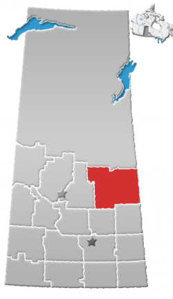 | |
|---|---|---|
| Towns | ||
| Villages | ||
| Resort villages | ||
| Rural municipalities |
| |
| First Nations | ||
| Indian reserves | ||
| Unincorporated communities | ||