Flaxcombe, Saskatchewan
Flaxcombe (2016 population: 124) is a village in the Canadian province of Saskatchewan within the Rural Municipality of Kindersley No. 290 and Census Division No. 13. The village is located approximately 30 km west of the Town of Kindersley, on Highway 7, and approximately 27 km east of the Alberta-Saskatchewan border.
Flaxcombe | |
|---|---|
| Village of Flaxcombe | |
 Location of Flaxcombe in Saskatchewan  Flaxcombe, Saskatchewan (Canada) | |
| Coordinates: 51.459°N 109.622°W | |
| Country | Canada |
| Province | Saskatchewan |
| Region | West-central |
| Census division | 13 |
| Rural Municipality | Kindersley |
| Post office Founded | March 1, 1910 |
| Government | |
| • Type | Municipal |
| • Governing body | Flaxcombe Village Council |
| • Mayor | Blaine Sautner |
| • Administrator | Charlotte Helfrich |
| • MP | Bill Boyd |
| • MLA | David Anderson |
| Area | |
| • Total | 1.49 km2 (0.58 sq mi) |
| Population (2016) | |
| • Total | 129 |
| • Density | 74.6/km2 (193/sq mi) |
| Time zone | UTC-6 (CST) |
| Postal code | S0L 1E0 |
| Area code(s) | 306 |
| Highways | |
| Railways | Canadian National Railway |
| [1][2][3][4] | |
History
Flaxcombe incorporated as a village on June 4, 1913.[5]
Demographics
In the 2016 Census of Population conducted by Statistics Canada, the Village of Flaxcombe recorded a population of 124 living in 50 of its 51 total private dwellings, a 5.6% change from its 2011 population of 117. With a land area of 1.49 km2 (0.58 sq mi), it had a population density of 83.2/km2 (215.5/sq mi) in 2016.[8]
In the 2011 Census of Population, the Village of Flaxcombe recorded a population of 117, a 5.4% change from its 2006 population of 111. With a land area of 1.49 km2 (0.58 sq mi), it had a population density of 78.5/km2 (203.4/sq mi) in 2011.[9]
See also
- List of communities in Saskatchewan
- Villages of Saskatchewan
References
- National Archives, Archivia Net, Post Offices and Postmasters, archived from the original on October 6, 2006
- Government of Saskatchewan, MRD Home, Municipal Directory System, archived from the original on November 21, 2008
- Canadian Textiles Institute. (2005), CTI Determine your provincial constituency, archived from the original on 2007-09-11
- Commissioner of Canada Elections, Chief Electoral Officer of Canada (2005), Elections Canada On-line, archived from the original on April 21, 2007
- "Urban Municipality Incorporations". Saskatchewan Ministry of Government Relations. Archived from the original on October 15, 2014. Retrieved June 1, 2020.
- "Saskatchewan Census Population" (PDF). Saskatchewan Bureau of Statistics. Archived from the original (PDF) on September 24, 2015. Retrieved May 31, 2020.
- "Saskatchewan Census Population". Saskatchewan Bureau of Statistics. Retrieved May 31, 2020.
- "Population and dwelling counts, for Canada, provinces and territories, and census subdivisions (municipalities), 2016 and 2011 censuses – 100% data (Saskatchewan)". Statistics Canada. February 8, 2017. Retrieved May 30, 2020.
- "Population and dwelling counts, for Canada, provinces and territories, and census subdivisions (municipalities), 2011 and 2006 censuses (Saskatchewan)". Statistics Canada. June 3, 2019. Retrieved May 30, 2020.
Places adjacent to Flaxcombe, Saskatchewan | ||||||||||
|---|---|---|---|---|---|---|---|---|---|---|
| ||||||||||
| Towns | 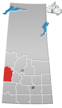 | ||||
|---|---|---|---|---|---|
| Villages | |||||
| Rural municipalities |
| ||||
| First Nations | |||||
| Indian reserves | |||||
| Unincorporated communities |
| ||||