Elrose, Saskatchewan
Elrose is a town located just to the north of the Coteau Hills. It is south of Rosetown and north of Swift Current on Highway 4 and Highway 44.[3] A community in the middle of an agricultural economy, Elrose has also become a local hub of activity in the oil industry. The town is surrounded by the Rural Municipality of Monet No. 257.
Elrose | |
|---|---|
Town | |
 | |
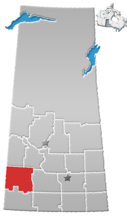
 Elrose Location of Elrose in Saskatchewan | |
| Coordinates: 51°12′1″N 108°02′0″W | |
| Country | Canada |
| Province | Saskatchewan |
| Rural Municipalities (R.M.) | R.M. of Monet 257 |
| Settled | 1909 - 1913 |
| Incorporated (Village) | 1914 |
| Incorporated (Town) | 1951 |
| Government | |
| • Mayor | Dane MacDonald |
| • Administrator | Connie Henning |
| • Governing body | Elrose Town Council |
| • MLA Rosetown-Elrose | Jim Reiter |
| • MP Cypress Hills-Grasslands | David Anderson |
| Area | |
| • Land | 2.76 km2 (1.07 sq mi) |
| Elevation | 624 m (2,047 ft) |
| Population (2016) | |
| • Total | 496 |
| • Density | 172.8/km2 (448/sq mi) |
| Time zone | UTC-6 (CST) |
| Postal code | S0L 0Z0 |
| Area code(s) | 306 |
| Website | Official website |
| [1][2] | |
History
Some homesteaders and other settlers were established in the area before the arrival of the railroads, being is situated along the remains of the historic Swift Current-Battleford Trail, but the majority of newcomers arrived by rail later. In 1909, the Rural Municipality Monet 257, Saskatchewan was organized. It was named after a local farmer, Fortunat Monet (pronounced Monette). The town of Elrose was originally called LaBerge after local landowner Albert LaBerge. After the railway arrived in 1913, the countryside quickly filled with people and a meeting was called to discuss a permanent name for the town. Elrose was chosen, although the origin of this name is unclear for certain.
Elrose incorporated as a village in 1914. Schools and grain elevators were built, the town grew as more people arrived, and prairie sod was turned under to sow crops. The newly tilled land was rich, agriculture was profitable, and communities thrived. In 1951 Elrose reached Town status. During the 60s and 70s smaller villages in the area (Hughton, Wartime, Forgan, Greenan) began to decline and their populations migrated to Elrose.
The Town of Elrose continues to move forward with the times and new prosperity appears as the local oilpatch is growing significantly. The agriculture industry is thriving as well, contributing to recent growth in the community.
Demographics
| Canada census – Elrose, Saskatchewan community profile | |||
|---|---|---|---|
| 2016 | 2011 | 2006 | |
| Population: | 496 (+4.0% from 2011) | 477 (+5.3% from 2006) | 453 (- 12.4% from 2001) |
| Land area: | 2.82 km2 (1.09 sq mi) | 2.76 km2 (1.07 sq mi) | 2.76 km2 (1.07 sq mi) |
| Population density: | 172.8/km2 (448/sq mi) | 164.1/km2 (425/sq mi) | |
| Median age: | 50.1 (M: 50.8, F: 48.9) | ||
| Total private dwellings: | 247 | 223 | |
| Median household income: | |||
| References: 2016[4] 2011[5] 2006[6] earlier[7] | |||
- Dominion Land Survey 9-26-15-W3
- Time zone (est) UTC-6
Climate
| Climate data for Elrose | |||||||||||||
|---|---|---|---|---|---|---|---|---|---|---|---|---|---|
| Month | Jan | Feb | Mar | Apr | May | Jun | Jul | Aug | Sep | Oct | Nov | Dec | Year |
| Record high °C (°F) | 11 (52) |
14 (57) |
22 (72) |
32 (90) |
37 (99) |
40 (104) |
38 (100) |
39 (102) |
37.2 (99.0) |
29 (84) |
22.8 (73.0) |
15.5 (59.9) |
40 (104) |
| Average high °C (°F) | −8.9 (16.0) |
−4.9 (23.2) |
2.5 (36.5) |
12.4 (54.3) |
19.4 (66.9) |
23.8 (74.8) |
26.3 (79.3) |
26.1 (79.0) |
19.8 (67.6) |
12.6 (54.7) |
0.7 (33.3) |
−6.3 (20.7) |
10.3 (50.5) |
| Daily mean °C (°F) | −13.9 (7.0) |
−10 (14) |
−2.8 (27.0) |
5.6 (42.1) |
12.3 (54.1) |
16.9 (62.4) |
19.2 (66.6) |
18.7 (65.7) |
12.8 (55.0) |
6.2 (43.2) |
−4.2 (24.4) |
−11.2 (11.8) |
4.1 (39.4) |
| Average low °C (°F) | −18.9 (−2.0) |
−15 (5) |
−8.1 (17.4) |
−1.3 (29.7) |
5.1 (41.2) |
9.9 (49.8) |
12.1 (53.8) |
11.2 (52.2) |
5.8 (42.4) |
−0.1 (31.8) |
−9.1 (15.6) |
−16.1 (3.0) |
−2 (28) |
| Record low °C (°F) | −41 (−42) |
−41 (−42) |
−32.8 (−27.0) |
−29.4 (−20.9) |
−9.5 (14.9) |
−2 (28) |
2.5 (36.5) |
0 (32) |
−9 (16) |
−26.5 (−15.7) |
−34.5 (−30.1) |
−42 (−44) |
−42 (−44) |
| Average precipitation mm (inches) | 18.6 (0.73) |
12.3 (0.48) |
22.9 (0.90) |
24.9 (0.98) |
54.5 (2.15) |
63.6 (2.50) |
63.9 (2.52) |
42.6 (1.68) |
29.9 (1.18) |
16.9 (0.67) |
18.5 (0.73) |
21 (0.8) |
389.4 (15.33) |
| Source: Environment Canada[8] | |||||||||||||
Government
Elrose is part of the Cypress Hills—Grasslands Federal Riding with David Anderson as the federal Member of Parliament representing this town in Ottawa. Elrose belongs to the provincial constituency Rosetown-Elrose, with the elected Member of the Legislative Assembly Jim Reiter who represents this town in Regina. The town of Elrose has its affairs looked after by Elrose Town Council, currently headed by Mayor Dane MacDonald.
Education
Elrose Composite School provides both primary and secondary for Elrose and surrounding rural areas. Elrose Composite School is part of the Sun West School Division which provides education to the west-central part of Saskatchewan, one of the largest school divisions in the area. Early childhood education is provided at the community owned daycare, the Elrose ABC Family Centre.
Recreation
As with most rural Saskatchewan towns, Elrose offers a variety of opportunities for people to get out and enjoy themselves. There is the Elrose Memorial Hall, a 40' x 120' structure built in the 1950s, that serves as an excellent venue for a variety of events including dances, plays, weddings and auctions.
The Elrose-Monet Uniplex is a multi-use facility located at the southern end of Elrose's Main Street. This facility was constructed following the loss by fire of the original Elrose Arena. The Elrose-Monet Uniplex houses a skating rink, curling rink, and an olympic sized indoor swimming pool. The building serves as a base for the sports grounds behind it, which include baseball diamonds, a batting cage, and a number of full service campsites. The Uniplex continues to be an outstanding facility for the town and surrounding community.
Recreational parks
- Elrose Regional Park[9]
Library
- Wheatland Regional Library
Media
Newspapers
Transportation
Previous to the building of railroads, many travellers through the area followed the historic Swift Current-Battleford Trail. This winding cart trail connected Fort Battleford on the North Saskatchewan River with the Saskatchewan Landing, a natural crossing on the South Saskatchewan River. Both Highway 4 and Highway 44 serve vehicular traffic to and from Elrose.
See also
References
- National Archives, Archivia Net. "Post Offices and Postmasters". Retrieved 20 June 2014.
- Government of Saskatchewan, MRD Home. "Municipal Directory System". Retrieved 20 June 2014.
- McLennan, David; University of Regina, "Elrose - Details", The Encyclopedia of Saskatchewan, archived from the original on 29 April 2013, retrieved 23 April 2007
- "2016 Community Profiles". 2016 Canadian Census. Statistics Canada. 21 February 2017.
- "2011 Community Profiles". 2011 Canadian Census. Statistics Canada. 5 July 2013. Retrieved 24 February 2013.
- "2006 Community Profiles". 2006 Canadian Census. Statistics Canada. 30 March 2011. Retrieved 24 February 2009.
- "2001 Community Profiles". 2001 Canadian Census. Statistics Canada. 17 February 2012.
- Environment Canada Canadian Climate Normals 1971–2000, accessed 27 July 2010
- Elrose Regional Park, archived from the original on 26 August 2007, retrieved 23 April 2007