Cadillac, Saskatchewan
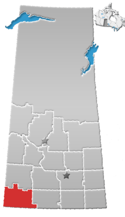
Cadillac (2016 population: 92) is a village in the Canadian province of Saskatchewan within the Rural Municipality of Wise Creek No. 77 and Census Division No. 4. It is at the intersection of Highway 13, the Red Coat Trail, and Highway 4 in southwest portion of the province. Located 40 mi/62 km south of the City of Swift Current,[5] The three largest buildings remaining in the community are the former Cadillac School, the Cadillac Skating and Curling Rink, and the former Saskatchewan Wheat Pool grain elevator.[6]
Cadillac | |
|---|---|
| Village of Cadillac | |
 Cadillac  Cadillac | |
| Coordinates: 49.717°N 107.733°W | |
| Country | |
| Province | |
| Region | Saskatchewan |
| Census division | 4 |
| Rural Municipality | Wise Creek No. 77 |
| Post office Founded | 1911-03-01 |
| Government | |
| • Type | Municipal |
| • Governing body | Cadillac Village Council |
| • Mayor | Bryce Evesque |
| • Administrator | Betty Moller |
| Area | |
| • Total | 1.05 km2 (0.41 sq mi) |
| Population (2016) | |
| • Total | 92 |
| • Density | 87.7/km2 (227/sq mi) |
| Time zone | UTC-6 (CST) |
| Postal code | S0N 0K0 |
| Area code(s) | 306 |
| Highways | |
| [1][2][3][4] | |
History
Cadillac incorporated as a village on July 2, 1914.[7] It was named after Cadillac, Michigan, the starting point for many early French speaking settlers who began arriving about 1910.[8]
Demographics
In the 2016 Census of Population conducted by Statistics Canada, the Village of Cadillac recorded a population of 92 living in 50 of its 66 total private dwellings, a 15.2% change from its 2011 population of 78. With a land area of 1.05 km2 (0.41 sq mi), it had a population density of 87.6/km2 (226.9/sq mi) in 2016.[11]
In the 2011 Census of Population, the Village of Cadillac recorded a population of 78, a -2.5% change from its 2006 population of 80. With a land area of 1.05 km2 (0.41 sq mi), it had a population density of 74.3/km2 (192.4/sq mi) in 2011.[12]
See also
- List of communities in Saskatchewan
- Villages of Saskatchewan
References
- National Archives, Archivia Net. "Post Offices and Postmasters". Archived from the original on 6 October 2006. Retrieved 21 September 2014.
- Government of Saskatchewan, MRD Home. "Municipal Directory System". Archived from the original on 15 January 2016. Retrieved 21 September 2014.
- Canadian Textiles Institute. (2005), CTI Determine your provincial constituency, archived from the original on 2007-09-11
- Commissioner of Canada Elections, Chief Electoral Officer of Canada (2005), Elections Canada On-line, archived from the original on 2007-04-21
- "allrefer.com gazetteer". Archived from the original on 2007-09-29. Retrieved 2007-07-27.
- Photo Gallery Of Canadian Grain Elevators Cadillac Grain elevator Archived 2008-12-20 at the Wayback Machine
- "Urban Municipality Incorporations". Saskatchewan Ministry of Government Relations. Archived from the original on October 15, 2014. Retrieved June 1, 2020.
- Barry, Bill (September 2005). Geographic Names of Saskatchewan. Regina, Saskatchewan: People Places Publishing, Ltd. p. 69. ISBN 1-897010-19-2.
- "Saskatchewan Census Population" (PDF). Saskatchewan Bureau of Statistics. Archived from the original (PDF) on September 24, 2015. Retrieved May 31, 2020.
- "Saskatchewan Census Population". Saskatchewan Bureau of Statistics. Retrieved May 31, 2020.
- "Population and dwelling counts, for Canada, provinces and territories, and census subdivisions (municipalities), 2016 and 2011 censuses – 100% data (Saskatchewan)". Statistics Canada. February 8, 2017. Retrieved May 30, 2020.
- "Population and dwelling counts, for Canada, provinces and territories, and census subdivisions (municipalities), 2011 and 2006 censuses (Saskatchewan)". Statistics Canada. June 3, 2019. Retrieved May 30, 2020.
Places adjacent to Cadillac, Saskatchewan | |
|---|---|