Viscount, Saskatchewan
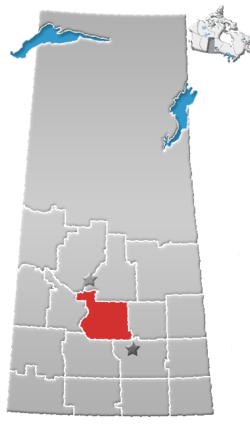
Viscount (2016 population: 232) is a village in the Canadian province of Saskatchewan within the Rural Municipality of Viscount No. 341 and Census Division No. 11. Viscount is located on Saskatchewan Highway 16, the Yellowhead Highway, in central Saskatchewan east of Colonsay and west of Lanigan.[6]
Viscount | |
|---|---|
Village | |
 Amherst Avenue | |
| Motto(s): "A warm welcoming community" | |
 Viscount  Viscount | |
| Coordinates: 51°57′0″N 105°39′0″W | |
| Country | Canada |
| Province | Saskatchewan |
| Rural Municipalities (R.M.) | Viscount No. 341, Saskatchewan |
| Post office Founded | 1908-01-01 |
| Government | |
| • Mayor | Moe Kirzinger |
| Area | |
| • Total | 1.18 km2 (0.46 sq mi) |
| Elevation | 548 m (1,798 ft) |
| Population (2011) | |
| • Total | 252 |
| • Density | 212.7/km2 (551/sq mi) |
| [1] | |
| • Summer (DST) | UTC-6 (CST) |
| Postal code | S0K 4M0 |
| Area code(s) | 306 |
| Website | Official website |
| [2][3][4][5] | |
Viscount post office first opened in 1908 in the Dominion Land Survey Sec.29, Twp.34, R.26, W2.
History
Viscount incorporated as a village on December 17, 1908.[7]
Demographics
In the 2016 Census of Population conducted by Statistics Canada, the Village of Viscount recorded a population of 232 living in 104 of its 137 total private dwellings, a -8.6% change from its 2011 population of 252. With a land area of 1.18 km2 (0.46 sq mi), it had a population density of 196.6/km2 (509.2/sq mi) in 2016.[10]
In the 2011 Census of Population, the Village of Viscount recorded a population of 252, a 0.4% change from its 2006 population of 251. With a land area of 1.18 km2 (0.46 sq mi), it had a population density of 213.6/km2 (553.1/sq mi) in 2011.[11]
Climate
| Climate data for Viscount | |||||||||||||
|---|---|---|---|---|---|---|---|---|---|---|---|---|---|
| Month | Jan | Feb | Mar | Apr | May | Jun | Jul | Aug | Sep | Oct | Nov | Dec | Year |
| Record high °C (°F) | 6.5 (43.7) |
9.5 (49.1) |
19.5 (67.1) |
30 (86) |
37 (99) |
40.5 (104.9) |
37.5 (99.5) |
36.5 (97.7) |
33 (91) |
28.5 (83.3) |
18.9 (66.0) |
8.5 (47.3) |
40.5 (104.9) |
| Average high °C (°F) | −11.7 (10.9) |
−8.3 (17.1) |
−0.7 (30.7) |
10.6 (51.1) |
18.6 (65.5) |
22.8 (73.0) |
24.9 (76.8) |
24.2 (75.6) |
17.8 (64.0) |
10.2 (50.4) |
−2.3 (27.9) |
−9.9 (14.2) |
8 (46) |
| Daily mean °C (°F) | −16.8 (1.8) |
−13.3 (8.1) |
−5.6 (21.9) |
4.4 (39.9) |
11.6 (52.9) |
16.1 (61.0) |
18.1 (64.6) |
17.1 (62.8) |
11.2 (52.2) |
4.2 (39.6) |
−6.7 (19.9) |
−14.7 (5.5) |
2.1 (35.8) |
| Average low °C (°F) | −21.8 (−7.2) |
−18.2 (−0.8) |
−10.5 (13.1) |
−1.9 (28.6) |
4.5 (40.1) |
9.4 (48.9) |
11.3 (52.3) |
9.9 (49.8) |
4.6 (40.3) |
−1.8 (28.8) |
−11.1 (12.0) |
−19.4 (−2.9) |
−3.8 (25.2) |
| Record low °C (°F) | −40.5 (−40.9) |
−41.5 (−42.7) |
−35 (−31) |
−26.7 (−16.1) |
−10 (14) |
−1 (30) |
3.5 (38.3) |
−3 (27) |
−8 (18) |
−23.5 (−10.3) |
−35 (−31) |
−42 (−44) |
−42 (−44) |
| Average precipitation mm (inches) | 16.7 (0.66) |
12.2 (0.48) |
20.3 (0.80) |
26.5 (1.04) |
54.6 (2.15) |
71.1 (2.80) |
61.5 (2.42) |
51.2 (2.02) |
38.8 (1.53) |
23.8 (0.94) |
14.3 (0.56) |
20.7 (0.81) |
411.6 (16.20) |
| Source: Environment Canada[12] | |||||||||||||
References
- "2011 Community Profiles". Statistics Canada. Government of Canada. Retrieved 2014-08-21.
- National Archives, Archivia Net. "Post Offices and Postmasters". Retrieved 2014-08-21.
- Government of Saskatchewan, MRD Home. "Municipal Directory System". Retrieved 2014-08-21.
- Canadian Textiles Institute. (2005), CTI Determine your provincial constituency, archived from the original on 2007-09-11
- Commissioner of Canada Elections, Chief Electoral Officer of Canada (2005), Elections Canada On-line
- Adamson, J, Rand McNally 1924 Saskatchewan Map, retrieved 2008-03-26
- "Urban Municipality Incorporations". Saskatchewan Ministry of Government Relations. Archived from the original on October 15, 2014. Retrieved June 1, 2020.
- "Saskatchewan Census Population" (PDF). Saskatchewan Bureau of Statistics. Archived from the original (PDF) on September 24, 2015. Retrieved May 31, 2020.
- "Saskatchewan Census Population". Saskatchewan Bureau of Statistics. Retrieved May 31, 2020.
- "Population and dwelling counts, for Canada, provinces and territories, and census subdivisions (municipalities), 2016 and 2011 censuses – 100% data (Saskatchewan)". Statistics Canada. February 8, 2017. Retrieved May 30, 2020.
- "Population and dwelling counts, for Canada, provinces and territories, and census subdivisions (municipalities), 2011 and 2006 censuses (Saskatchewan)". Statistics Canada. June 3, 2019. Retrieved May 30, 2020.
- Environment Canada - Canadian Climate Normals 1971-2000—Canadian Climate Normals 1971–2000, accessed 23 December 2010
Places adjacent to Viscount, Saskatchewan | ||||||||||
|---|---|---|---|---|---|---|---|---|---|---|
| ||||||||||