Semans, Saskatchewan
Semans (2016 population: 196) is a village in the Canadian province of Saskatchewan within the Rural Municipality of Mount Hope No. 279 and Census Division No. 10. The village is located approximately 125 km north of the City of Regina and 195 km southeast of the City of Saskatoon.
Semans | |
|---|---|
Village | |
 Semans  Semans | |
| Coordinates: 51.24°N 104.24°W | |
| Country | Canada |
| Province | Saskatchewan |
| Region | Saskatchewan |
| Census division | 10 |
| Rural Municipality | Mount Hope |
| Post office Founded | 1908-10-12 |
| Incorporated (Village) | December 14, 1908 |
| Government | |
| • Mayor | Duane Linford |
| • Administrator | Ashley Greenshields |
| • Governing body | Semans Village Council |
| Area | |
| • Total | 1.14 km2 (0.44 sq mi) |
| Elevation | 558 m (1,831 ft) |
| Population (2011)[1] | |
| • Total | 204 |
| • Density | 178.3/km2 (462/sq mi) |
| Time zone | UTC-6 (CST) |
| Postal code | S0A 3S0 |
| Area code(s) | 306 |
| Highways | Highway 15 |
| Website | Official Website Semans, Saskatchewan |
| [2][3] | |
History
Semans celebrated 100 years as a village with a centennial anniversary homecoming on July 2008. Settlers first homesteaded in the Semans area as early as 1904. Semans, named for the wife of a railroad official, was one in the alphabetical sequence of towns on the Grand Trunk Railway line between Winnipeg, Manitoba and Saskatoon, Saskatchewan. A picture of the first station shows the spelling as "Semons". The first sports day was held on July 1, 1908. The railroad station and first grain elevator were built by the fall of 1908. In a little more than a year, local businesses could supply almost all necessary commodities and the population was 48 people. The first open air rink was in use by 1907. On October 28, 1908, the Semans Board of Trade sent correspondence regarding the organization of Semans under the Village Act of 1908. A petition was sent on November 4, 1908, signed by the businesses. Semans incorporated as a village on December 14, 1908.[4]
Demographics
In the 2016 Census of Population conducted by Statistics Canada, the Village of Semans recorded a population of 196 living in 103 of its 137 total private dwellings, a -4.1% change from its 2011 population of 204. With a land area of 1.14 km2 (0.44 sq mi), it had a population density of 171.9/km2 (445.3/sq mi) in 2016.[7]
In the 2011 Census of Population, the Village of Semans recorded a population of 204, a 4.6% change from its 2006 population of 195. With a land area of 1.14 km2 (0.44 sq mi), it had a population density of 178.9/km2 (463.5/sq mi) in 2011.[8]
Climate
| Climate data for Semans | |||||||||||||
|---|---|---|---|---|---|---|---|---|---|---|---|---|---|
| Month | Jan | Feb | Mar | Apr | May | Jun | Jul | Aug | Sep | Oct | Nov | Dec | Year |
| Record high °C (°F) | 7 (45) |
12.8 (55.0) |
20.5 (68.9) |
32.8 (91.0) |
37.8 (100.0) |
40 (104) |
42.2 (108.0) |
41.1 (106.0) |
35.6 (96.1) |
31.7 (89.1) |
21.1 (70.0) |
13.3 (55.9) |
42.2 (108.0) |
| Average high °C (°F) | −11.5 (11.3) |
−8.5 (16.7) |
−0.9 (30.4) |
10.4 (50.7) |
18.5 (65.3) |
22.7 (72.9) |
24.8 (76.6) |
24.3 (75.7) |
17.5 (63.5) |
10.5 (50.9) |
−1.8 (28.8) |
−9.7 (14.5) |
8 (46) |
| Daily mean °C (°F) | −16.8 (1.8) |
−13.7 (7.3) |
−5.8 (21.6) |
4.4 (39.9) |
11.8 (53.2) |
16.2 (61.2) |
18.2 (64.8) |
17.4 (63.3) |
11.1 (52.0) |
4.5 (40.1) |
−6.3 (20.7) |
−14.6 (5.7) |
2.2 (36.0) |
| Average low °C (°F) | −22.1 (−7.8) |
−18.8 (−1.8) |
−10.6 (12.9) |
−1.7 (28.9) |
5 (41) |
9.7 (49.5) |
11.5 (52.7) |
10.5 (50.9) |
4.6 (40.3) |
−1.6 (29.1) |
−10.7 (12.7) |
−19.5 (−3.1) |
−3.6 (25.5) |
| Record low °C (°F) | −44.4 (−47.9) |
−45 (−49) |
−38.9 (−38.0) |
−28.9 (−20.0) |
−12.2 (10.0) |
−5 (23) |
−1.1 (30.0) |
−5 (23) |
−13.9 (7.0) |
−23.5 (−10.3) |
−33.5 (−28.3) |
−43.5 (−46.3) |
−45 (−49) |
| Average precipitation mm (inches) | 20.6 (0.81) |
15.1 (0.59) |
17.3 (0.68) |
21.2 (0.83) |
46.7 (1.84) |
67.8 (2.67) |
74.3 (2.93) |
45.4 (1.79) |
35.5 (1.40) |
22.2 (0.87) |
19 (0.7) |
26.2 (1.03) |
411.3 (16.19) |
| Source: Environment Canada[9] | |||||||||||||
Notable people
- Gordon MacMurchy, MLA for Last Mountain and Member of the Saskatchewan Order of Merit
- Sherwood Bassin, hockey executive in Ontario Hockey League and the Canadian National junior team
See also
- List of communities in Saskatchewan
- Villages of Saskatchewan
References
- "2011 Community Profiles". Statistics Canada. Government of Canada. Retrieved 2014-08-21.
- National Archives, Archivia Net. "Post Offices and Postmasters". Retrieved 2014-08-21.
- Government of Saskatchewan, MRD Home. "Municipal Directory System". Retrieved 2014-08-21.
- "Urban Municipality Incorporations". Saskatchewan Ministry of Government Relations. Archived from the original on October 15, 2014. Retrieved June 1, 2020.
- "Saskatchewan Census Population" (PDF). Saskatchewan Bureau of Statistics. Archived from the original (PDF) on September 24, 2015. Retrieved May 31, 2020.
- "Saskatchewan Census Population". Saskatchewan Bureau of Statistics. Retrieved May 31, 2020.
- "Population and dwelling counts, for Canada, provinces and territories, and census subdivisions (municipalities), 2016 and 2011 censuses – 100% data (Saskatchewan)". Statistics Canada. February 8, 2017. Retrieved May 30, 2020.
- "Population and dwelling counts, for Canada, provinces and territories, and census subdivisions (municipalities), 2011 and 2006 censuses (Saskatchewan)". Statistics Canada. June 3, 2019. Retrieved May 30, 2020.
- Environment Canada - Canadian Climate Normals 1971-2000—Canadian Climate Normals 1971–2000, accessed 22 December 2010
External links
| Towns | 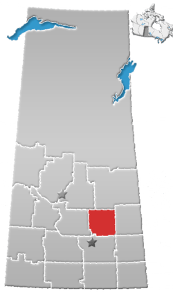 | ||||
|---|---|---|---|---|---|
| Villages | |||||
| Resort villages | |||||
| Rural municipalities | |||||
| First Nations | |||||
| Indian reserves | |||||
| Unincorporated communities |
| ||||