Markinch, Saskatchewan
Markinch (2016 population: 58) is a village in the Canadian province of Saskatchewan within the Rural Municipality of Cupar No. 218 and Census Division No. 6. It is located about 68 km north of the City of Regina. It was named by settlers for Markinch, Scotland.
Village of Markinch | |
|---|---|
Village | |
| Nickname(s): Kinch | |
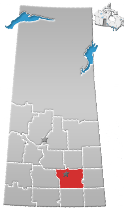
 Location of Markinch in Saskatchewan  Markinch, Saskatchewan (Canada) | |
| Coordinates: 50.944°N 104.349°W | |
| Country | Canada |
| Province | Saskatchewan |
| Region | Saskatchewan |
| Census division | 6 |
| Rural Municipality | Cupar No. 218 |
| Post office | 1906 - 1989 |
| Incorporated (Village) | N/A |
| Incorporated (Town) | N/A |
| Government | |
| • Mayor | Robert Fenwick |
| • Administrator | Rita T. Orb |
| • Governing body | Markinch Village Council |
| Area | |
| • Total | 0.68 km2 (0.26 sq mi) |
| Elevation | 610 m (2,000 ft) |
| Population (2016) | |
| • Total | 58 |
| • Density | 85.9/km2 (222/sq mi) |
| Time zone | CST |
| Postal code | S0G 3J0 |
| Area code(s) | 306 |
| Highways | Saskatchewan_Highway_22 |
| Waterways | Loon Creek |
| [1][2][3][4] | |
The first European settlers in the district were Paul Blaser and Tom Bradwell in 1900 [5] The railway from Brandon, reached Markinch in 1905 and highway 22 was completed in 1930. Markinch was established with the coming of the railroad. The population in 1906/07 was 40 people and reached its height in 1921 with 175 people.
History
Markinch incorporated as a village on February 16, 1911.[6]
Demographics
In the 2016 Census of Population conducted by Statistics Canada, the Village of Markinch recorded a population of 58 living in 29 of its 31 total private dwellings, a -24.1% change from its 2011 population of 72. With a land area of 0.68 km2 (0.26 sq mi), it had a population density of 85.3/km2 (220.9/sq mi) in 2016.[9]
In the 2011 Census of Population, the Village of Markinch recorded a population of 72, a 22% change from its 2006 population of 59. With a land area of 0.68 km2 (0.26 sq mi), it had a population density of 105.9/km2 (274.2/sq mi) in 2011.[10]
See also
- List of communities in Saskatchewan
- Villages of Saskatchewan
Footnotes
- National Archives, Archivia Net, Post Offices and Postmasters, archived from the original on 2006-10-06
- Government of Saskatchewan, MRD Home, Municipal Directory System, archived from the original on November 21, 2008
- Canadian Textiles Institute. (2005), CTI Determine your provincial constituency, archived from the original on 2007-09-11
- Commissioner of Canada Elections, Chief Electoral Officer of Canada (2005), Elections Canada On-line, archived from the original on 2007-04-21
- Markinch History, 1905-1955. Markinch, Sask.: S.n., 1955. Print. (available through the Saskatchewan Legislative Library)
- "Urban Municipality Incorporations". Saskatchewan Ministry of Government Relations. Archived from the original on October 15, 2014. Retrieved June 1, 2020.
- "Saskatchewan Census Population" (PDF). Saskatchewan Bureau of Statistics. Archived from the original (PDF) on September 24, 2015. Retrieved May 31, 2020.
- "Saskatchewan Census Population". Saskatchewan Bureau of Statistics. Retrieved May 31, 2020.
- "Population and dwelling counts, for Canada, provinces and territories, and census subdivisions (municipalities), 2016 and 2011 censuses – 100% data (Saskatchewan)". Statistics Canada. February 8, 2017. Retrieved May 30, 2020.
- "Population and dwelling counts, for Canada, provinces and territories, and census subdivisions (municipalities), 2011 and 2006 censuses (Saskatchewan)". Statistics Canada. June 3, 2019. Retrieved May 30, 2020.
Places adjacent to Markinch, Saskatchewan | |
|---|---|