Elbow, Saskatchewan
Elbow (2016 population: 337) is a village in the Canadian province of Saskatchewan within the Rural Municipality of Loreburn No. 254 and Census Division No. 11. Elbow was founded in 1909, near what is now Lake Diefenbaker. It is 8 km northwest of Mistusinne, 10 km northwest of Douglas Provincial Park and 16 km southeast of Loreburn. The village got its name from its position on the elbow of the South Saskatchewan River.
Elbow | |
|---|---|
| Village of Elbow | |
 Grain elevator in Elbow, Note: original Saskatchewan Wheat Pool logo | |
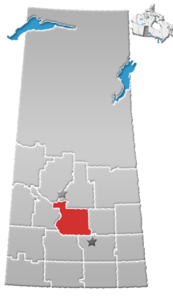
 Elbow Location of Elbow in Saskatchewan  Elbow Elbow (Canada) | |
| Coordinates: 51.144°N 106.559°W | |
| Country | |
| Province | |
| Region | South-central |
| Census division | 11 |
| Rural Municipality | Loreburn No. 254 |
| Post office Founded | 1906-04-01 |
| Government | |
| • Type | Municipal |
| • Governing body | Elbow Village Council |
| • Mayor | Robert (Rob) Hundeby |
| • Administrator | Yvonne Akre-Jess |
| • MP | Kelly Block |
| • MLA | Jim Reiter |
| Area | |
| • Total | 3.92 km2 (1.51 sq mi) |
| Population (2016) | |
| • Total | 337 |
| • Density | 86.0/km2 (223/sq mi) |
| Time zone | UTC-6 (CST) |
| Postal code | S0H 1J0 |
| Area code(s) | 306 |
| Highways | |
| Railways | Canadian National Railway |
| Website | Official website |
| [1][2][3][4] | |
The village contains a marina for boat storage and house boat rental, a golf course, a boat dealership and two restaurants. There is also a sod house, (which is used for a museum) and a library.
History
Elbow incorporated as a village on April 6, 1909.[5]
Demographics
In the 2016 Census of Population conducted by Statistics Canada, the Village of Elbow recorded a population of 337 living in 163 of its 243 total private dwellings, a 6.8% change from its 2011 population of 314. With a land area of 3.92 km2 (1.51 sq mi), it had a population density of 86.0/km2 (222.7/sq mi) in 2016.[8]
In the 2011 Census of Population, the Village of Elbow recorded a population of 314, a 6.8% change from its 2006 population of 294. With a land area of 3.92 km2 (1.51 sq mi), it had a population density of 80.1/km2 (207.5/sq mi) in 2011.[9]
Climate
Elbow experiences a Humid continental climate (Dfb). The highest temperature ever recorded in Elbow was 43.3 °C (110 °F) on 24 June 1941.[10] The coldest temperature ever recorded was −43.3 °C (−46 °F) on 25 January 1972.[11]
| Climate data for Elbow, 1981–2010 normals, extremes 1918–present | |||||||||||||
|---|---|---|---|---|---|---|---|---|---|---|---|---|---|
| Month | Jan | Feb | Mar | Apr | May | Jun | Jul | Aug | Sep | Oct | Nov | Dec | Year |
| Record high °C (°F) | 10.0 (50.0) |
12.0 (53.6) |
21.8 (71.2) |
33.9 (93.0) |
38.0 (100.4) |
43.3 (109.9) |
41.1 (106.0) |
40.9 (105.6) |
38.3 (100.9) |
32.8 (91.0) |
21.1 (70.0) |
16.3 (61.3) |
43.3 (109.9) |
| Average high °C (°F) | −9.4 (15.1) |
−5.1 (22.8) |
1.5 (34.7) |
11.5 (52.7) |
17.5 (63.5) |
21.8 (71.2) |
25.6 (78.1) |
25.2 (77.4) |
19.4 (66.9) |
10.5 (50.9) |
0.4 (32.7) |
−6.0 (21.2) |
9.4 (48.9) |
| Daily mean °C (°F) | −14.6 (5.7) |
−10.6 (12.9) |
−4.1 (24.6) |
4.9 (40.8) |
10.4 (50.7) |
15.2 (59.4) |
18.3 (64.9) |
17.6 (63.7) |
12.0 (53.6) |
4.3 (39.7) |
−4.4 (24.1) |
−11.0 (12.2) |
3.2 (37.8) |
| Average low °C (°F) | −19.7 (−3.5) |
−15.9 (3.4) |
−9.6 (14.7) |
−1.9 (28.6) |
3.2 (37.8) |
8.6 (47.5) |
11.0 (51.8) |
9.9 (49.8) |
4.6 (40.3) |
−1.9 (28.6) |
−9.2 (15.4) |
−15.9 (3.4) |
−3.1 (26.4) |
| Record low °C (°F) | −43.3 (−45.9) |
−40.0 (−40.0) |
−42.8 (−45.0) |
−26.6 (−15.9) |
−12.2 (10.0) |
−2.8 (27.0) |
0.0 (32.0) |
−2.0 (28.4) |
−13.3 (8.1) |
−22.8 (−9.0) |
−32.7 (−26.9) |
−42.2 (−44.0) |
−43.3 (−45.9) |
| Average precipitation mm (inches) | 15.1 (0.59) |
7.7 (0.30) |
13.8 (0.54) |
20.8 (0.82) |
51.2 (2.02) |
78.9 (3.11) |
53.4 (2.10) |
45.2 (1.78) |
34.0 (1.34) |
18.4 (0.72) |
13.0 (0.51) |
12.1 (0.48) |
363.6 (14.31) |
| Average rainfall mm (inches) | 1.0 (0.04) |
0.7 (0.03) |
4.3 (0.17) |
16.7 (0.66) |
50.4 (1.98) |
78.9 (3.11) |
53.4 (2.10) |
45.2 (1.78) |
33.9 (1.33) |
14.9 (0.59) |
3.0 (0.12) |
0.8 (0.03) |
303.1 (11.93) |
| Average snowfall cm (inches) | 15.1 (5.9) |
7.0 (2.8) |
9.5 (3.7) |
4.1 (1.6) |
0.9 (0.4) |
0.0 (0.0) |
0.0 (0.0) |
0.0 (0.0) |
0.1 (0.0) |
3.6 (1.4) |
10.0 (3.9) |
11.3 (4.4) |
60.4 (23.8) |
| Source: Environment Canada[10][11][12] | |||||||||||||
See also
- List of communities in Saskatchewan
- Villages of Saskatchewan
- Elbow
References
- National Archives, Archivia Net, Post Offices and Postmasters, archived from the original on 2006-10-06, retrieved 2013-09-25
- Government of Saskatchewan, MRD Home. "Municipal Directory System". Archived from the original on 2016-01-15. Retrieved 2013-09-25.
- Canadian Textiles Institute. (2005), CTI Determine your provincial constituency, archived from the original on 2007-09-11
- Commissioner of Canada Elections, Chief Electoral Officer of Canada (2005), Elections Canada On-line, archived from the original on 2007-04-21
- "Urban Municipality Incorporations". Saskatchewan Ministry of Government Relations. Archived from the original on October 15, 2014. Retrieved June 1, 2020.
- "Saskatchewan Census Population" (PDF). Saskatchewan Bureau of Statistics. Archived from the original (PDF) on September 24, 2015. Retrieved May 31, 2020.
- "Saskatchewan Census Population". Saskatchewan Bureau of Statistics. Retrieved May 31, 2020.
- "Population and dwelling counts, for Canada, provinces and territories, and census subdivisions (municipalities), 2016 and 2011 censuses – 100% data (Saskatchewan)". Statistics Canada. February 8, 2017. Retrieved May 30, 2020.
- "Population and dwelling counts, for Canada, provinces and territories, and census subdivisions (municipalities), 2011 and 2006 censuses (Saskatchewan)". Statistics Canada. June 3, 2019. Retrieved May 30, 2020.
- "Elbow". Canadian Climate Normals. Environment Canada. Retrieved 3 May 2016.
- "Elbow 2 NE". Canadian Climate Normals. Environment Canada. Retrieved 3 May 2016.
- "Elbow CS". Canadian Climate Data. Environment Canada. Retrieved 3 May 2016.
Places adjacent to Elbow, Saskatchewan | ||||||||||
|---|---|---|---|---|---|---|---|---|---|---|
| ||||||||||