Young, Saskatchewan
Young (2016 population: 244) is a village in the Canadian province of Saskatchewan within the Rural Municipality of Morris No. 312 and Census Division No. 11. The economy is dominated by local agriculture and the nearby Mosaic Potash mine.[4]
Young | |
|---|---|
Village | |
 Main Street | |
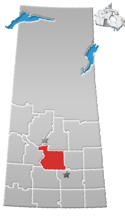
 Young Location of Young in Saskatchewan  Young Young (Canada) | |
| Coordinates: 51.46°N 105.44°W | |
| Country | Canada |
| Province | Saskatchewan |
| Region | Saskatchewan |
| Founded | 1908 |
| Post Office Established | 1909-04-01 |
| Village Incorporated | June 7, 1910 |
| Government | |
| • Mayor | Robert Clinkard |
| • Governing body | Young Village Council |
| Area | |
| • Land | 2.51 km2 (0.97 sq mi) |
| Population (2011)[1] | |
| • Total | 239 |
| • Density | 95.2/km2 (247/sq mi) |
| Time zone | CST |
| Postal code | S0K 4Y0 |
| Area code(s) | 306 |
| Highways | Highway 2 |
| Website | Official Site |
| [2][3] | |
History
Young came into being with the coming of the Grand Trunk Pacific Railway. Young incorporated as a village on June 7, 1910.[5] It was named for F.G. Young, a land agent.

A limestone kiln producing 1000 bushels of lime a day was established in the town at the northwest end of 2 Avenue.
The village has a population of less than 300 people. It has a 3 sheet curling rink with artificial ice and hockey arena, a swimming pool, golf course, ball diamonds and playground.[6]
A fire destroyed the village's oldest building, the former Young Hotel, on November 12, 2011. The hotel was built in 1910.[7]
Demographics
In the 2016 Census of Population conducted by Statistics Canada, the Village of Young recorded a population of 244 living in 117 of its 133 total private dwellings, a 2% change from its 2011 population of 239. With a land area of 2.51 km2 (0.97 sq mi), it had a population density of 97.2/km2 (251.8/sq mi) in 2016.[10]
In the 2011 Census of Population, the Village of Young recorded a population of 239, a -9.1% change from its 2006 population of 263. With a land area of 2.51 km2 (0.97 sq mi), it had a population density of 95.2/km2 (246.6/sq mi) in 2011.[11]
References
- "2011 Community Profiles". Statistics Canada. Government of Canada. Retrieved 2014-08-21.
- National Archives, Archivia Net. "Post Offices and Postmasters". Retrieved 2014-08-21.
- Government of Saskatchewan, MRD Home. "Municipal Directory System". Archived from the original on January 15, 2016. Retrieved 2014-08-21.
- "Economy of Young". Village of Young. Retrieved 2011-03-06.
- "Urban Municipality Incorporations". Saskatchewan Ministry of Government Relations. Archived from the original on October 15, 2014. Retrieved June 1, 2020.
- "History of Young". Village of Young. Retrieved 2011-03-06.
- "Young's century-old hotel building destroyed". CBC News. Retrieved 2013-02-09.
- "Saskatchewan Census Population" (PDF). Saskatchewan Bureau of Statistics. Archived from the original (PDF) on September 24, 2015. Retrieved May 31, 2020.
- "Saskatchewan Census Population". Saskatchewan Bureau of Statistics. Retrieved May 31, 2020.
- "Population and dwelling counts, for Canada, provinces and territories, and census subdivisions (municipalities), 2016 and 2011 censuses – 100% data (Saskatchewan)". Statistics Canada. February 8, 2017. Retrieved May 30, 2020.
- "Population and dwelling counts, for Canada, provinces and territories, and census subdivisions (municipalities), 2011 and 2006 censuses (Saskatchewan)". Statistics Canada. June 3, 2019. Retrieved May 30, 2020.
External links
| North: Viscount | ||
| West: Allan | Young | East: Watrous |