Broderick, Saskatchewan
Broderick (2016 population: 85) is a village in the Canadian province of Saskatchewan within the Rural Municipality of Rudy No. 284 and Census Division No. 11. The village is approximately 5 km (3.1 mi) east of the Town of Outlook.

Broderick | |
|---|---|
| Village of Broderick | |
 Grain elevators in Broderick | |
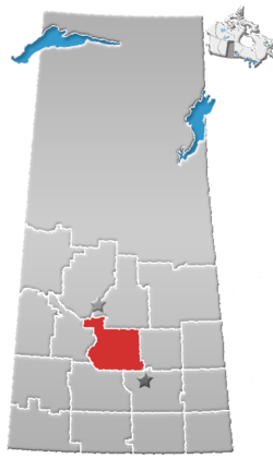
 Broderick Location of Broderick in Saskatchewan  Broderick Broderick (Canada) | |
| Coordinates: 51.512°N 106.912°W | |
| Country | Canada |
| Province | Saskatchewan |
| Region | West-central |
| Census division | 11 |
| Rural municipality | Rudy No. 284 |
| Post office Founded | December 1, 1907 |
| Government | |
| • Type | Municipal |
| • Governing body | Broderick Village Council |
| • Mayor | Arlin Simonson[1] |
| • Administrator | Shannon Pederson[2] |
| • MP | Kelly Block |
| • MLA | Jim Reiter |
| Area | |
| • Total | 0.91 km2 (0.35 sq mi) |
| Population (2016) | |
| • Total | 85 |
| • Density | 93.9/km2 (243/sq mi) |
| Time zone | UTC-6 (CST) |
| Postal code | S0H 0L0 |
| Area code(s) | 306 |
| Highways | |
| Railways | Canadian Pacific Railway (abandoned) |
| [3][4][5][6] | |
History
The post office was originally established under the name Chromar on December 1, 1907, but its name was changed to Broderick on January 1, 1909.[7] Broderick incorporated as a village on September 13, 1909.[8]
Demographics
In the 2016 Census of Population conducted by Statistics Canada, the Village of Broderick recorded a population of 85 living in 35 of its 37 total private dwellings, a 16.5% change from its 2011 population of 71. With a land area of 0.91 km2 (0.35 sq mi), it had a population density of 93.4/km2 (241.9/sq mi) in 2016.[11]
In the 2011 Census of Population, the Village of Broderick recorded a population of 71, a -7.8% change from its 2006 population of 77. With a land area of 0.91 km2 (0.35 sq mi), it had a population density of 78.0/km2 (202.1/sq mi) in 2011.[12]
See also
- List of communities in Saskatchewan
- Villages of Saskatchewan
References
- Municipal Directory System
- Municipal Directory System
- National Archives, Archivia Net, Post Offices and Postmasters, archived from the original on 2006-10-06
- Government of Saskatchewan, MRD Home. "Municipal Directory System". Archived from the original on 15 January 2016. Retrieved 6 September 2009.
- Canadian Textiles Institute. (2005), CTI Determine your provincial constituency, archived from the original on 2007-09-11
- Commissioner of Canada Elections, Chief Electoral Officer of Canada (2005), Elections Canada On-line, archived from the original on 2007-04-21
- National Archives, Archivia Net, Post Offices and Postmasters, archived from the original on 2006-10-06
- "Urban Municipality Incorporations". Saskatchewan Ministry of Government Relations. Archived from the original on October 15, 2014. Retrieved June 1, 2020.
- "Saskatchewan Census Population" (PDF). Saskatchewan Bureau of Statistics. Archived from the original (PDF) on September 24, 2015. Retrieved May 31, 2020.
- "Saskatchewan Census Population". Saskatchewan Bureau of Statistics. Retrieved May 31, 2020.
- "Population and dwelling counts, for Canada, provinces and territories, and census subdivisions (municipalities), 2016 and 2011 censuses – 100% data (Saskatchewan)". Statistics Canada. February 8, 2017. Retrieved May 30, 2020.
- "Population and dwelling counts, for Canada, provinces and territories, and census subdivisions (municipalities), 2011 and 2006 censuses (Saskatchewan)". Statistics Canada. June 3, 2019. Retrieved May 30, 2020.
| Wikimedia Commons has media related to Broderick, Saskatchewan. |
Places adjacent to Broderick, Saskatchewan | |
|---|---|