Meota, Saskatchewan
Meota (2016 population: 304) is a village in the Canadian province of Saskatchewan within the Rural Municipality of Meota No. 468 and Census Division No. 17. The village name is derived from the Cree phrase Meotate or Mo-Was-In-Ota, meaning "good place to camp" or "it is good here."[5][6]
Village of Meota | |
|---|---|
 Meota Business district | |
| Motto(s): It is good here! | |
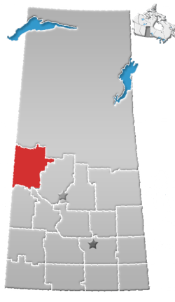
 Location of Meota in Saskatchewan  Meota, Saskatchewan (Canada) | |
| Coordinates: 53.04°N 108.46°W | |
| Country | Canada |
| Province | Saskatchewan |
| Region | Northwest |
| Census division | 17 |
| Rural Municipality | Meota |
| Established | 1894 |
| Incorporated (Village) | February 1, 1911 |
| Government | |
| • Mayor | John MacDonald |
| • Administrator | Bill Jamroziak |
| • Governing body | Meota Village Council |
| Area | |
| • Total | 1.55 km2 (0.60 sq mi) |
| Population (2006) | |
| • Total | 297 |
| • Density | 191.9/km2 (497/sq mi) |
| Time zone | CST |
| Postal code | S0M 1X0 |
| Area code(s) | 306 |
| Highways | Highway 26 |
| Railways | Canadian Northern Railway |
| [1][2][3][4] | |
Demographics
In the 2016 Census of Population conducted by Statistics Canada, the Village of Meota recorded a population of 304 living in 148 of its 208 total private dwellings, a -1% change from its 2011 population of 307. With a land area of 1.55 km2 (0.60 sq mi), it had a population density of 196.1/km2 (508.0/sq mi) in 2016.[9]
In the 2011 Census of Population, the Village of Meota recorded a population of 307, a 3.4% change from its 2006 population of 297. With a land area of 1.55 km2 (0.60 sq mi), it had a population density of 198.1/km2 (513.0/sq mi) in 2011.[10]
History
A post office named Meota was established in 1894, but it was located where the present-day community of Metinota is,[11] leading to some confusion over the origins of the current village of Meota. The first post office in present-day Meota was established in 1910, although it was initially called Beachview.[11]
Joseph A. Dart, an early merchant, had established a store in a tent near current-day Meota, and in 1910, he moved to the Meota townsite where his store operated in a building on Main Street.[5] The Canadian Northern Railway opened its line through Meota in 1910-1911.[5][11] Meota incorporated as a village on July 6, 1911.[12] In 1912 the first grain elevator was constructed, and then a dance pavilion opened in 1921.[11] Other industries included brick manufacturing, a flour mill, and commercial fishing ("Meota Whites").[11] Unfortunately a series of fires have decimated the village's business district, and the advent of the automobile caused many local residents to drive to North Battleford for shopping.
Meota has enjoyed a measure of prosperity due to summer vacationers at Jackfish Lake.
See also
- List of communities in Saskatchewan
- Villages of Saskatchewan
References
- National Archives, Archivia Net, Post Offices and Postmasters, archived from the original on 2006-10-06
- Government of Saskatchewan, MRD Home, Municipal Directory System, archived from the original (– Scholar search) on November 21, 2008
- Canadian Textiles Institute. (2005), CTI Determine your provincial constituency, archived from the original on 2007-09-11
- Commissioner of Canada Elections, Chief Electoral Officer of Canada (2005), Elections Canada On-line, archived from the original on 2007-04-21
- Russell, Edmund T. (1973), What's In a Name: The Story Behind Saskatchewan Place Names (3rd edition), Saskatoon, Saskatchewan: Western Producer Prairie Books, p. 200, ISBN 0-88833-053-7
- "Saskbiz Community Profiles: Meota". Enterprise Saskatchewan, Government of Saskatchewan. 2009. Retrieved 2009-10-19.
- "Saskatchewan Census Population" (PDF). Saskatchewan Bureau of Statistics. Archived from the original (PDF) on September 24, 2015. Retrieved May 31, 2020.
- "Saskatchewan Census Population". Saskatchewan Bureau of Statistics. Retrieved May 31, 2020.
- "Population and dwelling counts, for Canada, provinces and territories, and census subdivisions (municipalities), 2016 and 2011 censuses – 100% data (Saskatchewan)". Statistics Canada. February 8, 2017. Retrieved May 30, 2020.
- "Population and dwelling counts, for Canada, provinces and territories, and census subdivisions (municipalities), 2011 and 2006 censuses (Saskatchewan)". Statistics Canada. June 3, 2019. Retrieved May 30, 2020.
- McLennan, David (2008), Our Town: Saskatchewan Communities from Abbey to Zenon Park, Regina, Saskatchewan: Canadian Plains Research Center, University of Regina, p. 261, ISBN 978-0-88977-209-0, archived from the original on 2010-04-10
- "Urban Municipality Incorporations". Saskatchewan Ministry of Government Relations. Archived from the original on October 15, 2014. Retrieved June 1, 2020.
Places adjacent to Meota, Saskatchewan | |
|---|---|
| Cities |
|  |
|---|---|---|
| Towns |
| |
| Villages | ||
| Resort villages |
| |
| Rural municipalities |
| |
| First Nations | ||
| Indian reserves | ||
| Unincorporated communities | ||