Gull Lake, Saskatchewan
Gull Lake is a small town in Saskatchewan, Canada, west of Swift Current situated on the junction of the Trans-Canada Highway and Highway 37. It is identified by some by the wind turbines that can be seen in the distance while driving along the Trans-Canada Highway. The SunBridge Wind Farm is near Gull Lake.
Gull Lake | |
|---|---|
Town | |
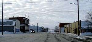
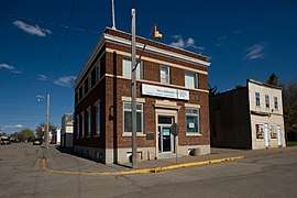 Buildings on Main Street, Gull Lake | |
 Gull Lake | |
| Coordinates: 50°03′36″N 108°17′24″W | |
| Country | Canada |
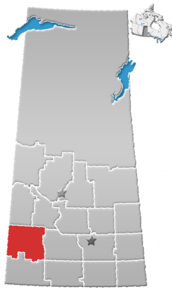
| Province | Saskatchewan |
| Region | Southwest Saskatchewan |
| Census division | 8 |
| Rural Municipality | Gull Lake |
| Post office Founded | 1884 |
| Incorporated (Village) | 1909 |
| Incorporated (Town) | 1911 |
| Government | |
| • Mayor | Blake Campbell |
| • Governing body | Gull Lake Town Council |
| • MP | Jeremy Patzer |
| • MLA | Doug Steele |
| Area | |
| • Total | 2.50 km2 (0.97 sq mi) |
| Population (2006) | |
| • Total | 965 |
| • Density | 386.0/km2 (1,000/sq mi) |
| Time zone | UTC−06:00 (CST) |
| Postal code | S0N 1A0 |
| Area code(s) | 306 |
| Highways | Highway 1 Highway 37 |
| Website | Official website |
| [1][2][3][4] | |
History
The history of the Gull Lake community dates back to 1906, when a development company Conrad and Price acquired and surveyed the town site and subdivided it into blocks. Unlike most other towns located along the Canadian Pacific Railway main line, Gull Lake was not planned and established by the railroad. In fact, there was some animosity from the railroad towards this town that bucked their plan. The origin of the name Gull Lake comes from the Cree word for the area, Kiaskus (kiyaskos) which means "little gull".[5]
From 1906 to 1909 there was no municipal government or authority other than Conrad and Price: the company had full jurisdiction over civic affairs. In 1909 the citizens of Gull Lake had their community incorporated as a village.[6]
Before 1906 the town of Gull Lake was part of the famed Ranch 76 that stretched over most of southwestern Saskatchewan. There are still a few buildings in the town that were part of the ranch.
Demographics
| Canada census – Gull Lake, Saskatchewan community profile | |||
|---|---|---|---|
| 2011 | 2006 | ||
| Population: | 989 (+2.5% from 2006) | 965 (-5.0% from 2001) | |
| Land area: | 2.50 km2 (0.97 sq mi) | 2.50 km2 (0.97 sq mi) | |
| Population density: | 395.6/km2 (1,025/sq mi) | 386.0/km2 (1,000/sq mi) | |
| Median age: | 48.3 (M: 46.8, F: 49.6) | 46.8 (M: 45.3, F: 48.9) | |
| Total private dwellings: | 475 | 410 | |
| Median household income: | $55,712 | ||
| References: 2011[7] 2006[8] earlier[9] | |||
Climate
Gull Lake Experiences a Humid Continental climate (Dfb) with warm summers and long, cold winters.
| Climate data for Gull Lake | |||||||||||||
|---|---|---|---|---|---|---|---|---|---|---|---|---|---|
| Month | Jan | Feb | Mar | Apr | May | Jun | Jul | Aug | Sep | Oct | Nov | Dec | Year |
| Record high °C (°F) | 14 (57) |
15 (59) |
20.6 (69.1) |
30 (86) |
38 (100) |
39 (102) |
37 (99) |
40 (104) |
37.8 (100.0) |
29 (84) |
21.5 (70.7) |
14.4 (57.9) |
40 (104) |
| Average high °C (°F) | −6.1 (21.0) |
−3.4 (25.9) |
2.6 (36.7) |
11.4 (52.5) |
17.8 (64.0) |
22.4 (72.3) |
25.4 (77.7) |
25 (77) |
18.2 (64.8) |
11.8 (53.2) |
1.5 (34.7) |
−4.7 (23.5) |
10.2 (50.4) |
| Daily mean °C (°F) | −11.5 (11.3) |
−8.6 (16.5) |
−2.9 (26.8) |
4.6 (40.3) |
10.6 (51.1) |
15.1 (59.2) |
17.6 (63.7) |
17 (63) |
10.8 (51.4) |
4.9 (40.8) |
−4 (25) |
−10.1 (13.8) |
3.6 (38.5) |
| Average low °C (°F) | −16.8 (1.8) |
−13.8 (7.2) |
−8.5 (16.7) |
−2.2 (28.0) |
3.5 (38.3) |
7.8 (46.0) |
9.8 (49.6) |
8.9 (48.0) |
3.4 (38.1) |
−1.9 (28.6) |
−9.4 (15.1) |
−15.4 (4.3) |
−2.9 (26.8) |
| Record low °C (°F) | −40.6 (−41.1) |
−42.8 (−45.0) |
−36.1 (−33.0) |
−26.1 (−15.0) |
−9 (16) |
−5.6 (21.9) |
0 (32) |
−1.5 (29.3) |
−10.6 (12.9) |
−25.5 (−13.9) |
−33.5 (−28.3) |
−41.5 (−42.7) |
−42.8 (−45.0) |
| Average precipitation mm (inches) | 18.1 (0.71) |
13.7 (0.54) |
22.3 (0.88) |
26.5 (1.04) |
64.9 (2.56) |
64.6 (2.54) |
52.9 (2.08) |
41.3 (1.63) |
35.9 (1.41) |
15.7 (0.62) |
12.4 (0.49) |
19.6 (0.77) |
387.9 (15.27) |
| Source: Environment Canada[10] | |||||||||||||
Economy
Agriculture is the top employment field with many surrounding farms and ranches, with some work in the oil fields as well.
Attractions
Regional Attractions:

- Big Muddy Badlands, a series of badlands in southern Saskatchewan and northern Montana along Big Muddy Creek. They are found in the Big Muddy Valley, a cleft of erosion and sandstone along Big Muddy Creek. The valley is 55 kilometres (34 mi) long, 3.2 kilometres (2.0 mi) wide and 160 metres (520 ft) deep.[11] The valley was formed when it was part of an ancient glacial meltwater channel that carried great quantities of water southeastward during the last ice age.[12]
- Cypress Hills Interprovincial Park, an interprovincial park straddling the southern Alberta-Saskatchewan border, located north-west of Robsart. It is Canada's first and only interprovincial park.
- Cypress Hills Vineyard & Winery, open by appointment only from Christmas until May 14.[13]
- Fort Walsh, is part of the Cypress Hills Interprovincial Park. As a National Historic Site of Canada the area possesses National Historical Significance. It was established as a North-West Mounted Police (NWMP) fort after and at the location of the Cypress Hills Massacre.
- Grasslands National Park, represents the Prairie Grasslands natural region, protecting one of the nation's few remaining areas of undisturbed dry mixed-grass/shortgrass prairie grassland. The park is located in the WWF-defined Northern short grasslands ecoregion, which spans across much of Southern Saskatchewan, Southern Alberta, and the northern Great Plains states in the United States. The unique landscape and harsh, semi-arid climate provide niches for several specially adapted plants and animals. The park and surrounding area house the country's only black-tailed prairie dog colonies. Other rare and endangered fauna that can be found in the park include the pronghorn, sage grouse, burrowing owl, ferruginous hawk, prairie rattlesnake, black-footed ferret and eastern short-horned lizard. Flora includes blue grama grass, needlegrass, Plains Cottonwood and silver sagebrush.
- The Great Sandhills, is a sand dune rising 50 feet above the ground and covering 1,900 square kilometers. Native prairie grass helps keep the sand together. The sand dunes are fringed by small groves of aspen, birch, and willow trees, and by rose bushes, chokecherry and sagebrush. Subjected to strong winds, the dunes are always moving, creating an ever-changing landscape for photographers.[14]
- Robsart Art Works, opens July 1 to August 28, 2010 from 1 to 4 p.m. and by appointment and features Saskatchewan artists featuring photographers of old buildings and towns throughout Saskatchewan.[15]
- T.rex Discovery Centre, a world class facility to house the fossil record of the Eastend area started many years before the discovery of "Scotty" the T.Rex in 1994.[16]
References
- National Archives, Archivia Net, Post Offices and Postmasters
- Government of Saskatchewan, MRD Home, Municipal Directory System, archived from the original (– Scholar search) on November 21, 2008
- Canadian Textiles Institute. (2005), CTI Determine your provincial constituency, archived from the original on 2007-09-11
- Commissioner of Canada Elections, Chief Electoral Officer of Canada (2005), Elections Canada On-line, archived from the original on 2007-04-21
- Barry, Bill (October 1, 1998), The Dictionary of Saskatchewan Place Names, Betty K Books & Food, ISBN 978-1-894022-19-4
- Town of Gull Lake History Committee. (1989). Gull Lake memories: a history of the town of Gull Lake. Regina: Focus, p37.
- "2011 Community Profiles". 2011 Canadian Census. Statistics Canada. July 5, 2013. Retrieved 2012-10-30.
- "2006 Community Profiles". 2006 Canadian Census. Statistics Canada. March 30, 2011. Retrieved 2009-02-24.
- "2001 Community Profiles". 2001 Canadian Census. Statistics Canada. February 17, 2012.
- Environment Canada Canadian Climate Normals 1971–2000, accessed 27 July 2010
- Yanko, Dave. "The Badlands". Virtual Saskatchewan. Retrieved 2010-05-11.
- Harel, Claude-Jean (2006). "Big Muddy Valley". Encyclopedia of Saskatchewan. Great Plains Research Center. Archived from the original on 2009-06-19. Retrieved 2010-05-11.
- Cypress Hills Vineyard & Winery
- Great Sandhills Archived 2011-08-27 at the Wayback Machine
- Robsart Art Works Archived 2013-06-20 at the Wayback Machine
- T.rex Discovery Centre
External links
| Wikimedia Commons has media related to Gull Lake, Saskatchewan. |
Places adjacent to Gull Lake, Saskatchewan | |
|---|---|