Paradise Hill, Saskatchewan
Paradise Hill (2016 population: 491) is a village in the Canadian province of Saskatchewan within the Rural Municipality of Frenchman Butte No. 501 and Census Division No. 17.
Paradise Hill | |
|---|---|
Village | |
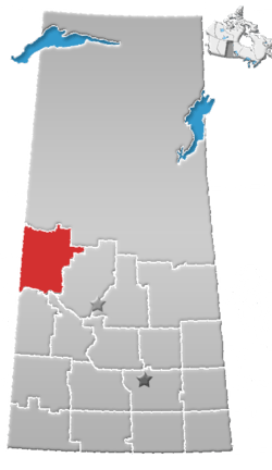
 Paradise Hill  Paradise Hill | |
| Coordinates: 53.532°N 109.451°W | |
| Country | Canada |
| Province | Saskatchewan |
| Region | Saskatchewan |
| Census division | 17 |
| Rural Municipality | Frenchman Butte |
| Government | |
| • Mayor | Bernard Ecker |
| • Administrator | Cindy Villeneuve |
| • Governing body | Paradise Hill Village Council |
| Area | |
| • Total | 2.56 km2 (0.99 sq mi) |
| Population (2016) | |
| • Total | 495 |
| • Density | 201.1/km2 (2.56/sq mi) |
| Time zone | CST |
| Postal code | S0M 2G0 |
| Area code(s) | 306 |
| Highways | Highway 3 |
| Website | Official Website |
| [1][2][3][4] | |
The school offers grades from K to 12.
Oil, natural gas and farming are the primary providers for the economy.
History
Paradise Hill incorporated as a village on January 1, 1947.[5]
Demographics
In the 2016 Census of Population conducted by Statistics Canada, the Village of Paradise Hill recorded a population of 491 living in 204 of its 239 total private dwellings, a -4.9% change from its 2011 population of 515. With a land area of 2.56 km2 (0.99 sq mi), it had a population density of 191.8/km2 (496.8/sq mi) in 2016.[8]
In the 2011 Census of Population, the Village of Paradise Hill recorded a population of 515, a 6.6% change from its 2006 population of 483. With a land area of 2.56 km2 (0.99 sq mi), it had a population density of 201.2/km2 (521.0/sq mi) in 2011.[9]
Attractions
- The Roman Catholic church of Our Lady of Sorrows in Paradise Hill was decorated by the artist Berthold Imhoff.[10]
- A giant ox and cart at the entrance of the village commemorates the Carlton Trail.[11]
- The Marsh north and west of the village with its walkways, paths and lookout offers bird watching opportunities.
The Frenchman Butte Museum,[12] the Battle of Frenchman Butte National Historic Site and Fort Pitt Provincial Park are all located within 15 to 30 minute driving distance.[13]
See also
- List of communities in Saskatchewan
- Villages of Saskatchewan
- Paradise Hill Airport
References
- National Archives, Archivia Net, Post Offices and Postmasters, retrieved 2014-06-22
- Government of Saskatchewan, MRD Home. "Municipal Directory System". Retrieved 2014-06-22.
- Canadian Textiles Institute. (2005), CTI Determine your provincial constituency, archived from the original on 2007-09-11
- Commissioner of Canada Elections, Chief Electoral Officer of Canada (2005), Elections Canada On-line, archived from the original on 2007-04-21
- "Urban Municipality Incorporations". Saskatchewan Ministry of Government Relations. Archived from the original on October 15, 2014. Retrieved June 1, 2020.
- "Saskatchewan Census Population" (PDF). Saskatchewan Bureau of Statistics. Archived from the original (PDF) on September 24, 2015. Retrieved May 31, 2020.
- "Saskatchewan Census Population". Saskatchewan Bureau of Statistics. Retrieved May 31, 2020.
- "Population and dwelling counts, for Canada, provinces and territories, and census subdivisions (municipalities), 2016 and 2011 censuses – 100% data (Saskatchewan)". Statistics Canada. February 8, 2017. Retrieved May 30, 2020.
- "Population and dwelling counts, for Canada, provinces and territories, and census subdivisions (municipalities), 2011 and 2006 censuses (Saskatchewan)". Statistics Canada. June 3, 2019. Retrieved May 30, 2020.
- "Our Lady of Sorrows". Archived from the original on 2013-12-16. Retrieved 2012-12-08.
- "Paradise Hill Community Attractions". Retrieved 2012-12-08.
- "The Frenchman Butte Museum". Retrieved 2012-12-08.
- "Paradise Hill Community Attractions". Retrieved 2012-12-08.
External links
Places adjacent to Paradise Hill, Saskatchewan | ||||||||||
|---|---|---|---|---|---|---|---|---|---|---|
| ||||||||||
| Cities |
|  |
|---|---|---|
| Towns |
| |
| Villages | ||
| Resort villages |
| |
| Rural municipalities |
| |
| First Nations | ||
| Indian reserves | ||
| Unincorporated communities | ||