Abbey, Saskatchewan
Abbey (2016 population: 129) is a village in the Canadian province of Saskatchewan within the Rural Municipality of Miry Creek No. 229 and Census Division No. 8. This village is in the southwestern region of the province, northwest of the City of Swift Current in Division No. 8. Abbey is serviced by Highway 32 near Highway 738.
Abbey | |
|---|---|
| Village of Abbey | |
 Abbey  Abbey | |
| Coordinates: 50.733°N 108.750°W | |
| Country | |
| Province | |
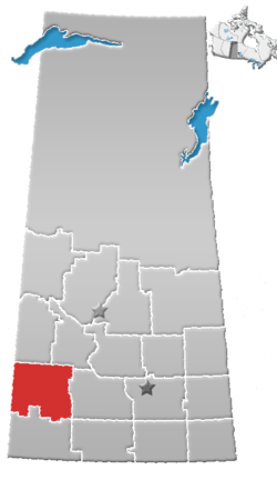
| Region | Southwest |
| Census division | 8 |
| Rural Municipality | Miry Creek No. 229 |
| Post office founded | August 1, 1913 |
| Incorporated (Village) | September 2, 1913 |
| Government | |
| • Governing body | Abbey Village Council |
| • Mayor | Bruce Walker |
| • Administrator | Jan Stern |
| Area | |
| • Total | 0.77 km2 (0.30 sq mi) |
| Elevation | 681 m (2,235 ft) |
| Population (2016) | |
| • Total | 129 |
| • Density | 167.5/km2 (434/sq mi) |
| Time zone | UTC-6 (CST) |
| Postal code | S0N 0A0 |
| Area code(s) | 306 |
| Highways | Hwy 783 |
| [1][2][3][4] | |
History
In 1910, the first post office used by area residents was Longworth, located in the home of Cassie Baldwin.[5] The townsite of Abbey was originally owned by a man named D.F. Kennedy. In 1913, the Canadian Pacific Railway (CPR) bought a quarter section of land from him to build a rail line.[5] The CPR gave Mr. Kennedy the honour of naming the community, giving it the name Abbey - the name of the Kennedy farm in Ireland.[6] Abbey incorporated as a village on September 2, 1913.[7]
Abbey has one municipal heritage property, the Abbey Fire Hall. Constructed in 1919 in response to a large fire that threatened the community in September 1918, the fire station was constructed as part of an upgrade to fire protection in Abbey. The station remained in service until a new fire station was constructed in 1975. The station is currently not in use, however the siren on the station tower is still used to signal emergencies in the community.[8]
Demographics
In the 2016 Census of Population conducted by Statistics Canada, the Village of Abbey recorded a population of 129 living in 65 of its 88 total private dwellings, a 10.9% change from its 2011 population of 115. With a land area of 0.77 km2 (0.30 sq mi), it had a population density of 167.5/km2 (433.9/sq mi) in 2016.[11]
In the 2011 Census of Population, the Village of Abbey recorded a population of 115, a -11.5% change from its 2006 population of 130. With a land area of 0.77 km2 (0.30 sq mi), it had a population density of 149.4/km2 (386.8/sq mi) in 2011.[12]
Geography
Abbey is located south of the South Saskatchewan River and north of The Great Sand Hills.
Climate
Abbey experiences a semi-arid climate (Köppen climate classification BSk) with long, cold, dry winters and short, warm summers. Precipitation is low, with an annual average of 315mm, and is concentrated in the warmer months.
| Climate data for Abbey | |||||||||||||
|---|---|---|---|---|---|---|---|---|---|---|---|---|---|
| Month | Jan | Feb | Mar | Apr | May | Jun | Jul | Aug | Sep | Oct | Nov | Dec | Year |
| Record high °C (°F) | 13.9 (57.0) |
17 (63) |
23 (73) |
31.5 (88.7) |
35 (95) |
39 (102) |
37 (99) |
41.1 (106.0) |
37.8 (100.0) |
33.9 (93.0) |
25 (77) |
16 (61) |
41.1 (106.0) |
| Average high °C (°F) | −8.1 (17.4) |
−3.7 (25.3) |
3.4 (38.1) |
12.5 (54.5) |
18.6 (65.5) |
23.2 (73.8) |
25.9 (78.6) |
25.9 (78.6) |
19.4 (66.9) |
12.4 (54.3) |
1.1 (34.0) |
−5.6 (21.9) |
10.4 (50.7) |
| Daily mean °C (°F) | −13.1 (8.4) |
−8.7 (16.3) |
−1.8 (28.8) |
5.9 (42.6) |
11.8 (53.2) |
16.3 (61.3) |
18.7 (65.7) |
18.5 (65.3) |
12.5 (54.5) |
6.1 (43.0) |
−3.9 (25.0) |
−10.6 (12.9) |
4.3 (39.7) |
| Average low °C (°F) | −18.1 (−0.6) |
−13.7 (7.3) |
−7 (19) |
−0.6 (30.9) |
5 (41) |
9.5 (49.1) |
11.5 (52.7) |
11 (52) |
5.7 (42.3) |
−0.3 (31.5) |
−8.8 (16.2) |
−15.6 (3.9) |
−1.8 (28.8) |
| Record low °C (°F) | −43.3 (−45.9) |
−42 (−44) |
−35 (−31) |
−20 (−4) |
−9 (16) |
−4 (25) |
2.5 (36.5) |
0 (32) |
−7.8 (18.0) |
−27 (−17) |
−36 (−33) |
−44 (−47) |
−44 (−47) |
| Average precipitation mm (inches) | 13.2 (0.52) |
9.2 (0.36) |
15.1 (0.59) |
21.4 (0.84) |
43.3 (1.70) |
60.4 (2.38) |
51.1 (2.01) |
29.5 (1.16) |
25.7 (1.01) |
15.1 (0.59) |
13.1 (0.52) |
17.5 (0.69) |
314.5 (12.38) |
| Source: Environment Canada[13] | |||||||||||||
References
- "2011 Community Profiles". Statistics Canada. Government of Canada. Retrieved 2014-04-09.
- National Archives, Archivia Net. "Post Offices and Postmasters". Archived from the original on 2006-10-06. Retrieved 2014-07-15.
- Government of Saskatchewan, MRD Home. "Municipal Directory System". Archived from the original on 2016-01-15. Retrieved 2014-07-15.
- Commissioner of Canada Elections, Chief Electoral Officer of Canada (2005). "Elections Canada On-line". Archived from the original on 2007-04-21. Retrieved 2014-07-15.
- Russell, E. T. (1973), What's In a Name?, Saskatoon, Saskatchewan: Western Producer Book Service, p1
- Our Roots History of Abbey Archived 2011-06-14 at the Wayback Machine Retrieved on 2008-12-14
- "Urban Municipality Incorporations". Saskatchewan Ministry of Government Relations. Archived from the original on October 15, 2014. Retrieved June 1, 2020.
- Abbey Fire Hall Heritage Property Details Archived March 14, 2012, at the Wayback Machine
- "Saskatchewan Census Population" (PDF). Saskatchewan Bureau of Statistics. Archived from the original (PDF) on September 24, 2015. Retrieved May 31, 2020.
- "Saskatchewan Census Population". Saskatchewan Bureau of Statistics. Retrieved May 31, 2020.
- "Population and dwelling counts, for Canada, provinces and territories, and census subdivisions (municipalities), 2016 and 2011 censuses – 100% data (Saskatchewan)". Statistics Canada. February 8, 2017. Retrieved May 30, 2020.
- "Population and dwelling counts, for Canada, provinces and territories, and census subdivisions (municipalities), 2011 and 2006 censuses (Saskatchewan)". Statistics Canada. June 3, 2019. Retrieved May 30, 2020.
- Environment Canada Canadian Climate Normals 1971–2000, accessed 23 July 2010
Places adjacent to Abbey, Saskatchewan | ||||||||||
|---|---|---|---|---|---|---|---|---|---|---|
| ||||||||||