North Portal
North Portal (2016 population: 115) is a village in the Canadian province of Saskatchewan within the Rural Municipality of Coalfields No. 4 and Census Division No. 1. It is adjacent to the United States border opposite Portal, North Dakota. The border crossing is considered the major entry point to and from the U.S. within Saskatchewan.
Village of North Portal | |
|---|---|
Village | |
 Location of North Portal in Saskatchewan  North Portal (Canada) | |
| Coordinates: 49.054°N 102.668°W | |
| Country | Canada |
| Province | Saskatchewan |
| Region | Saskatchewan |
| Census division | 1 |
| Rural Municipality | Coalfields |
| Post office Founded | N/A |
| Incorporated (Village) | N/A |
| Incorporated (Town) | N/A |
| Government | |
| • Mayor | Murray Arnold |
| • Administrator | Lindsay Arnold |
| • Governing body | North Portal Village Council |
| Area | |
| • Total | 2.49 km2 (0.96 sq mi) |
| Population (2006) | |
| • Total | 123 |
| • Density | 54.7/km2 (142/sq mi) |
| Time zone | CST |
| Postal code | S0C 1W0 |
| Area code(s) | 306 |
| Highways | Highway 39 |
| [1][2][3][4] | |
A notable tourist attraction is the Gateway Cities Golf Club, located next to the village. Eight of the course's nine holes are located within Canada, but the course's ninth hole, and its clubhouse, are located across the border in Portal, North Dakota.
History
North Portal incorporated as a village on November 16, 1903.[5]
Demographics
In the 2016 Census of Population conducted by Statistics Canada, the Village of North Portal recorded a population of 115 living in 52 of its 66 total private dwellings, a -24.3% change from its 2011 population of 143. With a land area of 2.49 km2 (0.96 sq mi), it had a population density of 46.2/km2 (119.6/sq mi) in 2016.[8]
In the 2011 Census of Population, the Village of North Portal recorded a population of 143, a 16.3% change from its 2006 population of 123. With a land area of 2.49 km2 (0.96 sq mi), it had a population density of 57.4/km2 (148.7/sq mi) in 2011.[9]
See also
- List of communities in Saskatchewan
- Villages of Saskatchewan
Footnotes
- National Archives, Archivia Net, Post Offices and Postmasters
- Government of Saskatchewan, MRD Home, Municipal Directory System, archived from the original (– Scholar search) on November 21, 2008
- Canadian Textiles Institute. (2005), CTI Determine your provincial constituency, archived from the original on 2007-09-11
- Commissioner of Canada Elections, Chief Electoral Officer of Canada (2005), Elections Canada On-line, archived from the original on 2007-04-21
- "Urban Municipality Incorporations". Saskatchewan Ministry of Government Relations. Archived from the original on October 15, 2014. Retrieved June 1, 2020.
- "Saskatchewan Census Population" (PDF). Saskatchewan Bureau of Statistics. Archived from the original (PDF) on September 24, 2015. Retrieved May 31, 2020.
- "Saskatchewan Census Population". Saskatchewan Bureau of Statistics. Retrieved May 31, 2020.
- "Population and dwelling counts, for Canada, provinces and territories, and census subdivisions (municipalities), 2016 and 2011 censuses – 100% data (Saskatchewan)". Statistics Canada. February 8, 2017. Retrieved May 30, 2020.
- "Population and dwelling counts, for Canada, provinces and territories, and census subdivisions (municipalities), 2011 and 2006 censuses (Saskatchewan)". Statistics Canada. June 3, 2019. Retrieved May 30, 2020.
| Cities | 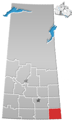 | ||||
|---|---|---|---|---|---|
| Towns | |||||
| Villages | |||||
| Rural municipalities | |||||
| First Nations |
| ||||
| Indian reserves | |||||
| Unincorporated communities |
| ||||