Beatty, Saskatchewan
Beatty (2016 population: 60) is a village in the Canadian province of Saskatchewan within the Rural Municipality of Flett's Springs No. 429 and Census Division No. 15. The village is located approximately 13 km (8 mi) northwest of the City of Melfort. It is at the junction of Highway 3 and Highway 368. In 1925, Beatty was a Canadian National Railways (CNR) rail station on the Swan River - Prince Albert branch line. The area surrounding Beatty is predominantly farmland, the main employer is agriculture.
Beatty | |
|---|---|
| Village of Beatty | |
 Location of Beatty in Saskatchewan  Beatty, Saskatchewan (Canada) | |
| Coordinates: 52.900619°N 104.804678°W | |
| Country | Canada |
| Province | Saskatchewan |
| Region | Saskatchewan |
| Census division | 14 |
| Rural Municipality | Flett's Springs |
| Post office Founded | 1908 |
| Government | |
| • Type | Municipal |
| • Governing body | Beatty Village Council |
| Area | |
| • Total | 0.82 km2 (0.32 sq mi) |
| Population (2006) | |
| • Total | 61 |
| Time zone | CST |
| Postal code | S0J 0C0 |
| Area code(s) | 306 |
History
Beatty was named in 1904, after (and by) Reginald Beatty, an employee of the Hudson's Bay Company and the first settler in the Melfort district.[1] Beatty post office was established in 1908 in the federal electoral district of Rosthern. Beatty incorporated as a village on March 31, 1921.[2]
A community center was built in 1978 through local fundraising. This is still open and serves as a venue for weddings and community events.
Demographics
In the 2016 Census of Population conducted by Statistics Canada, the Village of Beatty recorded a population of 60 living in 23 of its 25 total private dwellings, a -5% change from its 2011 population of 63. With a land area of 0.82 km2 (0.32 sq mi), it had a population density of 73.2/km2 (189.5/sq mi) in 2016.[5]
In the 2011 Census of Population, the Village of Beatty recorded a population of 63, a 3.3% change from its 2006 population of 61. With a land area of 0.82 km2 (0.32 sq mi), it had a population density of 76.8/km2 (199.0/sq mi) in 2011.[6]
Sports
Like most small communities in Saskatchewan, sports centered around hockey. In 1948 the Beatty Memorial Rink was built by a group of local volunteers. After many years, this rink was condemned to be destroyed because of its structural integrity. The town rallied again and built a new rink. This rink served the town until 1993.
In 1985 the Beatty Barons Senior Men's hockey team won the provincial championships. The town of Beatty fielded pre-novice and novice hockey teams until 1993. The rink was also used for community skating and hosting hockey tournaments.
Due to a financial issue which came to a head in 1993, the rink was sold to the town of Rocanville. The town of Rocanville had the rink taken apart piece by piece and moved 423 km away.
Education
Children living in Beatty are sent by bus to school in Melfort.
The early one room school house in town was Beatty School District #1766.[7] This also hosted a second one-room school house for the higher grades including grade 12. This school was open from 1933-1967.
References
- Memory Lane (Beatty-area history book), published by W.A. Print Works Ltd. (Regina) for the Beatty and District Historical Society, 1983. ISBN 0-919533-26-4
- "Urban Municipality Incorporations". Saskatchewan Ministry of Government Relations. Archived from the original on October 15, 2014. Retrieved June 1, 2020.
- "Saskatchewan Census Population" (PDF). Saskatchewan Bureau of Statistics. Archived from the original (PDF) on September 24, 2015. Retrieved May 31, 2020.
- "Saskatchewan Census Population". Saskatchewan Bureau of Statistics. Retrieved May 31, 2020.
- "Population and dwelling counts, for Canada, provinces and territories, and census subdivisions (municipalities), 2016 and 2011 censuses – 100% data (Saskatchewan)". Statistics Canada. February 8, 2017. Retrieved May 30, 2020.
- "Population and dwelling counts, for Canada, provinces and territories, and census subdivisions (municipalities), 2011 and 2006 censuses (Saskatchewan)". Statistics Canada. June 3, 2019. Retrieved May 30, 2020.
- "Alphabetical Schoolhouse Listing". One Room School Project. Saskatchewan Gen Web. Archived from the original on 22 October 2010. Retrieved 2010-09-10.
External links
- Post Offices and Postmasters - ArchiviaNet - Library and Archives Canada
- Prince Albert Gen Web Region
- Saskatchewan Country Elevator System Maps with Index Years:1924-25, 1947-48, 1950-51, 1952-53, 1984
- GeoNames Query
- Canadian Maps: January 1925 Waghorn's Guide. Post Offices in Man. Sask. Alta. and West Ontario.
| Cities | 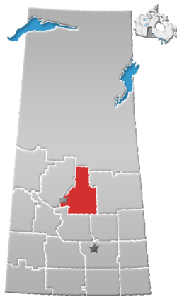 | ||
|---|---|---|---|
| Towns | |||
| Villages |
| ||
| Resort villages | |||
| Rural municipalities |
| ||
| First Nations | |||
| Indian reserves | |||
| Unincorporated communities |
| ||