Rural Municipality of Argyle No. 1
The Rural Municipality of Argyle No. 1 (2016 population: 290) is a rural municipality (RM) in the Canadian province of Saskatchewan within Census Division No. 1 and SARM Division No. 1. It is located in the southeast corner of the province along Highway 18.
Argyle No. 1 | |
|---|---|
| Rural Municipality of Argyle No. 1 | |
 Location of the RM of Argyle No. 1 in Saskatchewan | |
| Coordinates: 49.154°N 101.479°W[1] | |
| Country | Canada |
| Province | Saskatchewan |
| Census division | 1 |
| SARM division | 1 |
| Federal riding | Souris--Moose Mountain |
| Provincial riding | Cannington |
| Formed[2] | December 19, 1912 |
| Government | |
| • Reeve | Allen Henderson |
| • Governing body | RM of Argyle No. 1 Council |
| • Administrator | Erin McMillen |
| • Office location | Gainsborough |
| Area (2016)[4] | |
| • Land | 579.88 km2 (223.89 sq mi) |
| Population (2016)[4] | |
| • Total | 290 |
| • Density | 0.5/km2 (1/sq mi) |
| Time zone | CST |
| • Summer (DST) | CST |
| Postal code | S0C 0Z0 |
| Area code(s) | 306 and 639 |
History
The RM of Argyle No. 1 incorporated as a rural municipality on December 19, 1912.[2] Prior to it was Local Improvement District No. 1.
The exact derivation of the RM's name is unknown, as numerous Argyles and Argylls exist in Western Canada. Argyle Street in Regina and the Rural Municipality of Argyle in Manitoba were both intended to honour Sir John Campbell, 9th Duke of Argyll and fourth Governor-General of Canada. Why both adopted a more phonetic spelling of the name, most commonly used to refer to a type of knitting pattern, is unknown.[5]
Geography
The eastern boundary of the RM is the Municipality of Two Borders, in Manitoba. The southern boundary of the RM is the United States border at Renville County and Bottineau County, both in North Dakota.
Communities and localities
The following urban municipalities are surrounded by the RM.
Demographics
In the 2016 Census of Population conducted by Statistics Canada, the RM of Argyle No. 1 recorded a population of 290 living in 105 of its 110 total private dwellings, a 7.4% change from its 2011 population of 270. With a land area of 579.88 km2 (223.89 sq mi), it had a population density of 0.5/km2 (1.3/sq mi) in 2016.[4]
In the 2011 Census of Population, the RM of Argyle No. 1 recorded a population of 270, a 1.1% change from its 2006 population of 267. With a land area of 579.99 km2 (223.94 sq mi), it had a population density of 0.5/km2 (1.2/sq mi) in 2011.[8]
Government
The RM of Argyle No. 1 is governed by an elected municipal council and an appointed administrator that meets on the second Tuesday of every month.[3] The reeve of the RM is Allen Henderson while its administrator is Erin McMillen.[3] The RM's office is located in Gainsborough.[3]
Transportation
- Rail[9]
- Estevan Section C.P.R—serves Elva, Pierson, Gainsborough, Carievale, Carnduff, Glen Ewen, Oxbow, Rapeard
- Roads[10]
- Highway 18—serves Gainsborough
- Highway 600
References
- "Pre-packaged CSV files - CGN, Canada/Province/Territory (cgn_sk_csv_eng.zip)". Government of Canada. July 24, 2019. Retrieved May 23, 2020.
- "Rural Municipality Incorporations (Alphabetical)". Saskatchewan Ministry of Municipal Affairs. Archived from the original on April 21, 2011. Retrieved May 9, 2020.
- "Municipality Details: RM of Argyle No. 1". Government of Saskatchewan. Retrieved May 21, 2020.
- "Population and dwelling counts, for Canada, provinces and territories, and census subdivisions (municipalities), 2016 and 2011 censuses – 100% data (Saskatchewan)". Statistics Canada. February 8, 2017. Retrieved May 1, 2020.
- Barry, Bill (2005). Geographic Names of Saskatchewan. Regina, Saskatchewan: People Places Publishing Ltd. ISBN 1-897010-19-2.
- "Saskatchewan Census Population" (PDF). Saskatchewan Bureau of Statistics. Archived from the original (PDF) on September 24, 2015. Retrieved May 9, 2020.
- "Saskatchewan Census Population". Saskatchewan Bureau of Statistics. Retrieved May 9, 2020.
- "Population and dwelling counts, for Canada, provinces and territories, and census subdivisions (municipalities), 2011 and 2006 censuses (Saskatchewan)". Statistics Canada. June 3, 2019. Retrieved May 1, 2020.
- Canadian Maps: January 1925 Waghorn's Guide. Post Offices in Man. Sask. Alta. and West Ontario.
- Eversoft Streets and Trips
Places adjacent to Rural Municipality of Argyle No. 1 | |
|---|---|
| Cities | 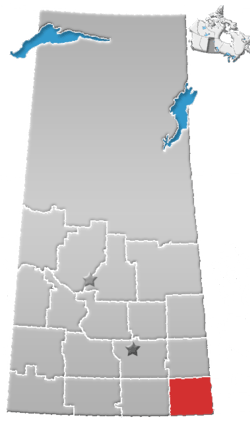 | ||||
|---|---|---|---|---|---|
| Towns | |||||
| Villages | |||||
| Rural municipalities | |||||
| First Nations |
| ||||
| Indian reserves | |||||
| Unincorporated communities |
| ||||