Nicholas County, Kentucky
| Nicholas County, Kentucky | |
|---|---|
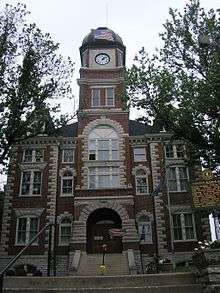 Nicholas County courthouse in Carlisle | |
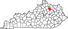 Location in the U.S. state of Kentucky | |
 Kentucky's location in the U.S. | |
| Founded | 1799 |
| Seat | Carlisle |
| Largest city | Carlisle |
| Area | |
| • Total | 197 sq mi (510 km2) |
| • Land | 195 sq mi (505 km2) |
| • Water | 1.7 sq mi (4 km2), 0.8% |
| Population | |
| • (2010) | 7,135 |
| • Density | 37/sq mi (14/km2) |
| Congressional district | 6th |
| Time zone | Eastern: UTC−5/−4 |
| Website |
nicholascounty |
Nicholas County is a county located in the U.S. state of Kentucky. As of the 2010 census, the population was 7,135.[1] Its county seat is Carlisle, which is also the only incorporated community in the county.[2] Founded in 1799, the county is named for Col. George Nicholas, the "Father of the Kentucky Constitution".[3][4]
History
Nicholas County was established in 1799 from land given by Bourbon and Mason counties. Nicholas was the 42nd Kentucky county in order of formation.[5] The general region is noted for its scenic beauty, history, horse farms and hospitality. Nicholas County has a picturesque, rural character. Its rolling countryside is typical of the Bluegrass belt where winding roads lead past manicured farms, through wooded glades and small villages. Nicholas County is home to Forest Retreat, listed on the National Historic register as a historic district, built in 1814 by Thomas Metcalf the 10th Governor of Kentucky. The 1954 Kentucky Derby Winner “Determine” was bred and born in Nicholas County on the Forest Retreat Farm. Daniel Boone’s last Kentucky home place is also located in Nicholas County, the Historic marker is located on US HWY 68 just past the traffic islands heading north. Built by Boone in 1795, Boone and his family resided in the one room cabin until 1799. Blue Licks Battlefield State Resort Park is a park located near Mount Olivet, Kentucky in Robertson and Nicholas counties. The park encompasses 148 acres (60 ha) and features a monument commemorating the August 19, 1782 Battle of Blue Licks.[6] The battle was regarded as the final battle of the American Revolutionary War.[7]
Geography
According to the U.S. Census Bureau, the county has a total area of 197 square miles (510 km2), of which 195 square miles (510 km2) is land and 1.7 square miles (4.4 km2) (0.8%) is water.[8]
Adjacent counties
- Robertson County (north)
- Fleming County (northeast)
- Bath County (southeast)
- Bourbon County (southwest)
- Harrison County (northwest)
Demographics
| Historical population | |||
|---|---|---|---|
| Census | Pop. | %± | |
| 1810 | 4,898 | — | |
| 1820 | 7,973 | 62.8% | |
| 1830 | 8,834 | 10.8% | |
| 1840 | 8,745 | −1.0% | |
| 1850 | 10,361 | 18.5% | |
| 1860 | 11,030 | 6.5% | |
| 1870 | 9,129 | −17.2% | |
| 1880 | 11,869 | 30.0% | |
| 1890 | 10,764 | −9.3% | |
| 1900 | 11,952 | 11.0% | |
| 1910 | 10,601 | −11.3% | |
| 1920 | 9,894 | −6.7% | |
| 1930 | 8,571 | −13.4% | |
| 1940 | 8,617 | 0.5% | |
| 1950 | 7,532 | −12.6% | |
| 1960 | 6,677 | −11.4% | |
| 1970 | 6,508 | −2.5% | |
| 1980 | 7,157 | 10.0% | |
| 1990 | 6,725 | −6.0% | |
| 2000 | 6,813 | 1.3% | |
| 2010 | 7,135 | 4.7% | |
| Est. 2016 | 7,084 | [9] | −0.7% |
| U.S. Decennial Census[10] 1790-1960[11] 1900-1990[12] 1990-2000[13] 2010-2013[1] | |||
As of the census[14] of 2010, there were 7,135 people, 2,809 households, and 1,956 families residing in the county. The population density was 35 per square mile (14/km2). There were 3,261 housing units at an average density of 16 per square mile (6.2/km2). The racial makeup of the county was 97.9% White, 0.6% Black or African American, 0.1% Native American, 0.2% Asian, 0.5% from other races, and 0.7% from two or more races. 1.4% of the population were Hispanic or Latino of any race.
There were 2,809 households out of which 29.20% had children under the age of 18 living with them, 52.60% were married couples living together, 11.10% had a female householder with no husband present, 5.9% had a male householder with no wife present, and 30.40% were non-families. 25.60% of all households were made up of individuals and 11.30% had someone living alone who was 65 years of age or older. The average household size was 2.51 and the average family size was 2.97.
In the county, the population was spread out with 26.40% under the age of 19, 4.8% from 20 to 24, 25.50% from 25 to 44, 27.8% from 45 to 64, and 15.60% who were 65 years of age or older. The median age was 40.5 years. For every 100 females there were 93.70 males. For every 100 females age 18 and over, there were 89.30 males.
The median income for a household in the county was $40,259, and the median income for a family was $43,410. The per capita income for the county was $18,452. About 9.70% of families and 13.20% of the population were below the poverty line, including 14.20% of those under age 18 and 16.80% of those age 65 or over.
Politics
| Year | Republican | Democratic | Third parties |
|---|---|---|---|
| 2016 | 68.9% 1,957 | 27.7% 787 | 3.4% 97 |
| 2012 | 61.3% 1,583 | 36.7% 948 | 1.9% 50 |
| 2008 | 55.0% 1,634 | 42.8% 1,272 | 2.2% 64 |
| 2004 | 55.6% 1,700 | 43.5% 1,332 | 0.9% 27 |
| 2000 | 60.3% 1,613 | 37.2% 994 | 2.5% 66 |
| 1996 | 41.1% 950 | 47.3% 1,092 | 11.6% 269 |
| 1992 | 32.1% 894 | 48.1% 1,341 | 19.9% 554 |
| 1988 | 49.7% 1,271 | 48.5% 1,242 | 1.8% 46 |
| 1984 | 57.4% 1,535 | 41.4% 1,107 | 1.2% 33 |
| 1980 | 38.9% 915 | 57.4% 1,349 | 3.7% 87 |
| 1976 | 31.0% 738 | 66.5% 1,582 | 2.4% 58 |
| 1972 | 56.2% 1,076 | 42.0% 804 | 1.8% 34 |
| 1968 | 35.2% 725 | 44.2% 911 | 20.7% 426 |
| 1964 | 26.1% 621 | 73.3% 1,742 | 0.6% 15 |
| 1960 | 42.1% 1,058 | 57.9% 1,455 | 0.0% 0 |
| 1956 | 37.1% 999 | 61.9% 1,667 | 1.1% 29 |
| 1952 | 38.8% 1,156 | 61.1% 1,819 | 0.1% 4 |
| 1948 | 29.3% 815 | 67.7% 1,885 | 3.0% 84 |
| 1944 | 36.7% 1,059 | 62.8% 1,813 | 0.5% 13 |
| 1940 | 36.1% 1,207 | 63.5% 2,124 | 0.4% 14 |
| 1936 | 35.3% 1,277 | 64.2% 2,325 | 0.5% 18 |
| 1932 | 30.6% 1,219 | 68.4% 2,728 | 1.0% 41 |
| 1928 | 50.4% 1,867 | 49.5% 1,836 | 0.1% 4 |
| 1924 | 37.2% 1,348 | 61.7% 2,235 | 1.2% 42 |
| 1920 | 33.3% 1,496 | 65.7% 2,953 | 1.0% 45 |
| 1916 | 34.1% 964 | 64.7% 1,829 | 1.2% 35 |
| 1912 | 27.0% 700 | 62.0% 1,611 | 11.0% 286 |
Communities
- Carlisle (county seat)
- East Union
- Headquarters
- Hooktown
- Moorefield
- Myers
Notable residents
- Barton Stone Alexander, born in Nicholas County, brigadier general in the American Civil War, designer of Fort McPherson[16]
- Daniel Boone, moved to Nicholas County in 1795 after living in the Kanawha Valley, Virginia.
Circa 1798, Boone moved to the mouth of the Little Sandy River at the site of present-day Greenup, Kentucky. Boone left Kentucky with his extended family for Missouri in 1799. While in Nicholas County, Boone lived on the Brushy Fork of Hinkston Creek in a cabin owned by his son Daniel Morgan Boone.[17]
- Thomas Metcalfe (March 20, 1780 – August 18, 1855), also known as Thomas Metcalf or as "Stonehammer", was a U.S. Representative, Senator, and the tenth Governor of Kentucky. He was the first gubernatorial candidate in the state's history to be chosen by a nominating convention rather than a caucus. He was also the first governor of Kentucky who was not a member of the Democratic-Republican Party, Metcalfe's primary concern as governor was the issue of internal improvements. Among his proposed projects were a road connecting Shelbyville to Louisville and a canal on the Falls of the Ohio. When President Andrew Jackson vetoed funds to construct a turnpike connecting Maysville and Lexington, Metcalfe built it anyway, paying for it entirely with state funds. Following his term as governor, he served in the state senate, and completed the unfinished term of John J. Crittenden in the U.S. Senate in 1848. After this, he retired to "Forest Retreat", his estate in Nicholas County, where he died of cholera in 1855. Metcalfe County, Kentucky was named in his honor.
- Author Barbara Kingsolver was raised near Carlisle.
- Joseph Drake was born in Nicholas County. Drake was a lawyer, plantation owner, and Colonel in the Confederate States Army during the Civil War.
- Glenn Fryman Nicholas Co highschool baseball legend
See also
http:www.carlisle-nicholascounty.org
References
- 1 2 "State & County QuickFacts". United States Census Bureau. Archived from the original on July 15, 2011. Retrieved March 6, 2014.
- ↑ "Find a County". National Association of Counties. Retrieved 2011-06-07.
- ↑ http://www.kyenc.org/entry/n/NICHO03.html
- ↑ The Register of the Kentucky State Historical Society, Volume 1. Kentucky State Historical Society. 1903. p. 36.
- ↑ Collins, Lewis (1882). Collins' Historical Sketches of Kentucky: History of Kentucky, Volume 2. Collins & Company. p. 26.
- ↑ "History". Blue Licks Battlefield State Resort Park. Kentucky Department of Parks. Retrieved September 23, 2013.
- ↑ Kleber, John E., ed. (1992). "Parks, State". The Kentucky Encyclopedia. Associate editors: Thomas D. Clark, Lowell H. Harrison, and James C. Klotter. Lexington, Kentucky: The University Press of Kentucky. ISBN 0-8131-1772-0.
- ↑ "2010 Census Gazetteer Files". United States Census Bureau. August 22, 2012. Archived from the original on August 12, 2014. Retrieved August 19, 2014.
- ↑ "Population and Housing Unit Estimates". Retrieved June 9, 2017.
- ↑ "U.S. Decennial Census". United States Census Bureau. Retrieved August 19, 2014.
- ↑ "Historical Census Browser". University of Virginia Library. Retrieved August 19, 2014.
- ↑ "Population of Counties by Decennial Census: 1900 to 1990". United States Census Bureau. Retrieved August 19, 2014.
- ↑ "Census 2000 PHC-T-4. Ranking Tables for Counties: 1990 and 2000" (PDF). United States Census Bureau. Retrieved August 19, 2014.
- ↑ "American FactFinder". United States Census Bureau. Retrieved 2008-01-31.
- ↑ Leip, David. "Dave Leip's Atlas of U.S. Presidential Elections". uselectionatlas.org. Retrieved 2018-07-05.
- ↑ Who Was Who in America, Historical Volume, 1607-1896. Chicago: Marquis Who's Who. 1963.
- ↑ Boone A Biography. Robert Morgan: Algonquin Books of Chapel Hill. 2007.
Municipalities and communities of Nicholas County, Kentucky, United States | ||
|---|---|---|
| City | | |
| Unincorporated communities | ||
