Dallas County, Iowa
| Dallas County, Iowa | |
|---|---|
 | |
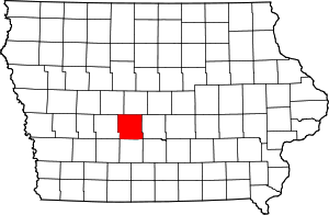 Location in the U.S. state of Iowa | |
 Iowa's location in the U.S. | |
| Founded | 13 January 1846 |
| Named for | George M. Dallas |
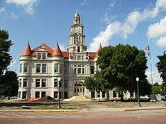
| Seat | Adel |
| Largest city | Waukee |
| Area | |
| • Total | 592 sq mi (1,533 km2) |
| • Land | 588 sq mi (1,523 km2) |
| • Water | 3.3 sq mi (9 km2), 0.5% |
| Population | |
| • (2010) | 66,135 |
| • Density | 112/sq mi (43/km2) |
| Congressional district | 3rd |
| Time zone | Central: UTC−6/−5 |
Dallas County is a county located in the U.S. state of Iowa. As of the 2010 Census, the population was 66,135.[1] Its county seat is Adel.[2] The county was named for George M. Dallas, Vice President of the United States under James K. Polk, the namesake of neighboring Polk County.
Dallas County is included in the Des Moines–West Des Moines, IA Metropolitan Statistical Area.[3]
History
The land that now forms Dallas County was ceded by the Sac and Fox nation to the United States in a treaty signed on 11 October 1842.
On 13 January 1846, the legislative body of the Indiana Territory authorized creation of twelve counties in the Iowa Territory,[4] with general descriptions of their boundaries.[5] Dallas County's name referred to United States Vice President George M. Dallas, who served from 1845 to 1849.
In 1847 the county residents voted to designate Penoch as the county seat (the name was changed to Adel in 1849). The county's population grew rapidly, with settlers coming to claim homesteads. By 1870 the population had crossed the 12,000 mark.
Geography
According to the United States Census Bureau, the county has a total area of 592 square miles (1,530 km2), of which 588 square miles (1,520 km2) is land and 3.3 square miles (8.5 km2) (0.5%) is water.[6]
Major highways


.svg.png)


Adjacent counties
- Adair County – southwest
- Boone County – north
- Greene County – north and northwest
- Guthrie County – west
- Madison County – south
- Polk County – east
- Warren County – southeast
Demographics
| Historical population | |||
|---|---|---|---|
| Census | Pop. | %± | |
| 1850 | 854 | — | |
| 1860 | 5,244 | 514.1% | |
| 1870 | 12,019 | 129.2% | |
| 1880 | 18,746 | 56.0% | |
| 1890 | 20,479 | 9.2% | |
| 1900 | 23,058 | 12.6% | |
| 1910 | 23,628 | 2.5% | |
| 1920 | 25,120 | 6.3% | |
| 1930 | 25,493 | 1.5% | |
| 1940 | 24,649 | −3.3% | |
| 1950 | 23,661 | −4.0% | |
| 1960 | 24,123 | 2.0% | |
| 1970 | 26,085 | 8.1% | |
| 1980 | 29,513 | 13.1% | |
| 1990 | 29,755 | 0.8% | |
| 2000 | 40,750 | 37.0% | |
| 2010 | 66,135 | 62.3% | |
| Est. 2016 | 84,516 | [8] | 27.8% |
| U.S. Decennial Census[9] 1790-1960[10] 1900-1990[11] 1990-2000[12] 2010-2013[1] | |||
2010 census
The 2010 census recorded a population of 66,135 in the county, with a population density of 112.7698/sq mi (43.5407/km2). There were 27,260 housing units, of which 25,240 were occupied.[13]
2000 census
As of the census[14] of 2000, there were 40,750 people, 15,584 households, and 11,173 families residing in the county. The population density was 70 people per square mile (27/km²). There were 16,529 housing units at an average density of 28 per square mile (11/km²). The racial makeup of the county was 94.75% White, 0.74% Black or African American, 0.15% Native American, 0.69% Asian, 0.04% Pacific Islander, 2.79% from other races, and 0.84% from two or more races. 5.40% of the population were Hispanic or Latino of any race.
There were 15,584 households out of which 37.20% had children under the age of 18 living with them, 60.60% were married couples living together, 8.00% had a female householder with no husband present, and 28.30% were non-families. 23.60% of all households were made up of individuals and 8.20% had someone living alone who was 65 years of age or older. The average household size was 2.59 and the average family size was 3.08.
In the county, the population was spread out with 28.20% under the age of 18, 6.90% from 18 to 24, 32.10% from 25 to 44, 21.60% from 45 to 64, and 11.10% who were 65 years of age or older. The median age was 35 years. For every 100 females, there were 97.70 males. For every 100 females age 18 and over, there were 93.80 males.
The median income for a household in the county was $48,528, and the median income for a family was $58,293. Males had a median income of $37,243 versus $27,026 for females. The per capita income for the county was $22,970. About 4.00% of families and 5.60% of the population were below the poverty line, including 6.10% of those under age 18 and 7.10% of those age 65 or over.
Communities
Cities
- ‡ partly in Polk County
Unincorporated communities
Townships
Population ranking
The population ranking of the following table is based on the 2010 census of Dallas County.[15]
† county seat
| Rank | City/Town/etc. | Municipal type | Population (2010 Census)
|
|---|---|---|---|
| 1 | West Des Moines (mostly in Polk County) | City | 56,609 |
| 2 | Urbandale (partially in Polk County) | City | 39,463 |
| 3 | Clive (partially in Polk County) | City | 15,447 |
| 4 | Waukee | City | 13,790 |
| 5 | Grimes (mostly in Polk County) | City | 8,246 |
| 6 | Perry | City | 7,702 |
| 7 | † Adel | City | 3,682 |
| 8 | Dallas Center | City | 1,623 |
| 9 | Granger (partially in Polk County) | City | 1,244 |
| 10 | De Soto | City | 1,050 |
| 11 | Woodward | City | 1,024 |
| 12 | Van Meter | City | 1,016 |
| 13 | Redfield | City | 835 |
| 14 | Dexter | City | 611 |
| 15 | Minburn | City | 365 |
| 16 | Linden | City | 199 |
| 17 | Dawson | City | 131 |
| 18 | Bouton | City | 129 |
Politics
| Year | Republican | Democratic | Third Parties |
|---|---|---|---|
| 2016 | 50.6% 19,339 | 41.1% 15,701 | 8.4% 3,212 |
| 2012 | 55.1% 20,988 | 43.5% 16,576 | 1.5% 552 |
| 2008 | 51.9% 16,954 | 46.4% 15,149 | 1.7% 540 |
| 2004 | 57.8% 15,183 | 41.5% 10,917 | 0.7% 193 |
| 2000 | 53.3% 10,306 | 44.3% 8,561 | 2.4% 463 |
| 1996 | 41.5% 6,647 | 50.1% 8,017 | 8.4% 1,346 |
| 1992 | 37.6% 5,587 | 44.1% 6,554 | 18.3% 2,720 |
| 1988 | 39.1% 4,858 | 60.4% 7,501 | 0.5% 60 |
| 1984 | 47.9% 6,080 | 51.7% 6,564 | 0.5% 63 |
| 1980 | 48.6% 6,296 | 41.0% 5,310 | 10.5% 1,358 |
| 1976 | 43.3% 5,308 | 54.9% 6,722 | 1.8% 217 |
| 1972 | 53.7% 6,143 | 44.5% 5,085 | 1.8% 208 |
| 1968 | 49.2% 5,549 | 44.9% 5,062 | 6.0% 676 |
| 1964 | 33.4% 3,763 | 66.1% 7,447 | 0.5% 52 |
| 1960 | 53.9% 6,566 | 46.0% 5,597 | 0.1% 13 |
| 1956 | 56.1% 6,619 | 43.9% 5,185 | 0.0% 2 |
| 1952 | 63.5% 8,008 | 35.7% 4,501 | 0.8% 101 |
| 1948 | 44.5% 4,810 | 52.3% 5,661 | 3.2% 348 |
| 1944 | 49.8% 5,413 | 48.9% 5,316 | 1.2% 135 |
| 1940 | 49.2% 6,218 | 49.7% 6,279 | 1.0% 131 |
| 1936 | 45.5% 5,442 | 53.0% 6,341 | 1.6% 190 |
| 1932 | 47.0% 4,516 | 50.9% 4,887 | 2.2% 208 |
| 1928 | 69.7% 7,294 | 29.7% 3,108 | 0.6% 58 |
| 1924 | 62.0% 6,359 | 9.1% 933 | 28.9% 2,969 |
| 1920 | 70.6% 6,677 | 27.3% 2,577 | 2.1% 200 |
| 1916 | 52.4% 2,900 | 45.1% 2,495 | 2.6% 143 |
| 1912 | 34.8% 1,825 | 32.7% 1,718 | 32.5% 1,706 |
| 1908 | 59.9% 3,132 | 35.8% 1,871 | 4.3% 222 |
| 1904 | 70.0% 3,499 | 23.2% 1,159 | 6.8% 341 |
| 1900 | 62.4% 3,601 | 33.6% 1,940 | 4.1% 234 |
| 1896 | 57.9% 3,326 | 40.3% 2,316 | 1.8% 105 |
See also
References
- 1 2 "State & County QuickFacts". United States Census Bureau. Archived from the original on 9 July 2011. Retrieved 16 July 2014.
- ↑ "Find a County". National Association of Counties. Archived from the original on 31 May 2011. Retrieved 7 June 2011.
- ↑ United States Office of Management and Budget. "Update of Statistical Area Definitions and Guidance on Their Uses" (PDF). pp. 5, 36. Archived from the original (PDF) on 14 May 2006. Retrieved 21 July 2006.
- ↑ The counties were Boone, Clarke, Dallas, Decatur, Jasper, Lucas, Madison, Marshall, Polk, Story, Warren, and Wayne.
- ↑ The History of Polk County, Iowa: Containing a History of the County, Its Cities, Towns, &c. Union Historical Co. 1880. pp. 419, 425.
- ↑ "US Gazetteer files: 2010, 2000, and 1990". US Census Bureau. 12 February 2011. Retrieved 23 April 2011.
- ↑ Dallas County, Iowa Google Maps (accessed 20 August 2018)
- ↑ "Population and Housing Unit Estimates". Retrieved 9 June 2017.
- ↑ "U.S. Decennial Census". United States Census Bureau. Archived from the original on 12 May 2015. Retrieved 16 July 2014.
- ↑ "Historical Census Browser". University of Virginia Library. Retrieved 16 July 2014.
- ↑ "Population of Counties by Decennial Census: 1900 to 1990". US Census Bureau. Retrieved 16 July 2014.
- ↑ "Census 2000 PHC-T-4. Ranking Tables for Counties: 1990 and 2000" (PDF). US Census Bureau. Retrieved 16 July 2014.
- ↑ "Population & Housing Occupancy Status 2010". US Census Bureau – American FactFinder. Retrieved 7 May 2011.
- ↑ "American FactFinder". US Census Bureau. Archived from the original on 11 September 2013. Retrieved 31 January 2008.
- ↑ "Archived copy". Archived from the original on 21 December 2013. Retrieved 13 February 2016.
- ↑ Leip, David. "Dave Leip's Atlas of U.S. Presidential Elections". uselectionatlas.org. Retrieved 25 April 2018.
External links
| Wikimedia Commons has media related to Dallas County, Iowa. |
Places adjacent to Dallas County, Iowa | ||||||||||
|---|---|---|---|---|---|---|---|---|---|---|
| ||||||||||
Municipalities and communities of Dallas County, Iowa, United States | ||
|---|---|---|
| Cities | ||
| Townships | ||
| Unincorporated communities | ||
| Footnotes | ‡This populated place also has portions in an adjacent county or counties | |

Coordinates: 41°40′58″N 94°02′06″W / 41.68278°N 94.03500°W